A key part of any search is knowing where to look. Regarding Karen and Rodney, I have partial information. I have a document from the LCSO released as part of the Oregonian series; since their case is still an open homicide, the actual case file is not publicly available. I also have Noelle Crombie’s reporting, photos and videos from Beth Nakamura and Dave Killen and archived newspaper articles from when their items were found. Using these references and boots on the ground site surveys, I should be able to locate those sites. For brevity I’ll refer to the specific locations as the Grissom Site and the Lee Site.
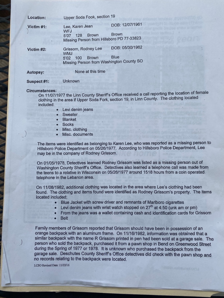
I know from this document that both Lee and Grissoms’ clothing were found in the same area, which is listed as Upper Soda Fork, Section 19. That is a lot more vague than a 10 digit grid coordinate, or even a mile marker on the road. My first challenge is narrowing down exactly where on Upper Soda Fork Rd the items were found.
There are many common names used, but the official designation of Soda Fork Rd is Forest Service Road 2041. FS 2041 joins US 20 just past mile marker 52. My next stop is the US Geographical Survey for a topographic map of the area. Conveniently, the map sheet is named “Upper Soda Quadrangle”.
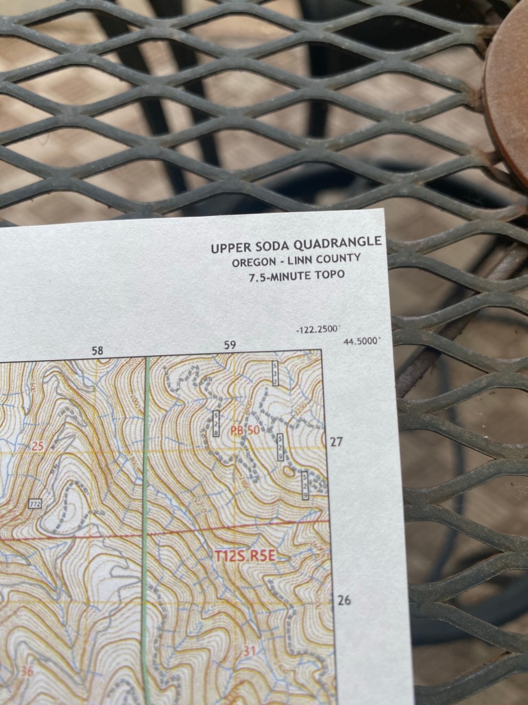
Now, I have to find Section 19 on this map. I started to turn on different layers in the map, trying to find the right layer that had a Section 19 that contained part of FS 2041. The Bureau of Land Management (BLM) administers a lot of land in the west, and they have what’s known as a checkerboard pattern to their maps. Each section of checkerboard is 1 square mile and numbered. When I added the BLM layer, I found Section 19.
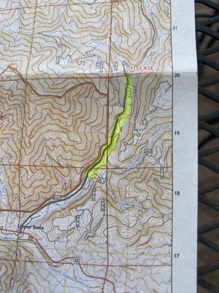
How do I know that I’m in the right place? I’m on the correct road, the road passes through BLM Section 19, and the BLM section number is the one most likely used by LCSO. Also, the section of road I’m looking at fits with Ackroyd’s MO. I have now narrowed down a rather vague descriptor of “Upper Soda Fork, Section 19” to about a mile long length of Forest Service Road. That’s a manageable area to begin a site survey in.

2 Comments