For now, this is an entry without a proper ending. The why for this may be apparent, and there is a good reason for it. Please be patient with me until that ending can be written.
I arrived at Soda Fork late in the morning on Saturday. My search plan had been developed the week prior, and I wanted to spend the day until dark completing a more intensive survey of the Lee and Grissom sites, and conduct some preliminary searching of areas of interest. My search plan for the day was to survey each site, identifying and plotting the following: draws, washes and intermittent water flows across the ground; debris piles at the exits of those flows; sunken and soft areas in the ground; check the bases of cliff outs on the hillside; check any accumulated debris and identify lines of drift down each hillside.
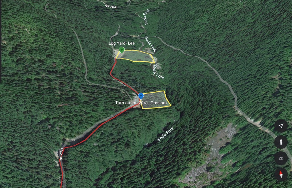
I had originally wanted to start at the Lee Site, since the terrain is easier to walk and slightly less vegetated. A family was target shooting into the berm at the landing, and after letting them know where I’d be in the area, I drove back to the Grissom site.
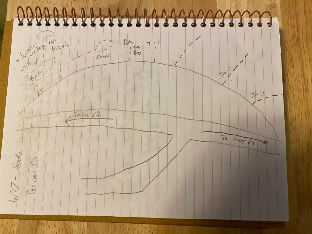
When I arrived at the Grissom Site, I parked and walked the turn-out. I took my notebook with me and sketched the turn-out and the different trails and lines of drift leading from the road down the hill.
I took about 2 hours and surveyed each trail and line of drift from the turn-out. I walked each one until they ended, or reached a natural terrain feature, such as a bluff that would cause foot travel to deviate around it. From the end, I would then turn around and examine the hillside leading to this point. I looked at how water would flow down the hill during the winter, where debris collected, were there any features identifiable looking up that weren’t apparent when walking down?
On the walk back up the hill, I would pull apart debris piles, rolled logs back, and otherwise searched the lines of drift and collection points. I found half a dozen truck tires, empty propane bottles, oil cans, and the normal detritus of a working forest.
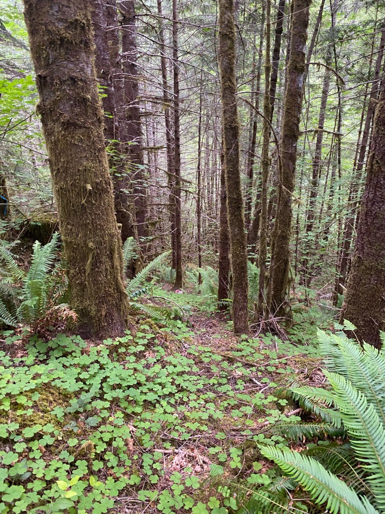
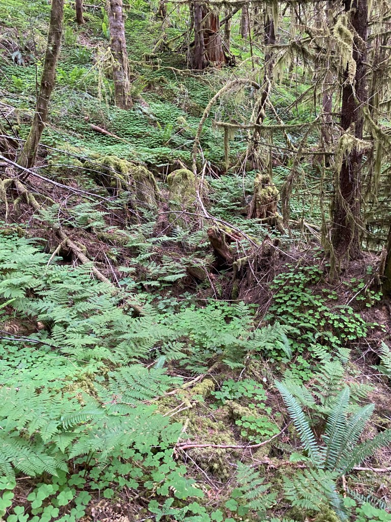
In the early afternoon I started on the first line of drift that I had found on the 15 May 2023 initial site survey. After examining the other trails from the turn-out, this one, with its below grade and concealed bench, still seemed like the most likely place where the crime occurred. Standing at the bench, I made a silent prayer to Karen and Rodney, that I was there to help them and that if they wanted, to bring them home.
I started walking down this line of drift, past the surveyor flags marking areas of interest I placed a month earlier.
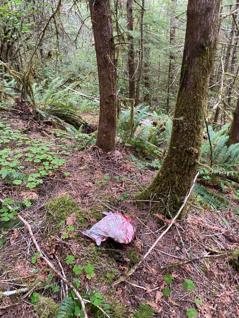
I used my trekking pole to sweep aside ferns and undergrowth along the sides, and kept going past this Mylar kids balloon that had drifted on the wind into the mountains.
I reached the outer boundary of where I had looked on 15 May 2023. I stood in the area and noticed that the hillside about 50 feet to the north leveled out. I walked over there and from that level spot, I noticed that the hillside formed a funnel above it, and that the funnel led to a depression where a tree had gone over. Debris was gathering in the hole the rootball left.
This is where I have to end this entry for now. I am hoping to have more information to share soon.

1 Comment