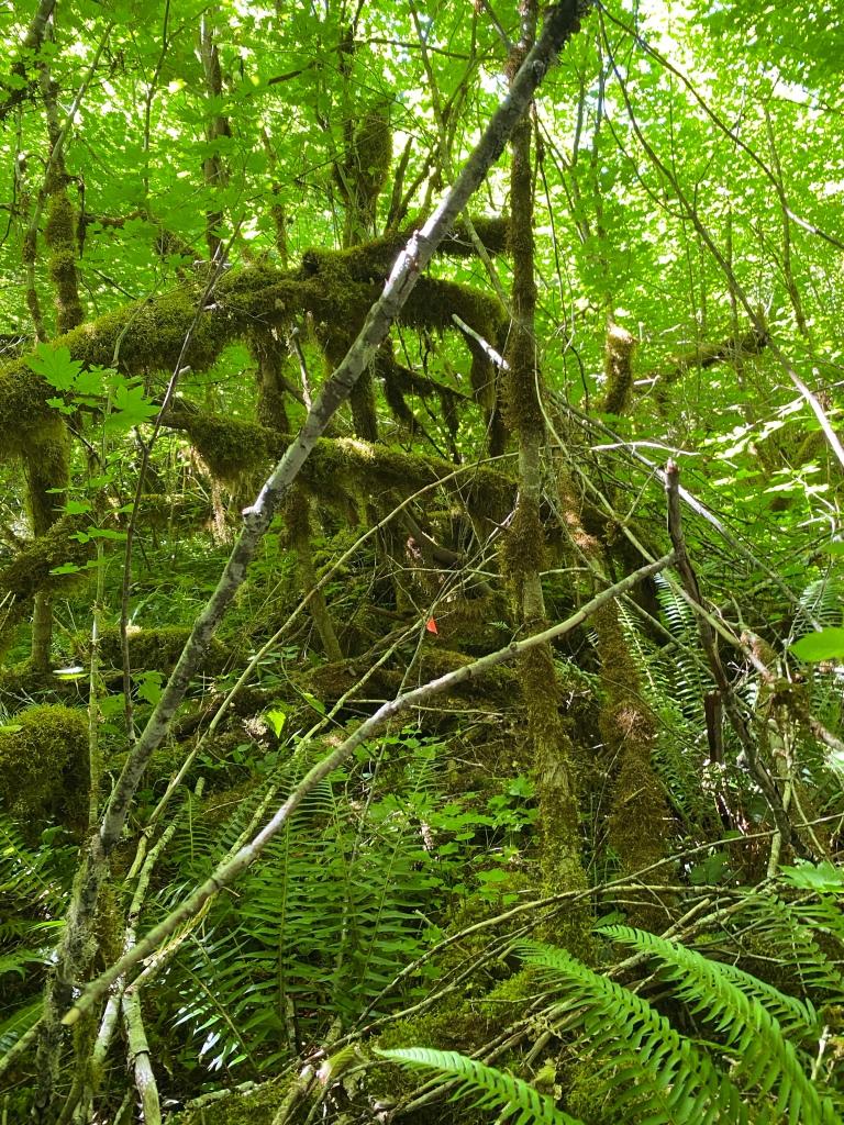
I went back to the Lee Site yesterday, with the intent of broadening the searched area. Even with the video tour, I still feel as though it is really hard to convey the size of the area and the overall rugged terrain and thick vegetation. The Lee Site is going to take a lot of time to search through, especially solo. My plan is to segment off areas, search them and then move onto the next area.
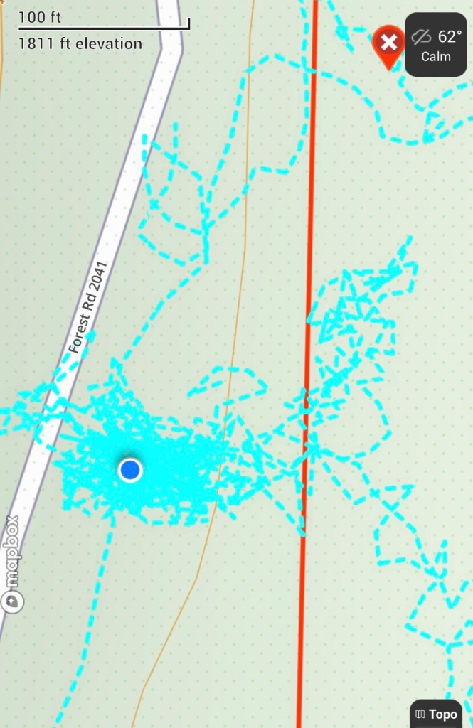
Yesterday’s segment was an intermittent stream bed that ran along the southern boundary of the Lee Site. The stream bed ran from a culvert under Soda Fork Rd east, downslope through a marshy area then finally joining Soda Fork Creek. The blue lines to the east (right) side of the GPS track are along the bank of Soda Fork Creek. This is a case where the GPS map and reality are off by about 15 meters or so.
The reasons I am segmenting the Lee Site into search boxes are driven by time and the records available. The vegetation at the landing has definitely grown in during the preceding 46 years, obscuring paths and other markers that may have been there in 1977. In the documentation, the best description of where Karen’s things were found is that they were “ about a 1/4 mile down a steep hillside from a logging landing in a heavy growth of underbrush and second-growth timber.”
That description more or less describes the entire area behind the berm. The hill behind the landing is a U shape, and I chose the southern leg of the U to search. Based on the information available, and the terrain, I believe that Karen’s remains were left with her clothing and blanket bundle. We also know from the news clipping that the LCSO Detective, LT Martinak, stated that the bundle was in a position that it had to be carried to that spot.
My challenge now is that without a more definitive location, I have to hands and knees search the entire area. I have made a conscious decision not to use the 1/4 mile measurement from the clipping as a reference. In the pre-GPS days, I’m going to guess that anything between 100’ and 1000’ was called a 1/4 mile. An actual 1/4 mile from the landing would put one on the other side of Soda Fork Creek, which is definitely out of the search area. The eastern boundary of the Lee Site is Soda Fork Creek, the western boundary is Soda Fork Rd, while a pair of intermittent streams form the southern and northern boundaries.
I walked the top of the hill, marking lines of drift downslope, and made my way to the southern intermittent stream. I followed a very faint path down the hill to it, then walked to the bottom of the stream bed, just before it broadened out into a marsh that is between the hill and creek. Based on the overall swampiness in the area, it does channel foot traffic in a certain way towards Soda Fork Creek, which will help later in determine where along the eastern boundary to start searching.
I walked the bottom of the slope, marking out lines of drift and washes visible from the base of the hill. Luckily, there is a gully running north-south that forms a nice catchment for debris coming down the hill. Once I had marked that off, I walked back to the southern intermittent stream, and began searching up hill, towards the culvert.
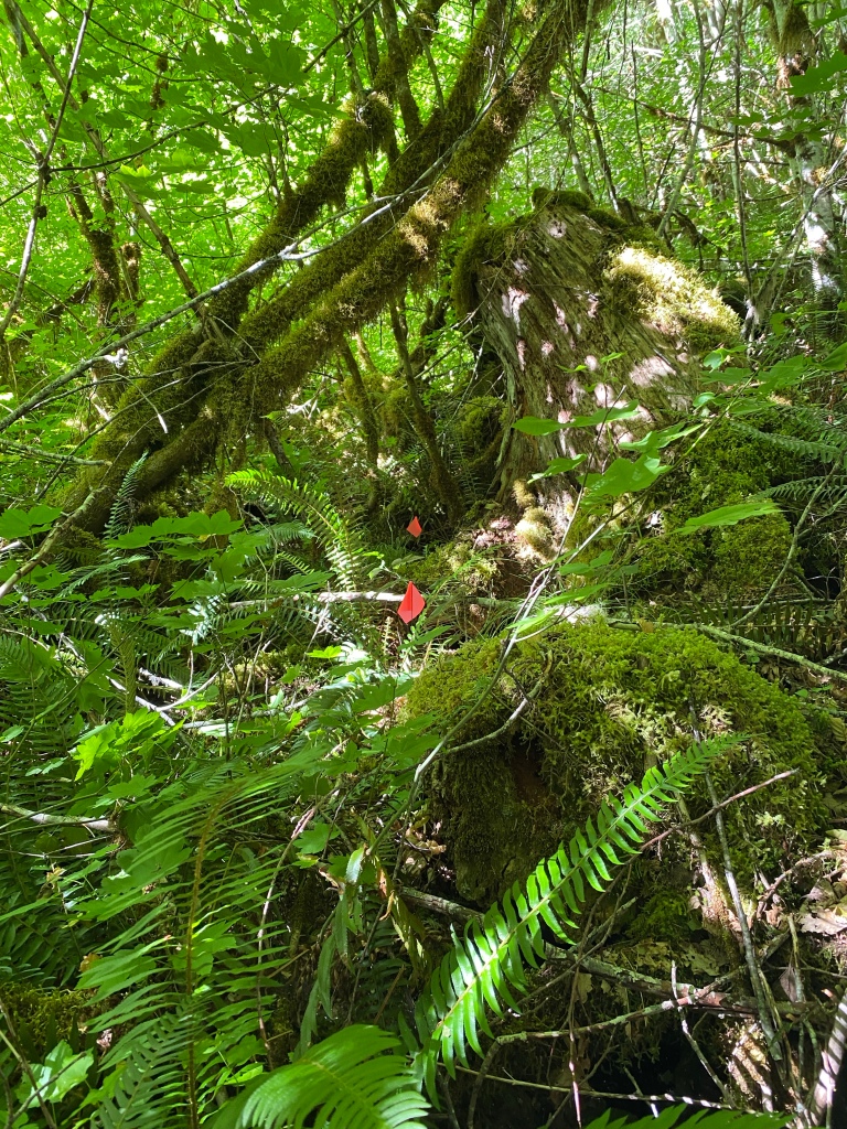
I searched for about 4 hours in the stream bed. I took apart all the debris piles, pulled back moss carpets and generally gave it a good going over. As you can tell from the GPS track, not a lot of ground was skipped in that area.
Despite “no joy” on the search for Karen yesterday, I left feeling positive. I now have two areas of the site thoroughly searched, and I’m learning more and more of the general layout of the area. I have a southern boundary formed by the now searched stream bed, that terminates in a marsh, which directs foot traffic towards a certain area along the creek. It is my belief that slow, methodical searching will help the mountain give up its secrets and help return Karen home.

I am Rodney’s cousin. I am humbled by your generosity in helping to solve this mystery. Thank you so very much. I hope to be able to help you on some point in this journey. Just need to be cleared by my surgeon.
LikeLike
Deni, thank you so much for your kind words. Knowing that one of the families is aware of the work I’m doing means a lot to me. Your help, in any capacity, is always welcome.
LikeLike
Let me know how I can help from afar (so far!) ! I am with Portland Police, in training. But let me know if I can do anything. I will have back surgery soon-ish and will have time on my hands.
LikeLike