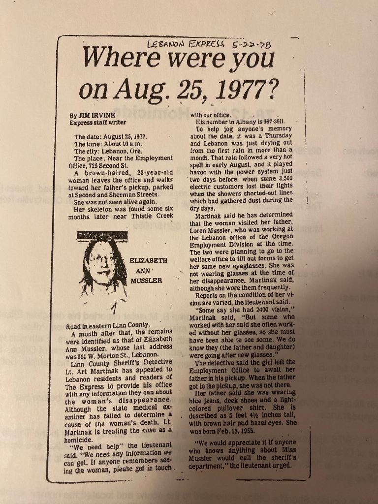
I apologize for the late update, I’ve had a somewhat busy week. I spent Saturday on another ground search at the Lee site, this time working areas I had identified on the 22 July ground search. I had a string of “alcoves” to search in the alder grove along the path from the berm to the creek. Also, I identified a flat, grassy bank along the stream to grid out.
I started with the alcoves and worked those for about 3 hours. Much the same as before, it is a hands and knees search of the debris and the forest floor. The good news is that no additional ground hornet nests were located. When searching the alcoves, it is tricky to assign a outer bound to the search. I tend to pick a fallen tree, or other feature as a limit, just to ensure that I have time to search the areas I’ve identified.
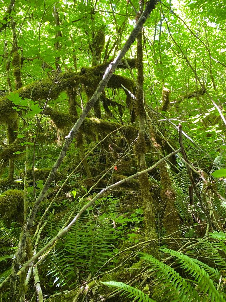
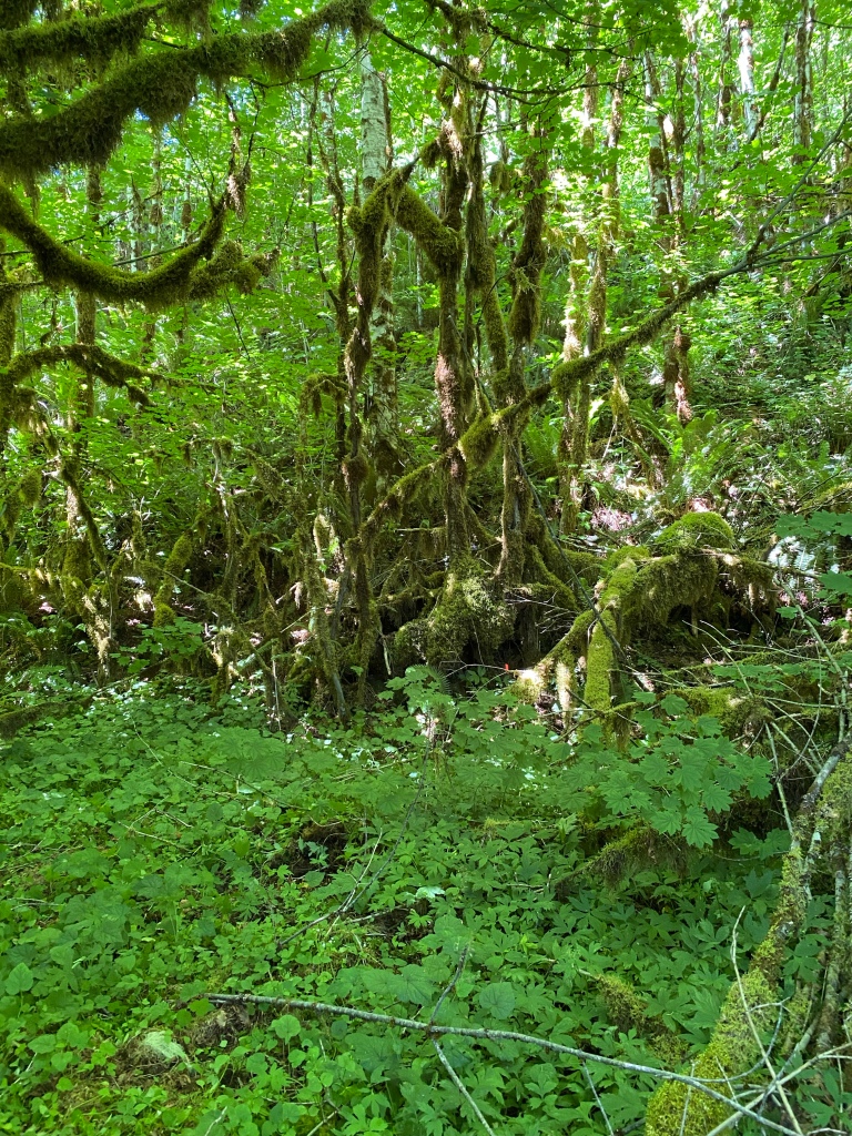
An alcove in the alders.
After completing the search of the alcoves, I moved on to the grassy bank along Soda Fork Creek. I grid searched the open grassy areas, then detail searched the debris collections, and the two intermittent stream beds there.
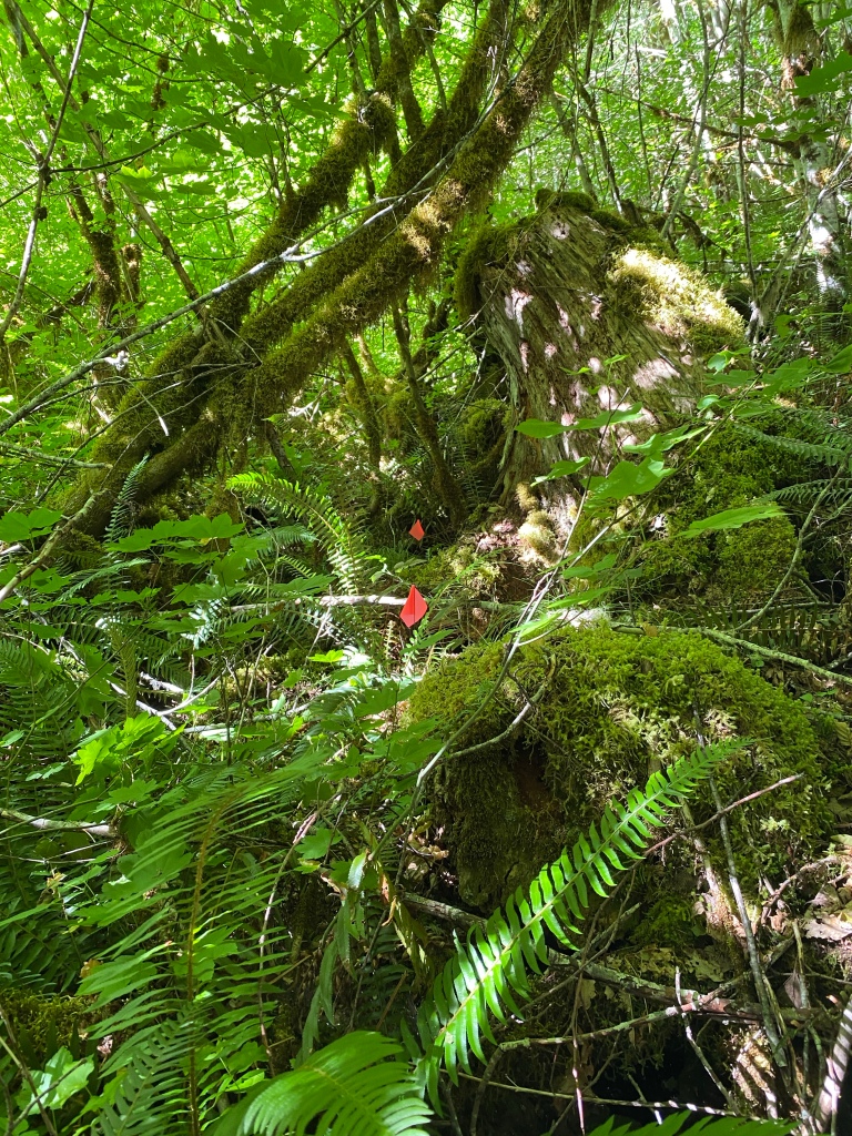
The grassy bank along Soda Fork.
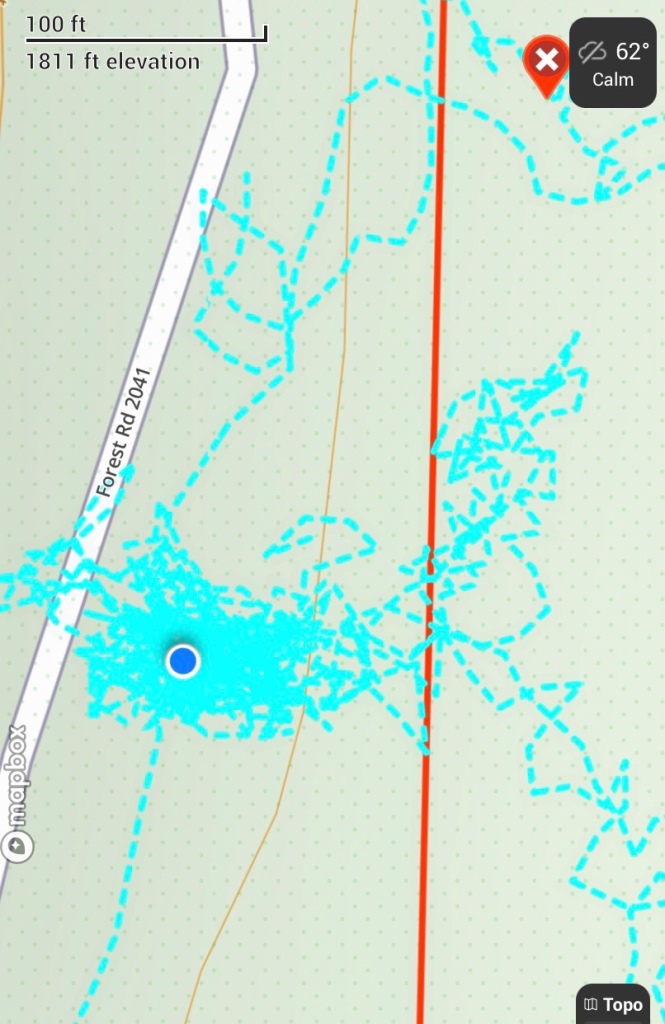
I use my GPS track to ensure that I don’t double search the same ground and that I know what hasn’t been searched. The GPS tracks are invaluable for planning each search, and greatly aid during the day. I have color coded the July 8th (green), July 22nd (turquoise) and July 29th (blue) tracks to make it easier to see the overall progress. I am slowly filling in the area of the Lee Site, and I am hopeful each time that I go out there that this will be the search that ends with a call to the LCSO.
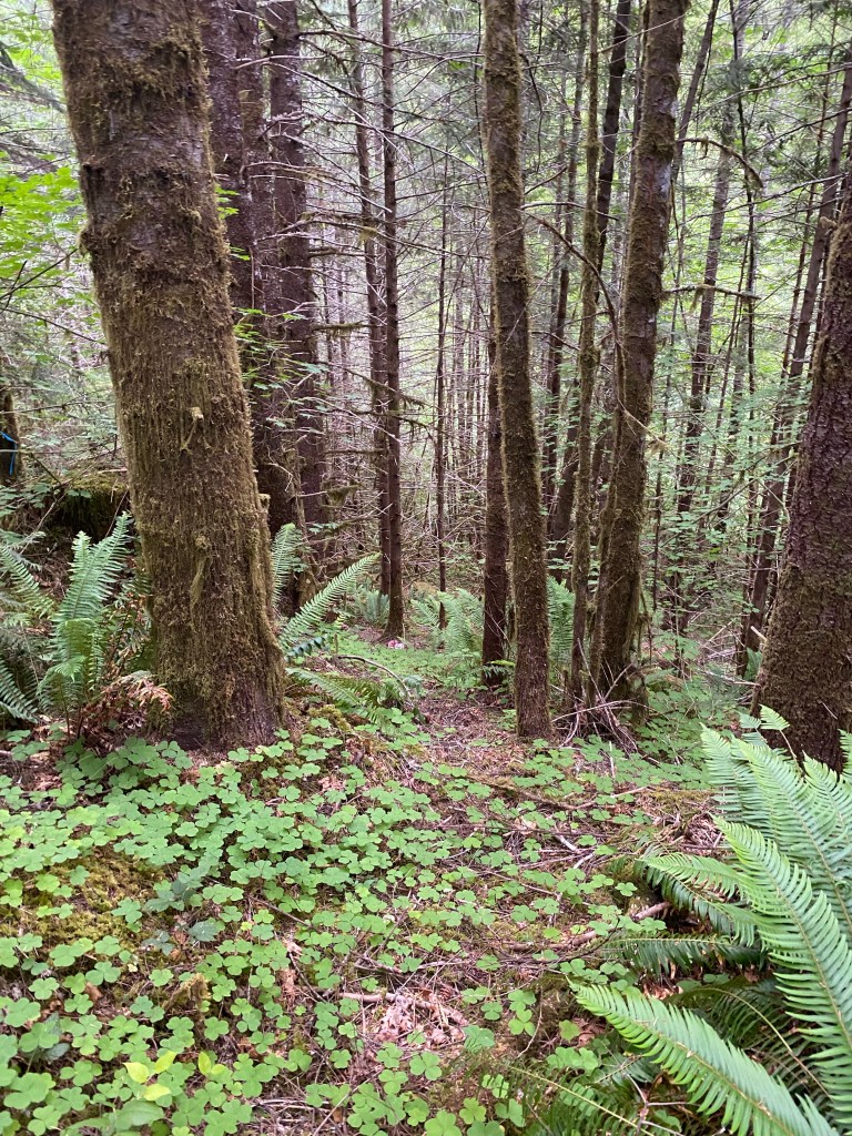
I was back at Soda Fork yesterday, continuing to clear the site a small section at a time. The plan for the day was to clear the gully that ran along the base of the hill in the morning, then begin to search the alder flat between the hill and the creek during the afternoon.
Searching in the gully. I’m working from this spot to the flag in the distance. Then repeat to the next flag. Getting under the ferns and clearing debris until reaching bare earth.
The gully ran north-south along the base of the hill. I searched that until I connected with an area I had previously searched on the 30th of June. I was working around a partially tipped over stump, mainly clearing out the hollow under the stump, when I found a hornet nest the hard way. I only took a few stings and Remy got none, so we are all ok here.
After finishing with the gully, I went back to the top of the hill, on the inside of the wood line from the berm. There was a bench on the hill, closest to where one would park if arriving at the landing from the Grissom site. I followed the line of drift from that bench to the alder grove along the river.
The alder grove along Soda Fork Creek.
This area fits well with the description of where Karen’s clothing and baggage were found. It’s also fairly large, is fairly level, without a lot of erosion or water courses, and so will require more of a grid type search than a targeted search of washes and depressions. Remy found himself a cool spot in the shade, I adjusted my knee pads, and I got to work while he supervised.
I searched one part of the grove during the rest of the afternoon. The temps were well past 90, so the dappled shade was appreciated, as was the breeze from the creek ruffling the leaves. It’s a rather beautiful spot on it’s own, and without the weight of knowing what happened here, it could be a nice spot for lunch and a nap. I searched until my knees were pretty much shot and I wrapped up for the day and began the drive back. The forest will give up its secrets when it is ready.
The day’s search is outlined in green. The area searched on 8 July is the area between Soda Fork Rd and the green line. The area between the two waypoints and the green line was searched on 30 June.
I went back to the Lee Site yesterday, with the intent of broadening the searched area. Even with the video tour, I still feel as though it is really hard to convey the size of the area and the overall rugged terrain and thick vegetation. The Lee Site is going to take a lot of time to search through, especially solo. My plan is to segment off areas, search them and then move onto the next area.
My GPS track from yesterday’s search. The Blue line follows my movements over the course of a 4 hour ground search. An intermittent stream and the area around it was my search box for the day.
Yesterday’s segment was an intermittent stream bed that ran along the southern boundary of the Lee Site. The stream bed ran from a culvert under Soda Fork Rd east, downslope through a marshy area then finally joining Soda Fork Creek. The blue lines to the east (right) side of the GPS track are along the bank of Soda Fork Creek. This is a case where the GPS map and reality are off by about 15 meters or so.
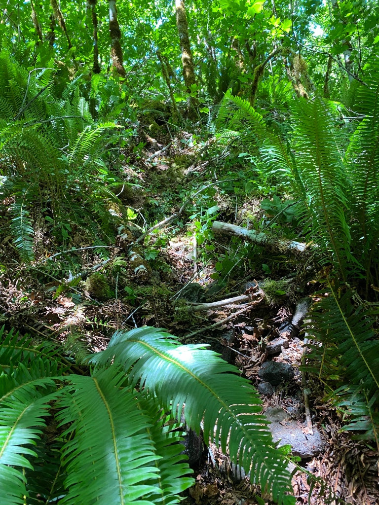
The underbrush and second growth at the Lee Site. The vegetation and terrain make for slow going.
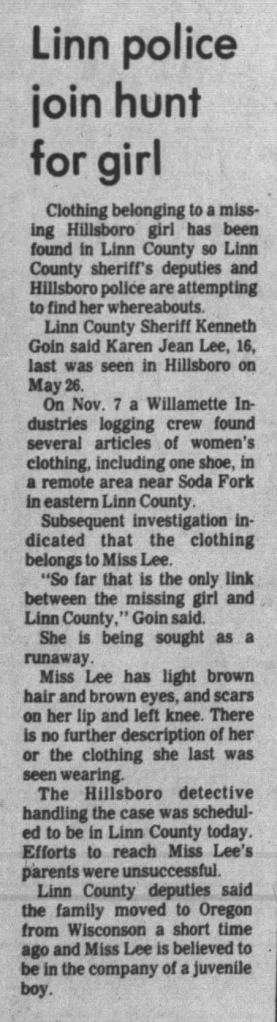
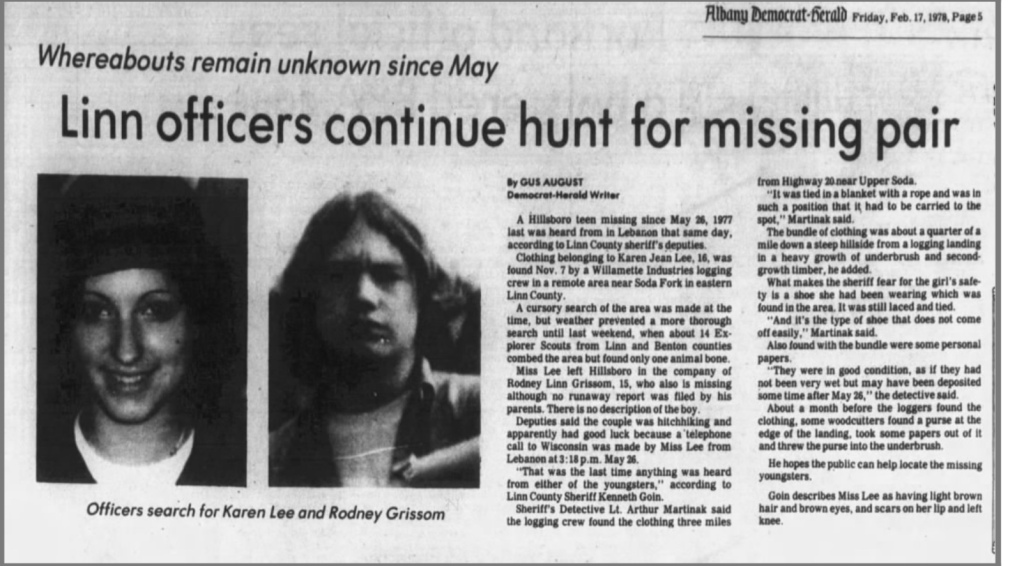
That description more or less describes the entire area behind the berm. The hill behind the landing is a U shape, and I chose the southern leg of the U to search. Based on the information available, and the terrain, I believe that Karen’s remains were left with her clothing and blanket bundle. We also know from the news clipping that the LCSO Detective, LT Martinak, stated that the bundle was in a position that it had to be carried to that spot.
My challenge now is that without a more definitive location, I have to hands and knees search the entire area. I have made a conscious decision not to use the 1/4 mile measurement from the clipping as a reference. In the pre-GPS days, I’m going to guess that anything between 100’ and 1000’ was called a 1/4 mile. An actual 1/4 mile from the landing would put one on the other side of Soda Fork Creek, which is definitely out of the search area. The eastern boundary of the Lee Site is Soda Fork Creek, the western boundary is Soda Fork Rd, while a pair of intermittent streams form the southern and northern boundaries.
I walked the top of the hill, marking lines of drift downslope, and made my way to the southern intermittent stream. I followed a very faint path down the hill to it, then walked to the bottom of the stream bed, just before it broadened out into a marsh that is between the hill and creek. Based on the overall swampiness in the area, it does channel foot traffic in a certain way towards Soda Fork Creek, which will help later in determine where along the eastern boundary to start searching.
I walked the bottom of the slope, marking out lines of drift and washes visible from the base of the hill. Luckily, there is a gully running north-south that forms a nice catchment for debris coming down the hill. Once I had marked that off, I walked back to the southern intermittent stream, and began searching up hill, towards the culvert.
Marking the gully at the base of the hill. It is rocky, overgrown, and there is a lot of deadfall on the ground and overhead.
I searched for about 4 hours in the stream bed. I took apart all the debris piles, pulled back moss carpets and generally gave it a good going over. As you can tell from the GPS track, not a lot of ground was skipped in that area.
A section of stream bed, post search
Despite “no joy” on the search for Karen yesterday, I left feeling positive. I now have two areas of the site thoroughly searched, and I’m learning more and more of the general layout of the area. I have a southern boundary formed by the now searched stream bed, that terminates in a marsh, which directs foot traffic towards a certain area along the creek. It is my belief that slow, methodical searching will help the mountain give up its secrets and help return Karen home.
Before I started searching yesterday, I took a few brief film clips of the Lee Site. Video works a little bit better than photos for capturing the landscape and what the terrain looks like.
Part 1: Soda Fork Rd and the LandingPart 2: From the top of the berm at the Lee SitePart 3: The backside of the landing and the hill Part 4: What a ground search looks like
This might be one of the more difficult posts to write, mainly because I’m not a huge fan of writing about myself, and to be very honest, this project is far more about bringing Karen and Rodney home than anything to do with me personally. I am asked on occasion why I am searching for them, and I figured I can summarize it here.
What started this for me was watching the documentary that Noelle Crombie and the staff at the Oregonian made for the “Ghosts of Highway 20” project. I had read the brief account about Karen and Rodney in part 5 of the series. In the documentary however, they interviewed Karen’s mother, Violet Gillmore, about her daughter’s disappearance. Her grief, even after the decades had passed by, was so strong that it quite frankly pulled at me. I help out with an organization that serves kids a lot like Rodney and Karen. I could see the kids I work with in the two photos of them that I had. I started to become curious about Karen and Rodney, and I wanted to know more about them and what may have happened.
Another interview that struck me, for different reasons, was the interview with now retired LCSO Detective Mike Harmon. He recounted how not recovering Karen, Rodney and later Rachandas’ remains have affected him. I remember him saying something to the effect that when he drives through the Santiam Pass, he wonders where Rachanda is, and if Karen and Rodney are with her. As a former soldier, I know a bit what it is like to have something gnaw at you; maybe you could have done something different and there might have been a different outcome. There’s a part of me that wants to resolve this for him as well.
Thankfully, the team at the Oregonian had provided a major assist. As part of the project, they published a footnoted PDF of the complete series. The footnotes were linked to source documentation from police, prosecutors, archived news articles, and interrogation transcripts. Included in that document haul was a summary of the LCSO case file about Karen Jean Lee and Rodney L. Grissom. That case file summary has been the single most important document to inform this search. Since this is still an open homicide investigation, LCSO did not release the full case file, but the gaps in the summary informed other research, and the summary became the standard to evaluate other information against.
That summary also personalized it for me, in a way I was not expecting. It listed the location where their clothing was found as “Upper Soda, Section 19”, and that was a brick of information hitting me. I’ve been going to the Middle Santiam Wilderness almost since I arrived here and Soda Fork Rd is the main way to access the trail head. It is one of my most favorite places in Oregon, where I go to fish, camp, hunt, hike and generally find some peace when I need it. When I came out for the 15 May 2023 Site Survey, I realized that I had changed a blown tire at the Grissom Site two years earlier. On my first visit, in 2017, I ended up fishing about 200’ from where I am now searching for Karen.
The final “why” so to speak, is that I have a professional background that is adjacent to this type of work. I was a Sensitive Site Exploitation SME a lifetime ago. What’s that? We used a mix of biometrics, forensics and other techniques as a tool during the Global War on Terror. I also volunteer for my County’s Search and Rescue team. Not only did I know the area, and feel a moral compunction to act, I also had the ability to do so.
After the 17 June 2023 ground search at the Grissom Site, I have shifted to searching the Lee Site only. I had some use or lose time, and decided to spend another day at Soda Fork. I got out there by a little after 8am and started with a more detailed site survey than I had completed on 15 May 2023.
I followed the same procedure I had employed previously at the Grissom Site. I sketch mapped the site, and located the trails and lines of drift leading from it. I noted that this time, the blackberry growth along the top of the berm had filled in about 80% of the back-top of the berm, effectively obscuring any trails that may have once been there. Thankfully the thicket is not mature, and is still passable in boots and heavy pants.
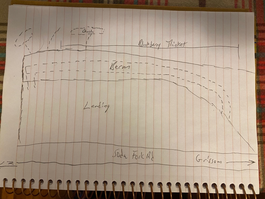
Site sketch of the Lee Site
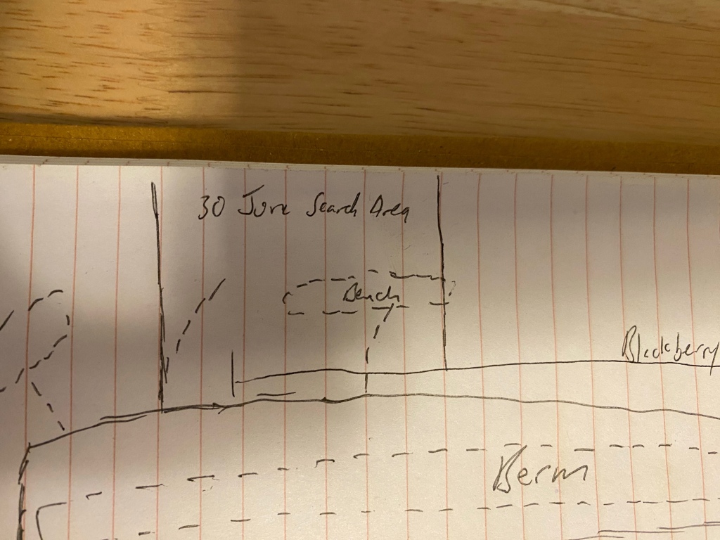
To me, this indicates that the vegetation has now obscured the topography that would have been visible in 1977. I still consider the bench noted on the 15 May site survey as a likely crime scene but not the only potential scene. I decided to section off the area I had previously identified and flagged as my search box for the day. I made my way to the bottom of the hill, surveying flags in hand and I began to mark debris piles, depressions and washes.
The 30 June 2023 Search box
I spent from roughly 9am to 3pm bear crawling up the hill to the top of the berm and back. I would start at the outflow of a wash, go through the debris pile in its delta, then work my way up on my hands and knees, clearing leaves, lifting fern mats, going through woody debris. I can move relatively quickly, despite the terrain and vegetation. The types of remains I am looking for, especially after 46 years of weather exposure are the long bones and the heavy bones: radius, ulna, humerus, femur, tibia, fibia, lower mandible, skull, and to a lesser degree, vertebrae and ribs. Even in partial form, these bones are large and distinctive, and likely to survive.
At the base of the hill for the day’s search. The debris that collected at the bottom will be searched.Looking up a searched wash towards the top of the hill. The northern 20% of the Lee Site is less steep than the remaining southern section. The rocky ground made me thankful I remembered to bring knee pads.
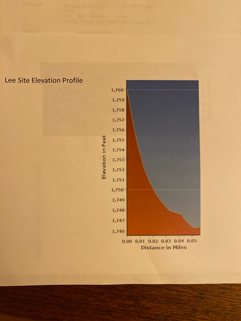
I finished the search of the day’s area by about 230. It was about 89, sunny and I was physically spent by the exertion of crawling up the hill repeatedly. Before leaving for the day, I walked the top of the hill, behind the blackberry thicket. This was a preliminary survey of the remaining 80% of the site that I hadn’t walked previously. It’s a steep, wooded and rocky hillside, with a 60 foot drop over 0.05 miles to the Soda Fork creek bed.
My tentative plan to search the remaining terrain is to section the hill into lanes that can be searched in 8 hour increments. The search plan would remain the same- identify washes, depressions and lines of drift, and focus the search there for the long and heavy bones. In all honesty, I was feeling slightly down until I walked the top of the hill on this survey. After striking a dry well on the day’s search in the sun and the heat, I was feeling it. Then on the survey, I realized that I had barely scratched the total area at the Lee Site.
Stay optimistic. This is a long process with no set end. The work will be done when it is done.
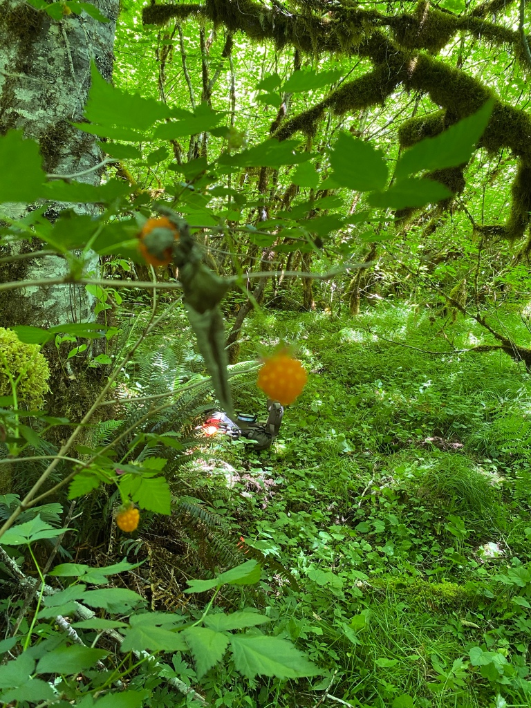
Salmon berries and the alder grove that was the center of the day’s search.
For now, this is an entry without a proper ending. The why for this may be apparent, and there is a good reason for it. Please be patient with me until that ending can be written.
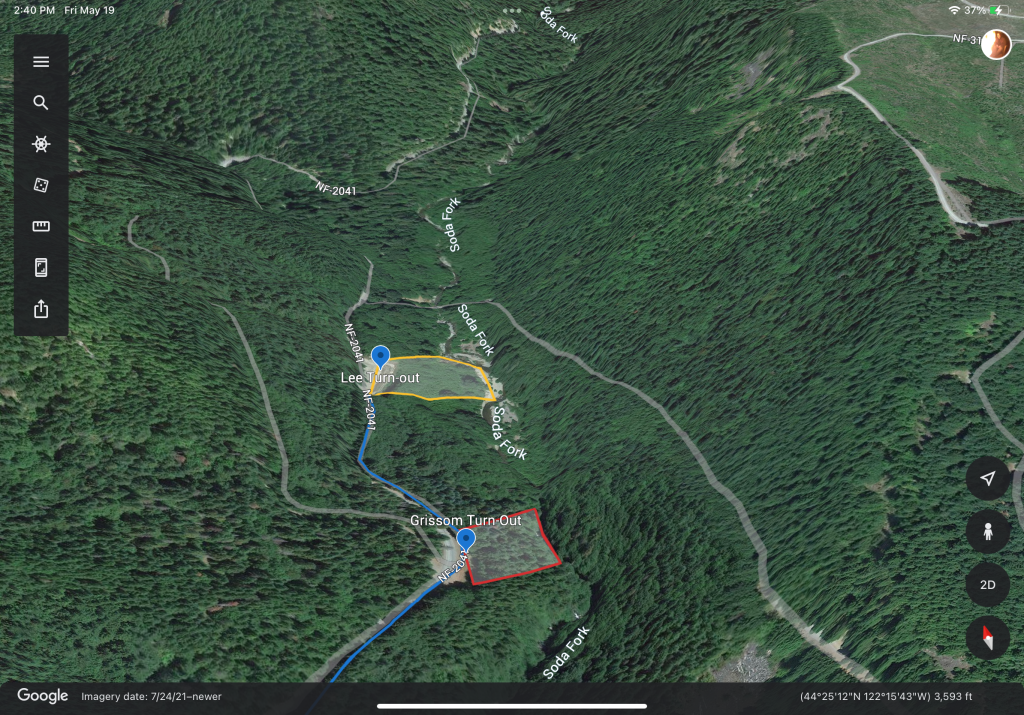
I arrived at Soda Fork late in the morning on Saturday. My search plan had been developed the week prior, and I wanted to spend the day until dark completing a more intensive survey of the Lee and Grissom sites, and conduct some preliminary searching of areas of interest. My search plan for the day was to survey each site, identifying and plotting the following: draws, washes and intermittent water flows across the ground; debris piles at the exits of those flows; sunken and soft areas in the ground; check the bases of cliff outs on the hillside; check any accumulated debris and identify lines of drift down each hillside.
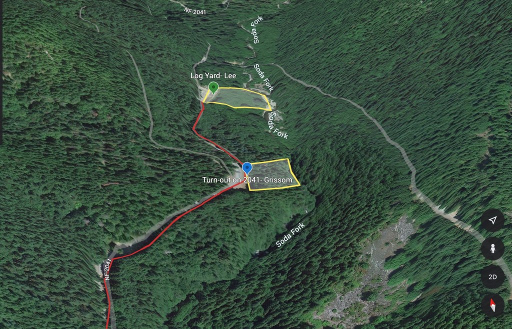
The Lee and Grissom Sites along Soda Fork Rd
I had originally wanted to start at the Lee Site, since the terrain is easier to walk and slightly less vegetated. A family was target shooting into the berm at the landing, and after letting them know where I’d be in the area, I drove back to the Grissom site.
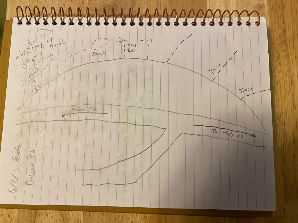
When I arrived at the Grissom Site, I parked and walked the turn-out. I took my notebook with me and sketched the turn-out and the different trails and lines of drift leading from the road down the hill.
Sketch of the Grissom Site, with trails and noted features annotated. As you can tell, drawing is not my strong suit.
I took about 2 hours and surveyed each trail and line of drift from the turn-out. I walked each one until they ended, or reached a natural terrain feature, such as a bluff that would cause foot travel to deviate around it. From the end, I would then turn around and examine the hillside leading to this point. I looked at how water would flow down the hill during the winter, where debris collected, were there any features identifiable looking up that weren’t apparent when walking down?
On the walk back up the hill, I would pull apart debris piles, rolled logs back, and otherwise searched the lines of drift and collection points. I found half a dozen truck tires, empty propane bottles, oil cans, and the normal detritus of a working forest.
In the early afternoon I started on the first line of drift that I had found on the 15 May 2023 initial site survey. After examining the other trails from the turn-out, this one, with its below grade and concealed bench, still seemed like the most likely place where the crime occurred. Standing at the bench, I made a silent prayer to Karen and Rodney, that I was there to help them and that if they wanted, to bring them home.
I started walking down this line of drift, past the surveyor flags marking areas of interest I placed a month earlier.
Looking downslope at the line of drift from the bench at the Grissom site.
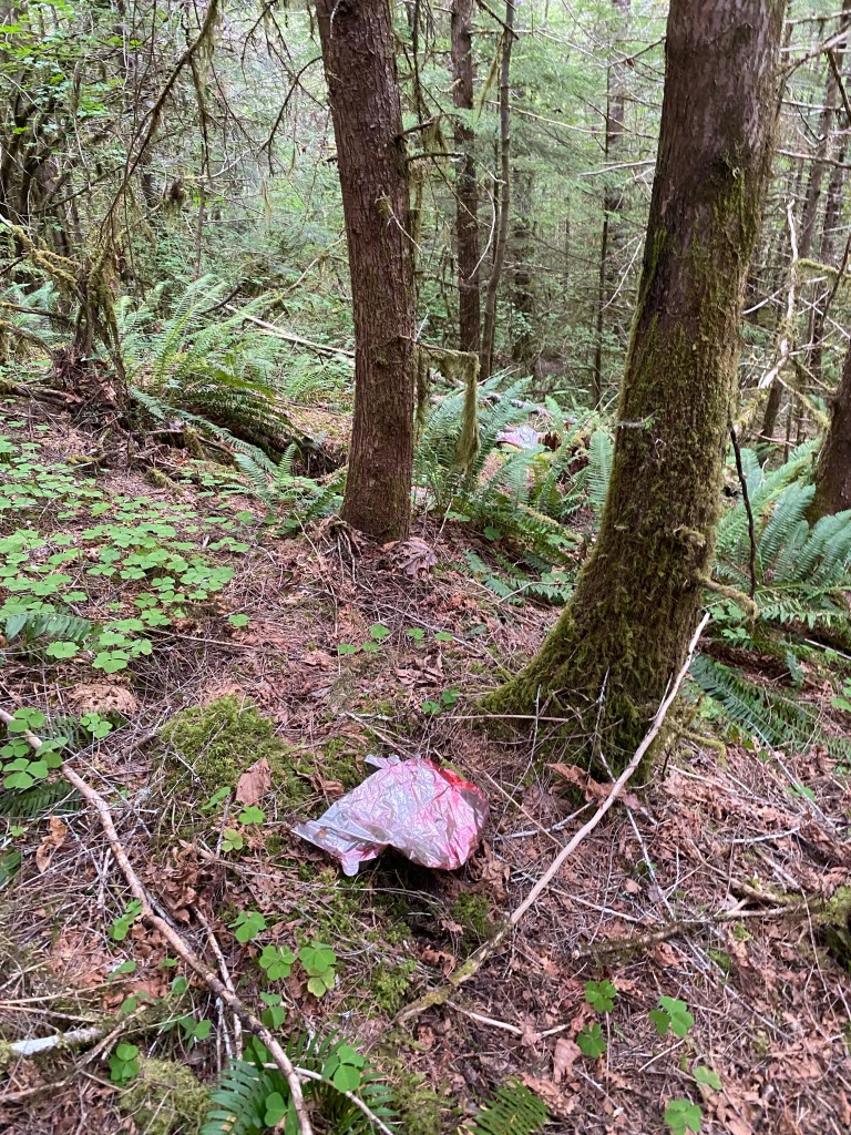
I used my trekking pole to sweep aside ferns and undergrowth along the sides, and kept going past this Mylar kids balloon that had drifted on the wind into the mountains.
A Mylar balloon at the Grissom Site
I reached the outer boundary of where I had looked on 15 May 2023. I stood in the area and noticed that the hillside about 50 feet to the north leveled out. I walked over there and from that level spot, I noticed that the hillside formed a funnel above it, and that the funnel led to a depression where a tree had gone over. Debris was gathering in the hole the rootball left.
A depression in the hillside where a tree once stood. Debris from the hillside above has collected in it.
This is where I have to end this entry for now. I am hoping to have more information to share soon.
I’ve spent the past couple of months compiling facts, trying to determine what they mean, examining maps and making a site survey in support of a search for Karen and Rodney’s remains. I’m at the point where the search is about to become time intensive and on the ground, so I am going to work through facts, assumptions and unknowns to ensure that I’m spending that time on the right piece of ground.
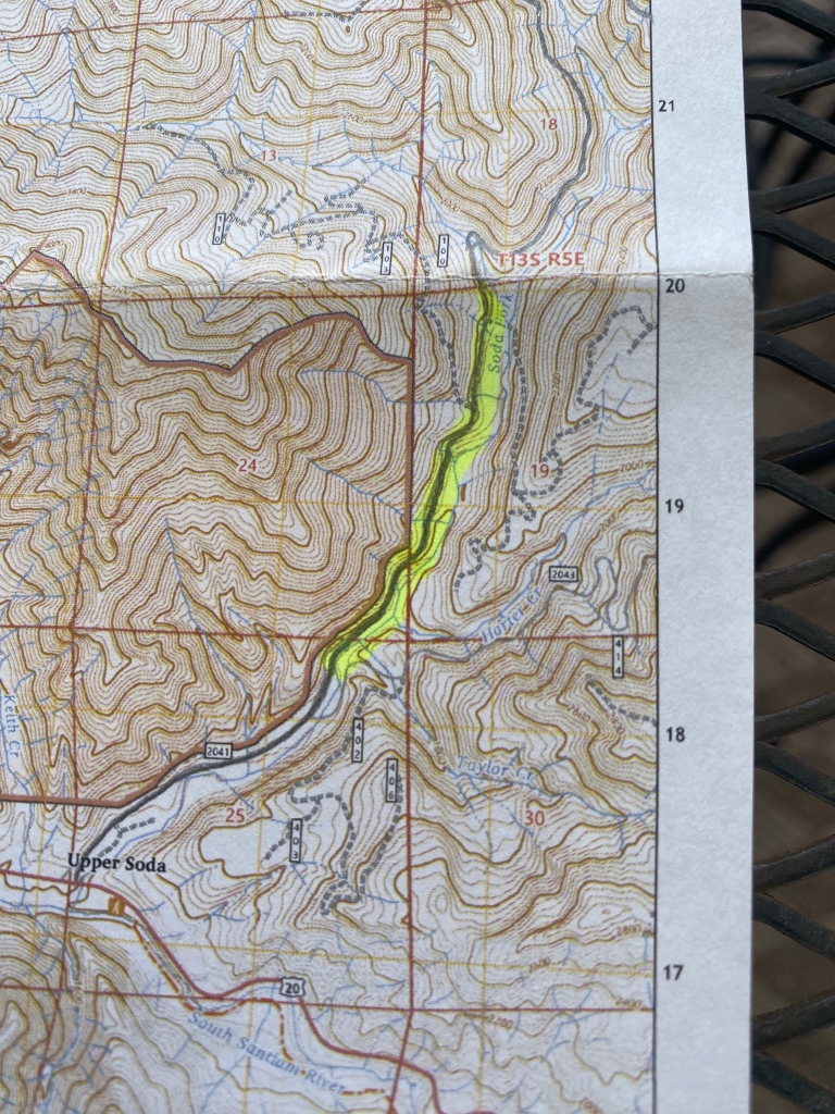
Section 19, Soda Fork Rd, Linn County, Oregon.
I’m want to lay out the facts, assumptions, and unknowns. Then I’m going to re-examine the assumptions to ensure they are still supported by the facts. I’m going to limit this to the facts and assumptions that have guided my search to the two locations to ensure that my on the ground time is well spent.
What We Know
Rodney was last seen 24 May 1977 in Albany, OR
Karen was last seen at 0830 26 May 1977 in Hillsboro or Cornelius, OR.
Karen’s last contact was a phone call from a pay phone in Lebanon, OR that ended at 3:18pm on 26 May 1977.
Karen’s clothing and belongings were found in the woods behind a landing within Section 19, Soda Fork Rd on 7 November 1977. Her worn clothing was recovered at this time and in this location.
Rodney’s clothing and belongings were found 1/4 mile from Karen’s on 8 November 1982. His clothing was also found within Section 19, Soda Fork Rd.
Both sets of clothing were found by Willamette Industries loggers.
Rodney’s watch was stopped at 4:50 on the “27th”
Karen’s luggage (blanket bundle) was recovered with her clothing from behind the landing.
Rodney’s luggage (orange external frame backpack with “R. Grissom” written in ink on it) was traced to a pawnshop in Bend, and then to a garage sale in Redmond.
Open Questions and Unknowns
Was Karen’s worn clothing packed into her blanket bundle or was it found in the area?
What does imagery from the 1979 Linn County aerial survey revel about the area?
What does John Ackroyd’s ODOT timecard record for his whereabouts for Monday 5/23 through Friday 6/10 1977. Did he take time off during the period when Karen and Rodney vanished? His work absences are correlated with his other crimes.
Assumptions Based on the Facts
Karen and Rodney were killed between 3:18pm 26 May and 4:50AM 27 May.
Supported by:
time stamp on pen register for last phone call.
Weather data supports water intrusion stopping Rodney’s watch at 4:50am on 27 May 1977.
It is a 50 minute drive from Lebanon to Soda Fork Rd. They would have arrived no earlier than 4:10pm on 26 May 1977.
Rodney was murdered first at the turn-out
Supported by:
The turn-out is the first location reached when driving from US 20 along Soda Fork Rd.
Rodney’s clothing recovered here.
Topography of turn-out and hillside would aid the crime and screen it from observation.
Karen was murdered second at the Landing
Supported by:
location is second when driving from US 20 along Soda Fork Rd.
Karen’s clothing and belongings were recovered here.
Location is 1/4 mile from the turn-out, matching news reports about the distance between the two sites.
Topology of the landing would aid the crime and screen it from observation.
John Arthur Ackroyd was the killer
Supported by:
LCSO attribution.
Victimology fits Ackroyd’s preference.
Location where clothing was found fits Ackroyd’s MO.
Disappearance occurred during Ackroyd’s 1976 to 1978 spree.
Not Supported by:
No direct evidence or confession.
Ackroyd not known to kill men
However, Ackroyd did have a later double homicide attributed to him.
Rodney was probably not the preferred victim, but an obstacle to remove.
Karen and Rodney’s bodies were left where their clothing and belongings were found.
Supported by:
Karen and Rodney’s clothing were found 1/4 mile apart and based on reports, this was their worn clothing.
If worn clothing was separated from the bodies, why thoroughly divide Rodney’s from Karen’s and dump separately, but relatively close together?
Moving two bodies from Soda Fork to another location off US 20 is too high risk for the perpetrator.
There is no way to explain away two bodies dead from homicidal violence if seen by another driver.
There would be no real advantage to loading both bodies into a vehicle and then dumping them deeper into the forest along Soda Fork. Both sites are more than 1.5 miles from US 20 and not near the residences at the junction of Soda Fork and US 20.
Would require the murderer to load Karen’s remains, then drive back to the turn-out, leave Karen’s body unattended while retrieving Rodney, then turn around and head deeper into the forest. Based on the effort required, and the advantage gained, this is too much effort and too risky in terms of discovery.
John Ackroyd does not seem to be organized enough to pursue this degree of obscuring his crimes.
Not Supported by:
Searches of the locations in 1977, 1982 and 2012 found no remains in the area.
After re-examining the facts and assumptions, I am positive that I am in the right location where their clothing and belongings were found. I am also still confident that these were the locations where Karen and Rodneys’ remains were left. Whether they still can be found is the open question. Let the ground search begin.