“Tied in a blanket with a rope” New Facts and New Analysis

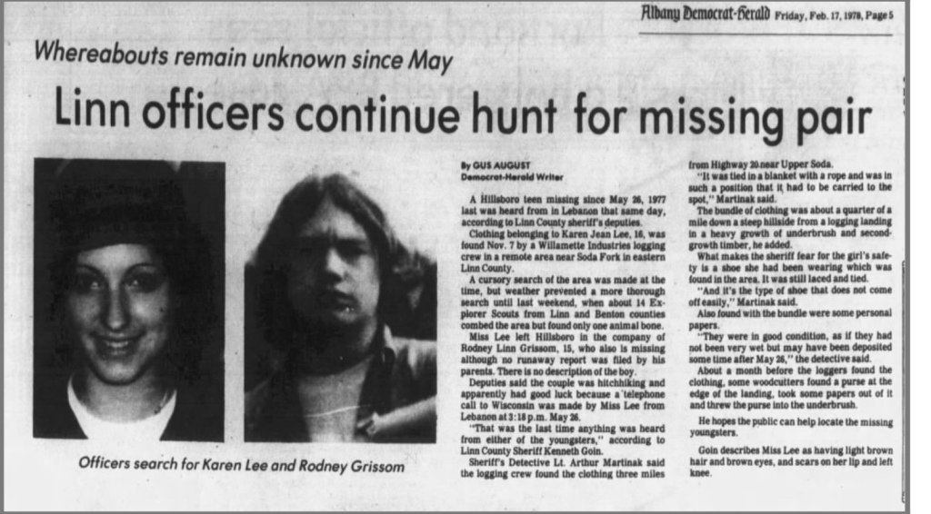
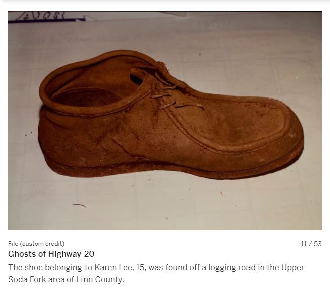
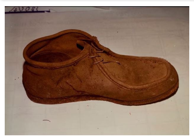
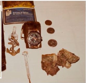
I learned this week that Karen’s clothing and belongings were found bundled in a blanket that had been tied with a rope. It was found down a steep hillside from a logging landing and in such a position that it had to be carried to the spot it was found in. I also learned that the shoe was not in the bundle, but found in the area.

The open question I have now is whether Karen’s worn clothing, in particular her cut jeans, were inside the bundle or were those clothing items found, like the shoe, in the area. I’m going to work through some possibilities, what those add to the known facts and how it could change the analysis and the search location.

Possibility 1: Karen’s worn clothing is found inside the bundle. Analysis: This leads me to believe that the crime occurred elsewhere and the killer separated the body from the belongings and clothes, packaged up the possessions and dumped the items at Soda Fork. Implications: This level of organization would lead me to rule out Ackroyd as a suspect since he hasn’t demonstrated this level of organization in his other crimes. I would also lessen the probability of finding Karen at Soda Fork, and my potential search area now encompasses Linn County east of Lebanon. How does this fit with the other facts: While Rodney’s backpack was traced to Bend, there is no mention in the police reports regarding Karen’s luggage. If this had been a dump of her clothing, separate from the body, then why make an extra stop to dispose of Rodney’s clothing in a different location? It would make more sense, even for an organized killer, to make a single stop and disposal of the items in one location.

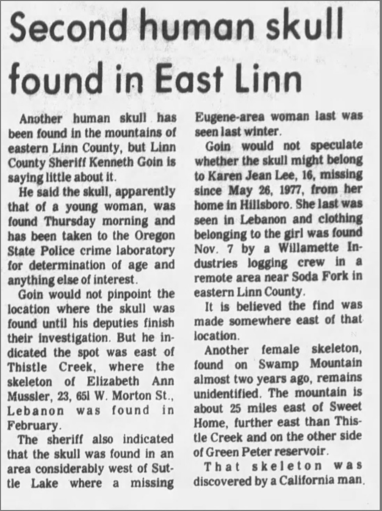
Possibility 2: Karen’s worn clothing is found in the area, similar to her shoe. Analysis: This indicates to me that the crime occurred at the Soda Fork location. Her worn clothing being found separate from the bundle indicates to me that in addition to leaving the body in that location, the killer also left her belongings. Implications: This still fits with Ackroyd’s MO and opportunity killer profile. Swamp Mountain Doe was found on the forest floor with a single shoe and her worn clothing, and her death has been attributed to Ackroyd by the LCSO. How does this fit with the other facts: This accounts for Karen’s luggage. Rodney’s backpack had value to pawn, and by pawning it in Deschutes County, it would be unlikely that it would be found and linked to a disappearance in Linn County. Karen may have made a hobo bundle to carry her belongings in, and this would be both of no value to pawn and highly incriminating to possess. It would make sense to leave the bundle at the location with the body. This still fits with the existing theory of the crime and better accounts for Rodneys’s belongings being in a separate location.

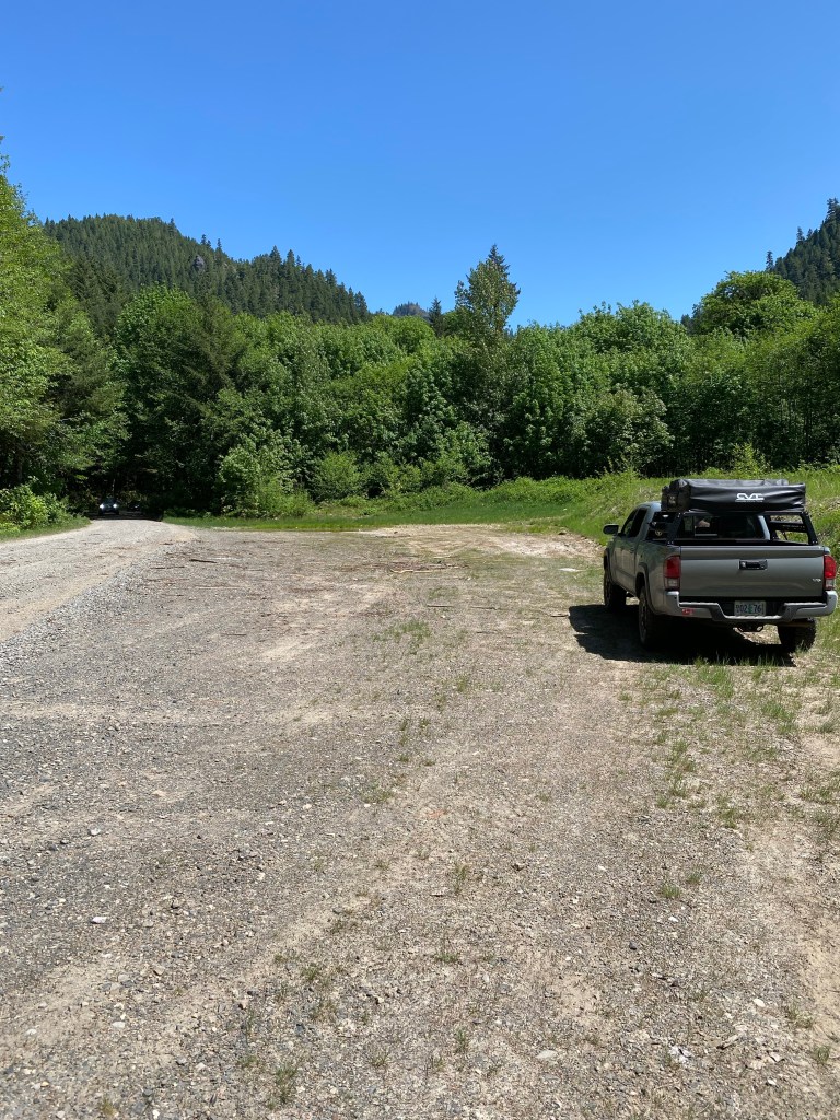
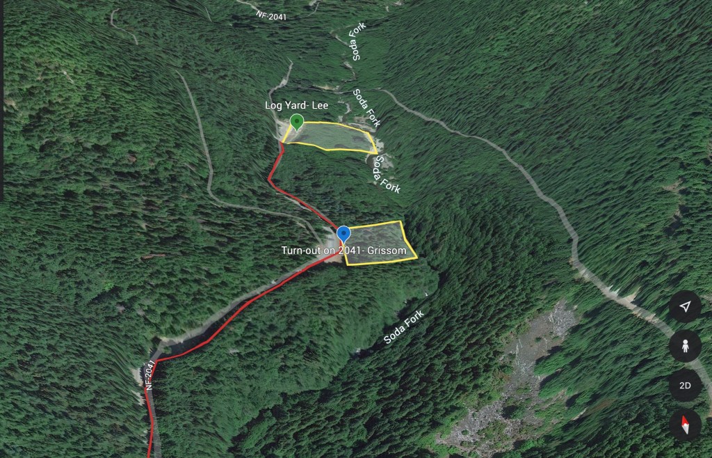
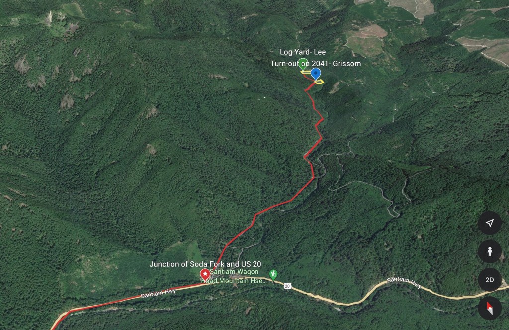
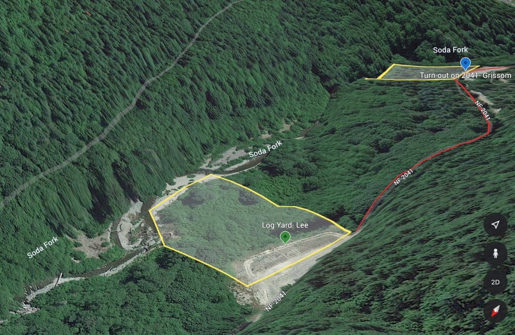
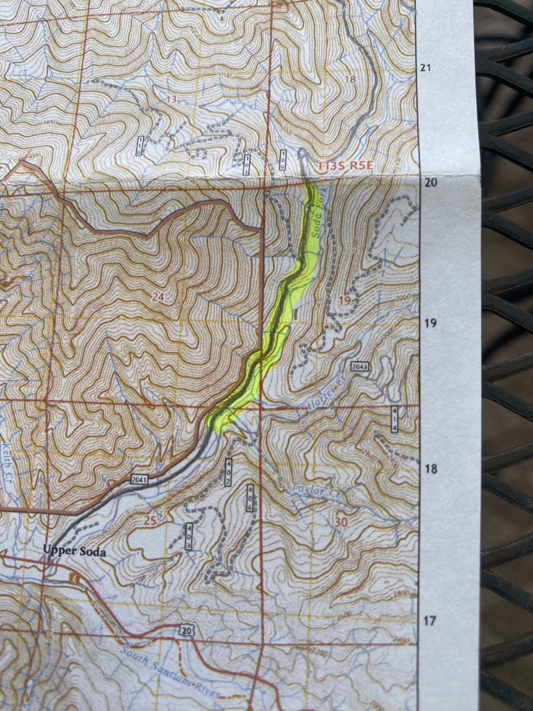
Comparing the two options for how Karen’s worn clothing was found, I believe that option 2 is more likely. It fits better with the other known facts, and doesn’t generate quite as many follow up questions as possibility 1. I am also open to being quite wrong on this belief and should new information develop, that will also be incorporated. The evidence still points to Soda Fork as being the likely location of Karen and Rodneys’ remains and I intend to continue focusing my search effort there.

In the newspaper article, it does mention that Lt. Martinak described the papers inside the bundle as being in good condition “as if they had not been very wet but may have been deposited some time after May 26.” Without knowing the exact location, what the overhead cover was like, what material the blanket was made from, how the papers were packed, and that’s a lot of variables to control for when looking at the historical weather data.

The historical monthly weather data for June to EOM October 1977 shows a typical dry summer, with light rain beginning intermittently in late September but staying fairly light on the precipitation through October. Without knowing the other variables listed above, I’m going to hold my assumption that the bundle was left at Soda Fork on May 26th.

Dusty Clippings and New Info

In addition to the documentation released by LCSO, I’ve also been reviewing news clippings about Karen and Rodney’s disappearance, looking for information, and hoping to find additional facts that will inform my search and perhaps fill in some blanks. I have relied on the newspaper archive search-fu of a friend, and I want to say thank you to Faith for the assist in finding these.

One article in particular has been most helpful. The article confirmed that what I had previously identified as the Lee Site, was in fact the correct location. From this confirmation, I also have a higher confidence in my identification of the Grissom Site.

“The bundle of clothing was about a quarter of a mile down a steep hillside from a logging landing in a heavy growth of underbrush and second-growth timber”

A persistent and somewhat vexing question I have had is what was the arrangement of their clothing when it was found. Were the clothes scattered around the forest floor? That could indicate that the body was not buried. Were the clothes found together in a pile? That indicates a different set of circumstances. Were they found neatly folded or just tossed together? The answers to these questions help inform the search.

This article answered the question partially in the Lee case. Detective Arthur Martinak is quoted as saying “it was tied in a blanket with a rope, and was in such a position that it had to be carried to the spot.” Additionally, we learn that the shoe was not in the bundle, it was found in the area and it was still “laced and tied”. Detective Martinak also states that “it’s the type of shoe that does not come off easily”.

The shoe referenced in the article above.

In the bundle, in addition to the clothing, personal papers, later revealed to be her journal, were found. The papers were in good condition, as if they had not been exposed to the elements long.

So, I now have new facts to add to the existing set, and I have to determine how these new facts align with or change my theory about the crime and where Karen and Rodney might be. I need to take some time and think through this, which will probably be my next entry. One additional question I can think of is “was her worn clothing, her cut jeans in particular, inside the bundle, or found in the area with the shoe?”

As a bonus, this article from 1978 has references to all of the victims, except Marlene Gabrielsen, associated with John Ackroyd up to that point. In a way, it is draft one of “Ghosts of Highway 20

Site Survey: 15 May 2023

My search is now transitioning from research and planning to boots on the ground searching. So that I’m not randomly walking around the woods, I’ll be using the facts and the analysis of the same, the theory of the crime and my prior map work to find the locations. From the map, I’ve narrowed done my search box to about a 1 mile length of Soda Fork Rd.

Key facts that inform the on the ground work are that 1) Lee and Grissoms’ belongings were found within 1/4 mile of each other; 2) logging operations cut short the first search for Lee; 3) their belongings were found by loggers. From the theory of the crime, I’m starting from a belief that Rodney was murdered first, followed by Karen at a second location, 1/4 mile away. I can also reasonably interpret that the loggers who found the belongings, 5 years and 1/4 mile apart found them while on a bathroom break. People who work in the woods tend to stay on the job site instead of randomly wandering around since the foreman isn’t paying for them for that.

The goals of my first site survey, on 15 May 2023, were to determine a drive time from the Shari’s in Lebanon to Soda Fork, then find suitable locations along the identified length of Soda Fork that is within Section 19 and that support the “two crime scenes” and “found by a logger relieving himself” theories. One fact that had me puzzled was the “logging operations” that cut short the first search for Karen. The right or east side of the road is protected riparian zone along Soda Fork and the left side is the Federally protected Menagerie Wilderness. My question was how to square “logging operations” in an area where tree felling was unlikely to occur.

I began the drive from the Shari’s parking lot, and it took about 50 minutes on the dot to reach Soda Fork Rd. I pulled onto the logging road, opened my GPS and set a tracker and began the drive in. After driving about a mile from US 20, I reached the boundary for Section 19, and began scanning the side of the road for pull outs. The first three pull outs were barely worth the name, as they were about 4 feet wide and more useful for pulling over to let an oncoming log truck pass by. The hillside also dropped sharply away to the creek bed, which made them seem less likely for bathroom breaks.

The next pull out was approximately 25 feet wide from the road to the wood line, had two fire pits and could have hosted 5-6 pickups at any given time. I pulled over, parked and walked the wood line. Very quickly I found a path from the pull out that went down a short incline to a flat, level spot. This bench was about 10-15 feet below the grade of the pull out, and my truck was not visible from that location. From the bench, the hillside dropped away again, with two natural lines of drift leading down the slope. I plugged a waypoint into my GPS as this was a likely location.

The Grissom Site

Returning to my truck, I reset the odometer and drove forward, looking for a pullout approximately 1/4 mile ahead. I exited the wood line and the road passed by a former log yard, exactly 1/4 mile from the previous location. That’s when it snapped together- the yard was the logging operation, and Karen’s belongings were found somewhere behind it. The yard consisted of a bulldozed flat section about 50 yards wide from the road to a berm. The berm rose about 10 feet, was about 50 feet wide with a rutted track along the top. The last 20 feet of the top before the wood line proper had started to grow in with Armenian blackberry, but there was still a well worn footpath to follow. This path went down the backside of the berm to another flat bench on the hillside. This bench was obscured from the road by the berm and the brush. Were there a row of stacked logs on top of the berm, that spot would be completely invisible. This was also entered into my GPS as the Lee Site.

The Log Yard and Lee Site
Google Earth view of the two locations in relation to each other

I drove back to the first pullout and realized I had found both locations. The documented facts, analysis and theory all fit the ground. I walked the footpath to the bench, and with my truck out of site, and feeling the breeze from the creek below, it became inescapable that this was the probable location were Rodney Grissom was murdered. Looking up into the trees, a deflated, mylar children’s birthday balloon was twisting and righting in the wind. This became the Grissom Site.

Google Earth view of Soda Fork Road and the two locations where Lee and Griossoms’ clothes and belongs were found.

I spent some time walking up and down the hillside, marking possible grave sites with surveyor flags and GPS waypoints. I returned to the log yard, now etched as the Lee Site. I walked up the berm, down the path to the bench, with Marlene Gabrielsen’s chilling account echoing in my head. I stood on the bench, looking at an otherwise unremarkable patch of alder scrub, but feeling the reverberation of the crime that had occurred there 46 years earlier.

It took 5 minutes to drive from the Grissom Site to US 20. I doubted those two kids, heading in the opposite direction and flush with being on an adventure, would have noticed how far from the pavement this bathroom break was.

Upper Soda Fork, Section 19: Finding the Locations

A key part of any search is knowing where to look. Regarding Karen and Rodney, I have partial information. I have a document from the LCSO released as part of the Oregonian series; since their case is still an open homicide, the actual case file is not publicly available. I also have Noelle Crombie’s reporting, photos and videos from Beth Nakamura and Dave Killen and archived newspaper articles from when their items were found. Using these references and boots on the ground site surveys, I should be able to locate those sites. For brevity I’ll refer to the specific locations as the Grissom Site and the Lee Site.

The document released to the Oregonian by the LCSO in 2016. It is a summary of the case file.

I know from this document that both Lee and Grissoms’ clothing were found in the same area, which is listed as Upper Soda Fork, Section 19. That is a lot more vague than a 10 digit grid coordinate, or even a mile marker on the road. My first challenge is narrowing down exactly where on Upper Soda Fork Rd the items were found.

There are many common names used, but the official designation of Soda Fork Rd is Forest Service Road 2041. FS 2041 joins US 20 just past mile marker 52. My next stop is the US Geographical Survey for a topographic map of the area. Conveniently, the map sheet is named “Upper Soda Quadrangle”.

A topographical map of the Upper Soda area. If you’re familiar with these, the contour lines say a lot about the ruggedness of the terrain.

Now, I have to find Section 19 on this map. I started to turn on different layers in the map, trying to find the right layer that had a Section 19 that contained part of FS 2041. The Bureau of Land Management (BLM) administers a lot of land in the west, and they have what’s known as a checkerboard pattern to their maps. Each section of checkerboard is 1 square mile and numbered. When I added the BLM layer, I found Section 19.

FS 2041 is highlighted starting at 1 mile from US 20 until it exits Section 19. You can see the red 19 in the center of the red-brown grid square. Navigational grid squares are in faint yellow.

How do I know that I’m in the right place? I’m on the correct road, the road passes through BLM Section 19, and the BLM section number is the one most likely used by LCSO. Also, the section of road I’m looking at fits with Ackroyd’s MO. I have now narrowed down a rather vague descriptor of “Upper Soda Fork, Section 19” to about a mile long length of Forest Service Road. That’s a manageable area to begin a site survey in.

“Our Ride is Here”: A Theory of the Crime

Note: This post contains a theory regarding a sexual assault and double homicide.

What follows is my theory of the crime that happened to Karen Lee and Rodney Grissom. It is drawn from the facts of the case, my analysis of those facts and what we have learned about John Ackroyd from Marlene Gabrielsen’s account and later investigations into him. While this is speculative, I believe it to be grounded in the facts as we know them. This is intended to fill in the blank between Karen’s final phone call at 3:18pm on 26 May 1977 and when Rodney’s watch stopped at 4:50am on 27 May 1977. This theory will be used to guide the search for Karen and Rodney’s remains.

Karen and Rodney arrive in Lebanon in the afternoon of 26 May 1977. They have decided to detour to Bend before making their way to California. They have hitchhiked from Albany to Lebanon and have arrived at Shari’s Cafe.

While searching for their next ride on the journey to Bend, they encounter John Ackroyd. At the time a 28 year old mechanic and welder working for a local shop, who lived in Sweet Home. Later he would begin work as a highway mechanic for the Oregon Department of Transportation. Since Bend was only about 2 hours east of his residence / workplace he offered to give them a ride the rest of the way.

Karen left for the gas station at 2412 S. Santiam Highway. Rodney loaded his orange backpack into Ackroyd’s truck bed and went to join Karen at the gas station. After buying a few items and while placing her final phone call, Ackroyd pulls into the gas station. Karen and Rodney get into the truck, most likely Rodney in the middle seat of the front bench seat, with Karen in the passenger seat and Ackroyd driving. They may have noticed a rifle in the rear window rack and the fixed blade knife on the dash. Given that the weather was in the mid-50s, the windows would have been rolled up, and we can only wonder if Karen or Rodney noticed that the passenger door lacked a window crank and door handle. The time is now approximately 3:20pm on 26 May 1977.

They may have made small talk on the drive from Lebanon to Bend on Highway 20. After about 50 minutes of driving, and as they near the junction of Highway 20 and Soda Fork Road (Forest Service Road 2041), Ackroyd announces that he “needs to take a leak” and turns off of Highway 20 and onto Soda Fork Rd.

The immediate area around the junction hosts a small grouping of houses and buildings such as lean-to garages, and larger storage sheds. Ackroyd drives past the inhabited area, and the nearby junction of Forest Service Road 2043. It is approximately 4:10pm, most, if not all, of the logging crews have finished work and have left the woods for the day.

Despite the junction of Soda Fork and 2043 Road having a large pullout, it is also a “hang out” area that sees a decent amount of traffic. There may have been off-shift loggers there, which would have made it less than ideal for a bathroom break and certainly for Ackroyd’s ulterior motive. If anyone had been parked here, they would have seen a pickup truck with what would appear to be a family unit or some kind of social grouping heading out to the woods on a spring afternoon.

Proceeding north on Soda Fork Rd, Ackroyd pulls off at the next large pullout. Ackroyd opens the driver door and gets out, Rodney sliding out after. Karen elects to stay behind in the truck, most likely not feeling comfortable relieving herself in the company of two males, or she would rather hold it until Bend. Ackroyd closes the driver’s side door behind him, effectively containing Karen in the truck until he returns.

Ackroyd and Rodney take a visible path into the woods, which quickly drops about 20 feet below grade until it levels out at a small “bench” on the hillside. In this location, the truck is not visible to the two males, the two males are not visible from the truck and the steepness of the hillside will absorb sound coming up from below. Rodney may have heard the sound of Soda Creek rushing through its course below them.

At this point I believe Ackroyd either shot, stabbed or otherwise fatally incapacitated Rodney Grissom. Leaving Rodney, Ackroyd walks up the hill and back to the truck. Karen is now alone and trapped. Either through guile or threat of violence, Ackroyd drives 1/4 mile ahead to a log yard. Parking his truck, he drags Karen into the forest behind the yard. At this point, anyone driving Soda Fork Rd would have noticed a pick up truck parked at the yard, but would have assumed it was a logger finishing up for the day.

Secluded from the road, Ackroyd orders Karen to undress. Karen removes one shoe, but as this is too slow for Ackroyd, he cuts her jeans off, leaving the other moccasin still on her right foot. In short order, Karen Lee is murdered by John Ackroyd.

The time is now 5pm. John Ackroyd has about 4 to 4.5 hours until dark. Ackroyd returns to his truck, and retrieves a shovel from the bed. Most Oregonians who regularly go into the woods carry a shovel, ax and fire extinguisher as part of the legally required “fire fighting” equipment for a vehicle. Ackroyd also retrieves Karen’s bag from the cab. Returning to the body, Ackroyd digs a shallow grave and places Karen in it. Ackroyd fills the grave in, then rifles through her clothes and belongings, leaving them in the woods behind the log yard.

Ackroyd returns to the turnout where Rodney’s body lays. Ackroyd strips the body at “the bench”, then drags the body downhill and buries Rodney in another shallow grave. Ackroyd moves the body out of the bench as it would likely be discovered by a logger also using the wood line at that pull out. Ackroyd stripped the body in an attempt to speed decomposition, or for unknown reasons. Ackroyd leaves Soda Fork near or after nightfall and returns to Santiam Junction. Starting at 11pm, it begins raining in Linn County and Rodney’s watch stops at 4:50am the following morning, 27 May 1977.

At some point in the following days, Ackroyd pawns Rodney’s backpack in Bend. Bend is two jurisdictions away from Linn County and it is unlikely that anyone would find the missing runaway’s backpack there.

Almost 6 months later, on 7 November 1977, a logger takes a post-lunch trip to the wood line behind the log yard to relieve himself. The logger stumbles across Karen’s clothing and belongings, and this is reported to the Linn County Sheriff. A cursory search of the area is made.

Over 5 years later, on 8 November 1982, a logger traveling on Soda Fork pulls over at the large pullout just before the log yard, and goes into the woods to relieve himself. He finds Rodney’s clothing and this is also reported to the Linn County Sheriff. Another cursory search of the immediate area is made.

Karen and Rodney remain in their shallow forest graves.

“Just Another Vehicle”

“…You go out there in the woods and there’s a [fire] lookout up there, you’re [sic] gonna see headlights out there, then they’re gonna call the police and they’re gonna come out and see what you’re doing. You go out in the daytime and they ain’t gonna think nothing of it.”

“Just another vehicle”

An exchange between John Ackroyd and Jim Salsberry, a Linn County Detective, during an interview on 11 March 1992. The subject was Ackroyd’s approach to poaching deer. Ackroyd frequently discussed poaching and hunting in his interrogations, and they can also be read as revelations about his murders.

John Ackroyd was profiled by the FBI as a “opportunity” killer. His MO is not entirely consistent from crime to crime, since each one had its own conditions and circumstances, but there are enough similarities between them that one can develop a theory for how a chance encounter with Karen and Rodney would have proceeded. This is not meant to be a profile of Ackroyd or a complete catalogue of his crimes. These are datapoints that I have used to develop my theory of the crime, which I am using to inform my search.

Ackroyd preyed on vulnerable young women. Of the known victims Marlene Gabrielsen was Native American; Elizabeth Mussler was poor, described by one Linn County Deputy as mentally handicapped and the photograph used by the Oregonian was an arrest mugshot from Benton County. Rachanda Pickle, his step-daughter was repeatedly failed by almost every adult in her short life and Melissa Sanders and Sheila Swanson were poor and ran with a rough crowd. Only Kaye Turner did not fit this general mold.

John Ackroyd was 5’10.5” and based on an undated, but probably contemporaneous photograph, a burly, barrel chested man probably closer to the heavier side of 225-250 pounds. A local to the Lebanon – Sweet Home area, he would have known the backroads, and would have a general knowledge of the work schedule of the logging industry.

Undated Photograph of John Ackroyd. Based on his apparent age in this, this would have been roughly around the time when Karen and Rodney disappeared. Photo courtesy of The Oregonian

Based on this, a 15 year old female, accompanied only by a 100 pound 14 year old male would have been an opportunity for Ackroyd.

Marlene Gabrielesen’s information is invaluable for two primary reasons. The first is she is the only known survivor of John Ackroyd. The second is that her assault occurred on June 12, 1977 or about 3 weeks after the disappearance of Karen and Rodney.

Marlene Gabrielsen recounted that the inside passenger door of his truck lacked both a door handle and a window crank. The door was only capable of being opened from the outside.

Marlene Gabrielsen also recounted that there was a rifle in the rear window rack and a sheath knife on the dashboard.

Marlene Gabrielsen stated that when he turned off of US 20 and onto the Santiam Wagon Road (a settlement era wagon trace through the Cascades), she asked what he was doing and he replied that he “had to take a leak”.

The summer before Kaye Turner’s murder, another woman in Camp Sherman later reported that Ackroyd pointed a pistol at her. He was also documented in police files as having a .22 caliber pistol.

Elizabeth Mussler and presumably Rachanda Pickle were buried in shallow graves. Elizabeth’s remains were discovered in a shallow grave, 325’ from the junction of Quartzville and Thistle Creek Roads above Green Peter Reservoir just outside Sweet Home. Rachanda has never been found, but “idle speculation” by Ackroyd indicated an internment of some sort.

A Note of Credit and Thanks

I want to take a moment and thank at least 4 people whose work has made this search possible. Without them, and those who assisted them, this project would not have been remotely feasible. The research conducted for this had it’s start with a series of Oregonian articles first published in 2018.

The Ghosts of Highway 20 was a long form journalism project written by Noelle Crombie, with major contributions from photojournalist Beth Nakamura and videographer Dave Killen. In particular, I want to thank Noelle Crombie for uploading and making available hundreds of pages of police reports, interrogation transcripts, archived news articles and other source materials as part of the project. That trove of materials directly informed this search.

The documentary below is by the Oregonian team and is an excellent film on the subject. I highly recommend it.

I would be remiss with only crediting Noelle for making the source material available. The reporting and narrative helped frame and make sense of often conflicting or incomplete primary sources. By way of example, if one was to try to make sense of the Lee and Grissom disappearance from the primary sources alone, you would spend a great deal of time chasing yourself in circles. Thank you Noelle, Beth and Dave for your hard work and dedication to the memory of the Ghosts of Highway 20.

I need to thank now retired Linn County Sheriff’s Detective Mike Harmon. His reopening of the Rachanda Pickle investigation in 2010 eventually led to John Ackroyd pleading no contest in the disappearance of his step-daughter. Mike Harmon also reviewed decades worth of unsolved homicides and disappearances as part of his investigation into John Ackroyd, of which the Lee and Grissom case is but one. His participation in the reporting project shined a light on dusty cases concerning marginalized or otherwise forgotten people. Thank you Sir.

Most importantly, Marlene Gabrielsen’s original police report and subsequent interviews with Noelle Crombie are invaluable to me. She is the only known survivor of John Ackroyd, and her attack, occurring only 3 weeks after Karen and Rodney vanished directly informed my search. Thank you for your bravery in coming forward at the time and in the years since.

Lee & Grissom: Analysis of the Facts

As a disclaimer upfront, what follows is a reasonable set of inferences developed from the facts available. While conjecture, I believe I have developed a logical interpretation of the facts, and one that I would brief an investigator from the Linn County Sheriff’s Office.

1. We will take as granted that Karen and Rodney were traveling together, with an ultimate destination of California.

2. Rodney departed Hillsboro on 24 May 1977. Karen departed on 26 May 1977. Rodney Grissom was last seen in Albany Oregon on 24 May 1977. We will assume that Karen traveled from Hillsboro on the 26th and rendezvoused with Rodney in Albany.

3. Albany OR is a mid-sized city of approximately 60,000 on I5. Highway 20 travels east-west through town, while I5 travels north-south.

4. The last contact with Karen Lee is at 3:18pm on 26 May 1977. This is a phone call from a pay phone in Lebanon, OR to a relative or friend in Wisconsin. Lebanon, OR is approximately 15-18 miles to the east of the I5 and US20 interchange in Albany.

5. Based on the conclusion of the phone call, “our ride is here, I have to go”, we can assume 3 things: Karen and Rodney were still traveling together; there is no indication of impending danger; they have arranged a ride from Lebanon.

5. If Karen and Rodney’s ultimate destination was California, why would they be in Lebanon, 15-18 miles away from I5? I5 is the most direct and well traveled route to California. Interpretation: Rodney had previously runaway to Bend Oregon, about 100 miles east of Lebanon on US20. Bend is also where his mother lived. My working assumption is that Rodney and Karen slightly changed their plan, and decided to go to Bend first, perhaps to link up with friends in the area, or to meet with Rodney’s mother.

6. It takes about 50 minutes to drive from Lebanon to Soda Fork Road. If Karen, Rodney and their ride left Lebanon at about 3:18pm, they would arrive at Soda Fork between 4 and 4:30.

7. When Karen’s clothing was recovered, her jeans appeared to be cut. This is a detail shared with the Ackroyd survivor Marlene Gabrielsen, who’s jeans were also cut off, and the clothing recovered from Ackroyd victim Kaye Turner, who’s running shorts had also been cut. Swamp Mountain Doe, another victim attributed to Ackroyd, also had cut jeans located with her remains. Between the cut jeans, and single shoe recovered, I assume that the missing shoe remained on Karen’s foot. From the records it is hard to determine how much of Karen’s worn clothing was recovered.

8. When Rodney’s clothing was recovered, the items listed in the sources were all outerwear- jacket, jeans, belt. His shirt, t-shirt, underwear, socks and shoes were not listed as recovered. Rodney was also in possession of an orange, external frame backpack with “R. Grissom” written in ink on it. The backpack was traced to a Bend pawnshop, where it was purchased and then later sold at a garage sale in Redmond, OR. No records of who sold the backpack to the pawnshop were found, and the pack has not been located.

9. I retrieved historical weather station data for the 48 hour period covering 26 and 27 May 1977 from the Albany OR weather station. On 26 May, the high was 56, with a low of 45. It started raining at 11pm, continuing throughout the night and intensifying in the very early morning hours and continuing throughout the day of 27 May. The high for 27 May was 55, with a low of 45.

10. Based on the weather data, I will assume that Karen’s recovered sweater was worn by her that day.

11. Rodney’s recovered watch had stopped on “27th” at “4:50”. Since the watch is a two arm dial, it is not knowable whether this is AM or PM. The following is my interpretation of this fact: The “27th” date is accurate; I will assume that the watch may have been a prized possession and kept in accurate, working order as a matter of personal pride. Rodney was carrying a jewelers type screwdriver in his pocket, the type one would use to remove the back of the watch to replace a battery. Based on precipitation data, my assumption is that the watch stopped at 4:50AM on 27 May from water intrusion. This indicates to me that Rodney was most likely dead by this time.

12. Karen Lee bears a similar resemblance to the forensic anthropologist’s reconstruction of the face of Swamp Mountain Doe (found 24 July 1976 on Swamp Mountain Road, 1 mile from US20). Swamp Mountain Doe is believed to be a victim of John Ackroyd. Karen also resembles Ackroyd survivor Marlene Gabrielsen, and missing step-daughter Rachanda Pickle. Lee, Gabrielsen, Pickle and the reconstruction of Swamp Mountain Doe all have dark brown hair and brown eyes.

13. Based on the physical appearance of Karen Lee, that her items were recovered on a logging road off US20, that the cut to her jeans is consistent with other victims and her last known location of Lebanon, I concur with LCSO Detective Mike Harmon that Ackroyd is a likely suspect.

14. The Shari’s Cafe in Lebanon is located on US20 and is a known location that Ackroyd frequented. It would also be a logical stop for two runaways looking for a ride to Bend.

15. Historical maps indicate that there was a pay phone at a gas station 2 blocks from the Shari’s. Without access to phone company pen registers from 1977, it is pure conjecture that Karen’s last call was made from this particular phone at 2412 S. Santiam Highway (US20).

The following map is a time phased recreation of their assumed journey.

Lee & Grissom: Facts

Karen Jean Lee, 15 Hillsboro Oregon. Judging by the Santa costume in the background, I will assume this was taken Christmas, 1976. Photo courtesy of The Oregonian

Karen Jean Lee was 15 years old, a recent arrival from the Midwest to Cornelius or Hillsboro, OR (records differ) with her family. She is listed as 5’7”, 128 pounds, with dark hair and brown eyes. She was last seen on the morning of May 26th, 1977 and is believed to have runaway to California with her friend, Rodney Grissom, who had left 2 days prior.

Rodney L. Grissom is 14, from Cornelius, or Hillsboro, OR. His height is listed at between 5’2” and 5’4”, 100-110 pounds. He has brown hair and blue eyes. His middle name is recorded as both “Lee”, “Lynn” or “Linn” in police and NCMEC documentation. Shortly before his disappearance, he had runaway to Bend, OR. He was located in Bend by his mother, Marjorie (Grissom) Burt, and she was also a Bend resident at the time. He was last seen on May 24th, 1977 in Albany, OR, about 15 miles west of Lebanon, OR. Rodney L. Grissom was not officially reported missing until February 27th, 2012. He may have been reported as a runaway to the Washington County Sheriff in 1977.

Rodney L. Grissom, 14. Photo courtesy of The Oregonian

The last known contact with the pair occurred on May 26th, 1977 at 3:18pm, when Karen placed a call from a pay phone in Lebanon, OR to a relative (or friend) in Wisconsin. The call concluded with “our ride is here, I have to go”.

On November 7th, 1977, at approximately 1:45pm, a logger found Lee’s clothing and items off Soda Fork Rd, Forest Service Road 2041. No remains were located by either the logger or a subsequent search by the Sheriff’s office. That search was cut short by logging operations in the area. Clothing and items recovered are listed as: Levis denim jeans, that appear to have been cut; a single shoe, a leather moccasin type, a sweater, blanket, socks, miscellaneous clothing to include a blouse sewn for a school project, a journal and other documents.

The recovered left shoe of Karen Lee. Photo courtesy of The Oregonian

On November 8th, 1982 a logger found Grissom’s clothing and items, also along Soda Fork Rd. No remains were found in this case, but the clothing and items were positively identified as Rodney Grissom’s by his mother, Marjorie (Grissom) Burt. The clothing and items recovered are listed as: Blue jacket with a screw driver in the pocket, and remnants of a pack of Marlboro cigarettes; Levis denim jeans with a wallet containing ID for Rodney Grissom, a house key on a fouled anchor key fob, cash and coins, and a wrist watch stopped on “27th” at “4:50”, unknown due to dial type if this is am or pm. It is by 1982 that the disappearance of Rodney and Karen is being treated as a homicide by LCSO.

Some of the recovered items of Rodney Grissom. Photo courtesy of The Oregonian

In 2012, as part of the investigation into John Ackroyd, the Linn County Sheriff again searched both locations along Soda Fork Rd, but no additional items or remains were located.