Due to the fire closure, I lost about 5 weeks of the summer search season. I plan on making that time up by working out here every weekend until the weather really takes a turn. I’ve made some significant progress since the closure lifted, and I’d like to keep the momentum going.
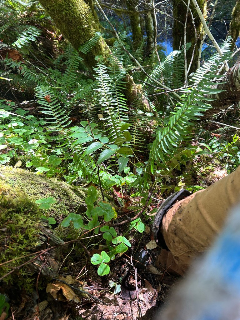
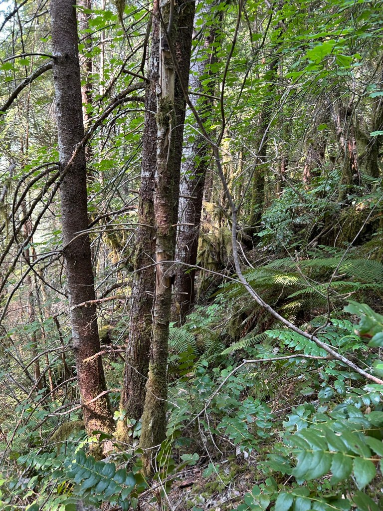
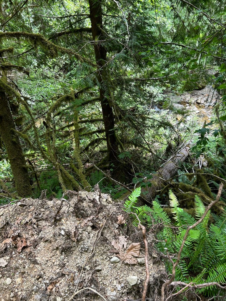
I’ve continued making progress along the hillside below the upper bench and south of the landing. Yesterday’s objective was to clear the area I marked off with pin flags last time. I made it out to the site in the morning, hiked down to the slope and got to work.
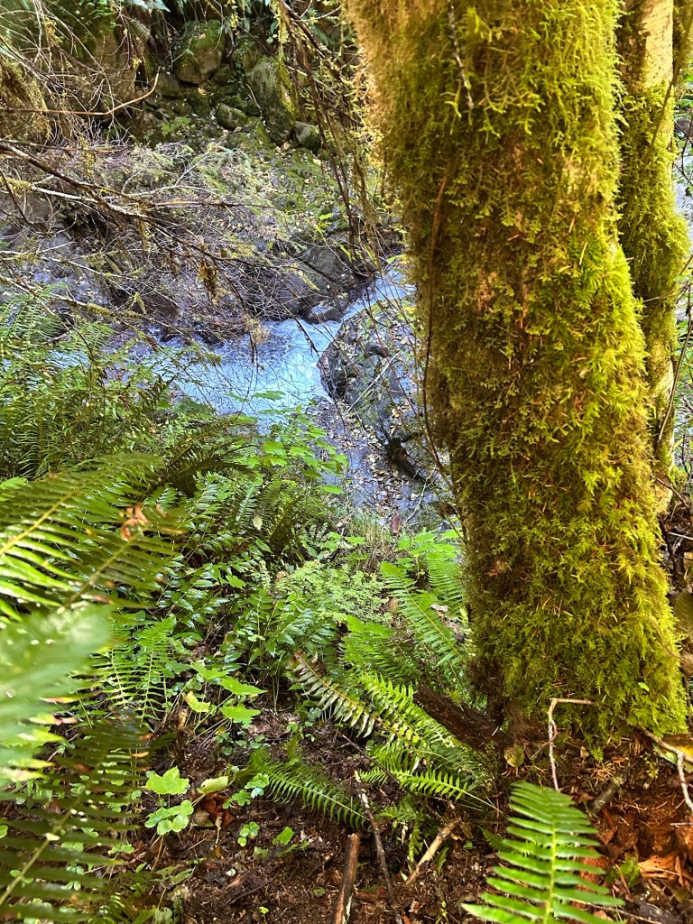
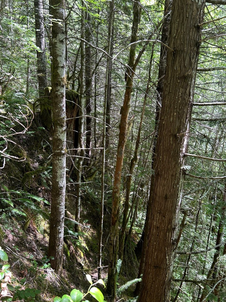
I started at the cliff out over the creek, overlapped with my last search lane and began to clear the slope. Much like last time, I worked parallel to the creek, crawling south to north, clearing a lane, then turning and heading back 1 arm length upslope.
Starting at the cliff out above the creek
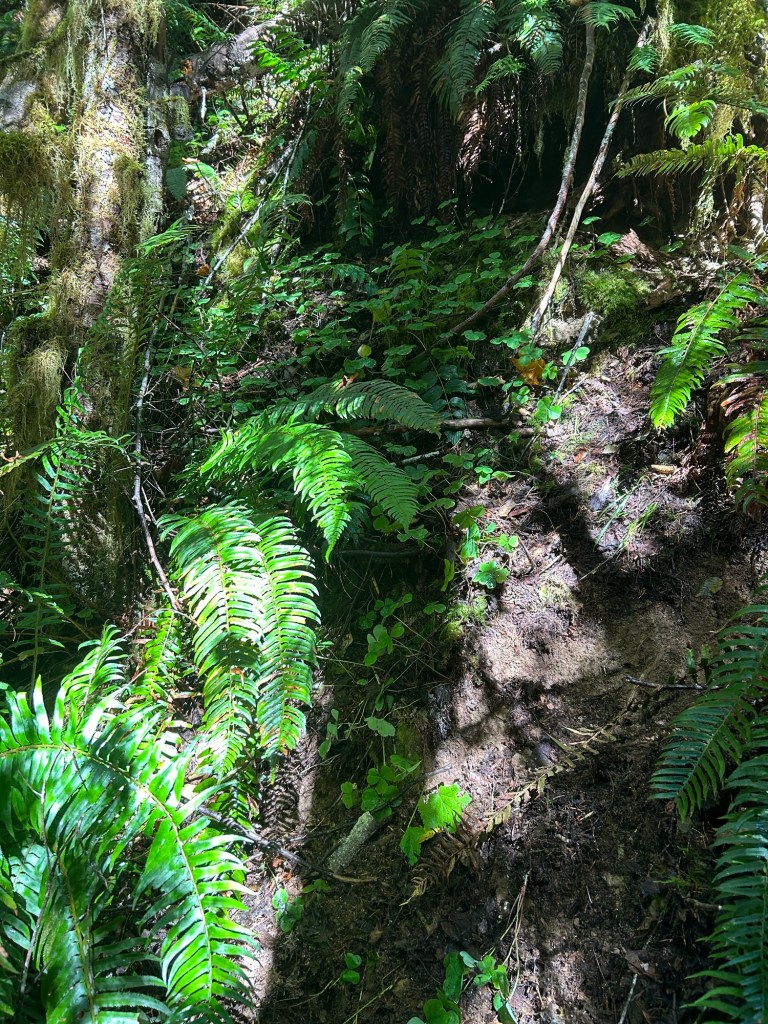
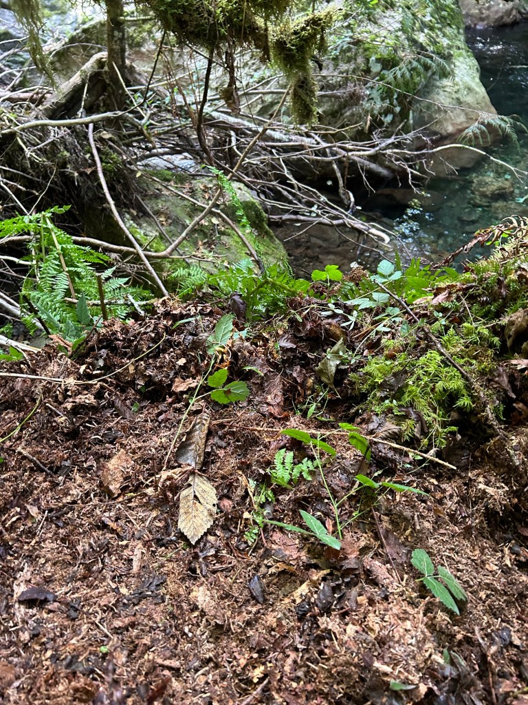
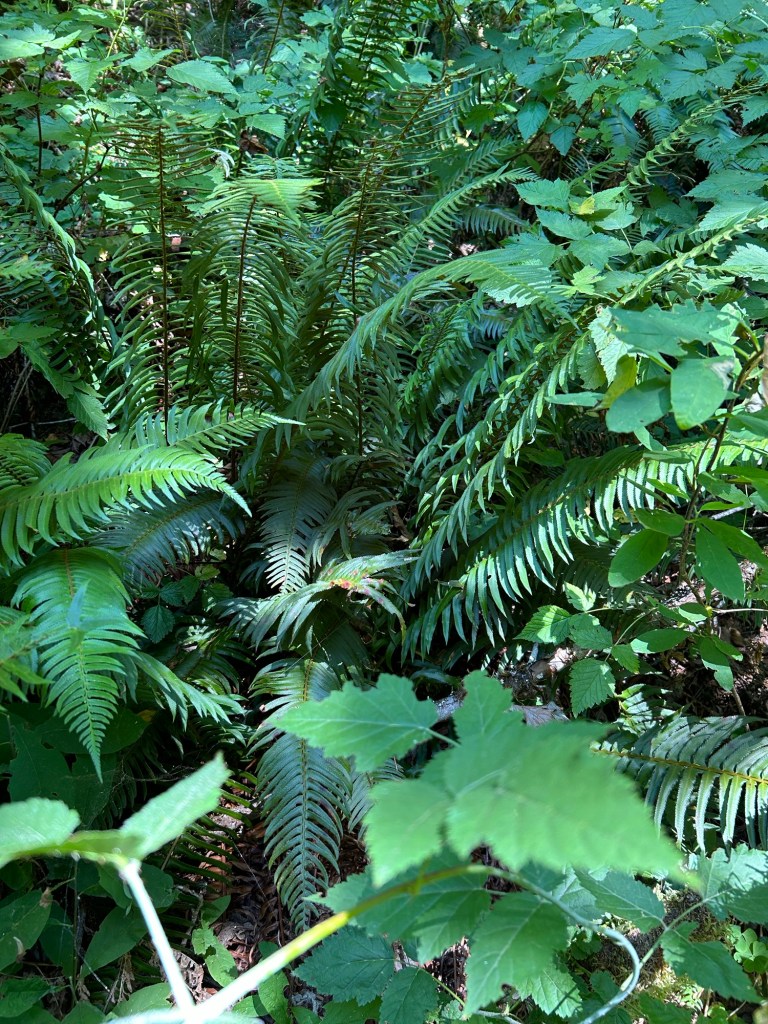
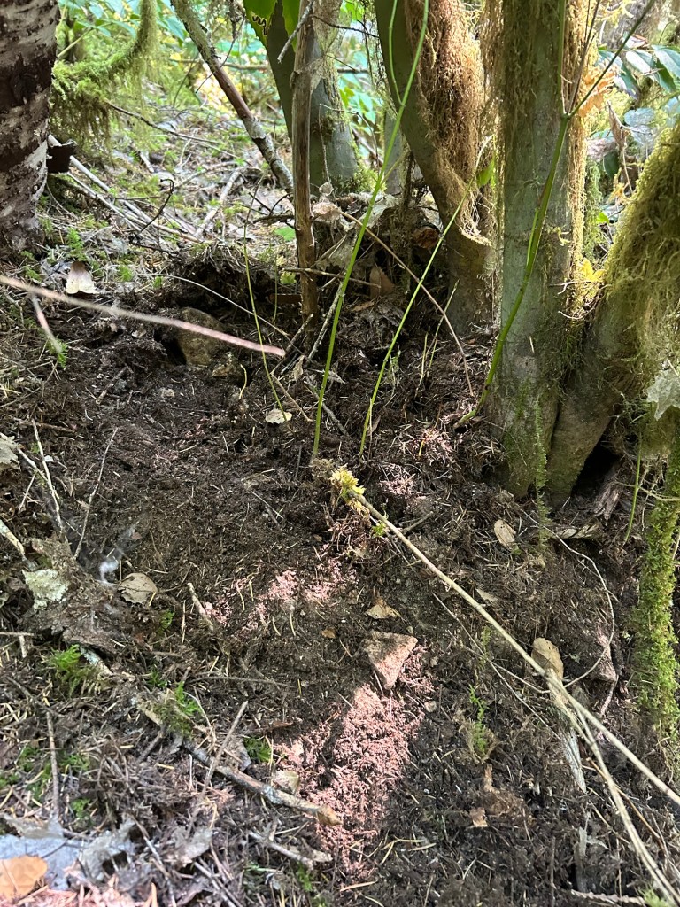
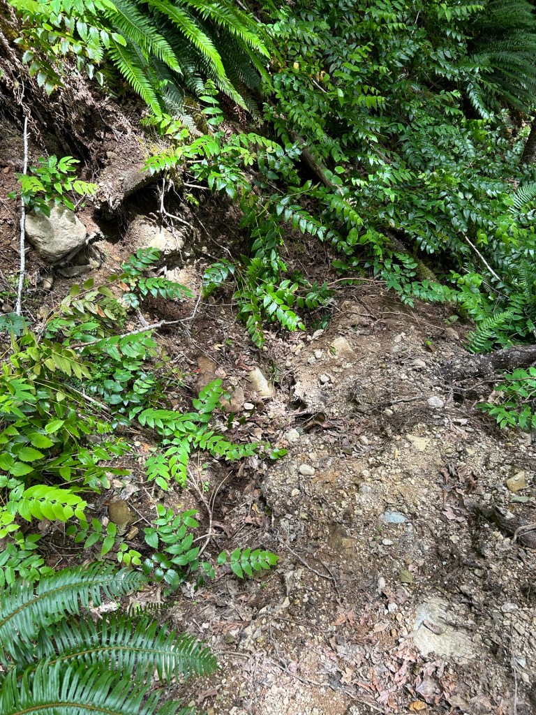
Where my path crossed a drainage chute or debris trap, I would stop and concentrate on those areas, ensuring that all the debris was sorted through, the base of ferns were checked and generally sweeping clean the forest floor. When working uphill on a drainage line, I generally could stand up and work the chute above me. The hill was that kind of steep, and this is the last least steep section as I continue working north along the creek.
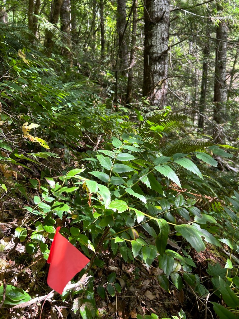
Clearing a drainage chute on the slope
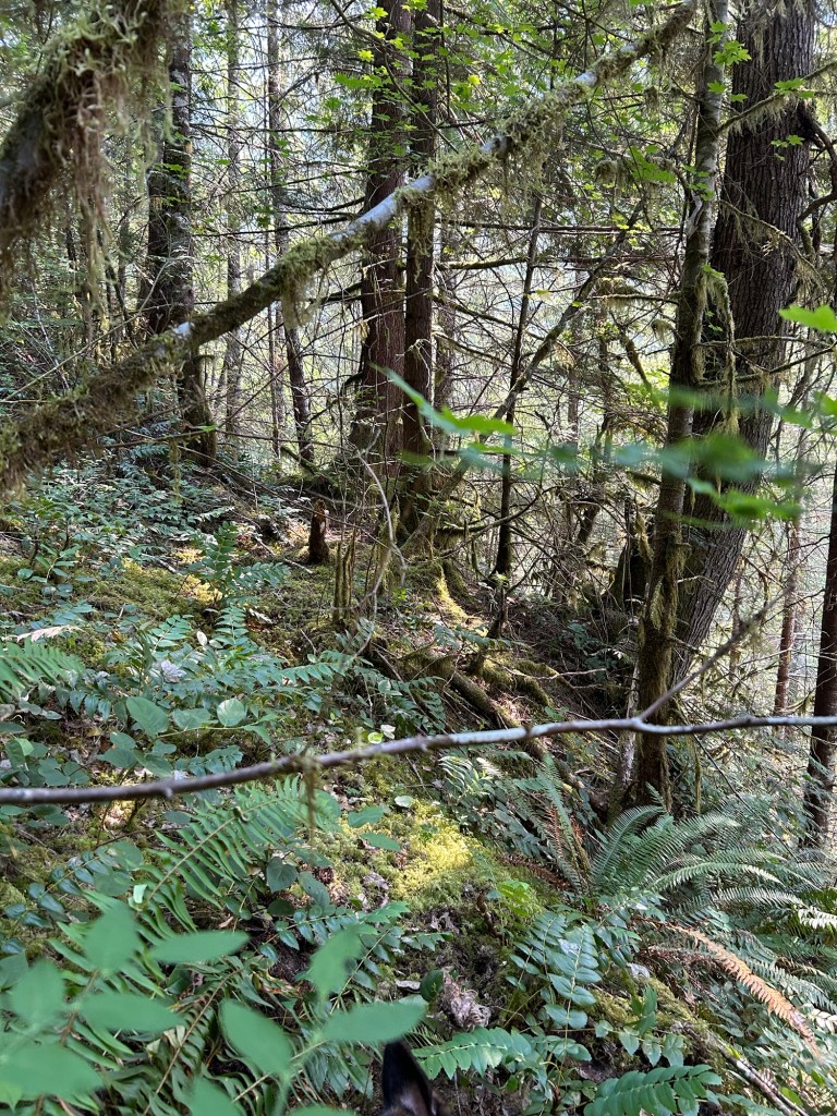
It took until late afternoon to complete the section I had marked out. I finished the day by marking out the next lane and scouting some anchor points for next week’s safety line. I’ll be working roped up from here forward, mainly to add to the safety margin of working on that hill. This will also allow me to develop techniques for working while roped, which will be useful on the much more steep Grissom site.
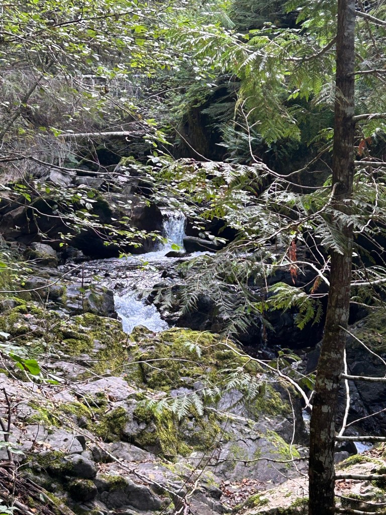
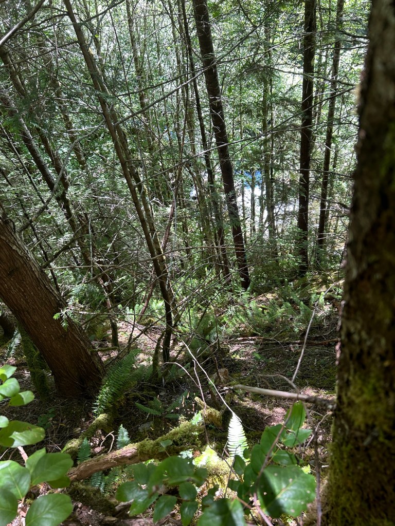
Looking down towards Soda Fork from about half way up the slope.I frequently had to brace a foot against a tree to maintain my position and keep from sliding down.
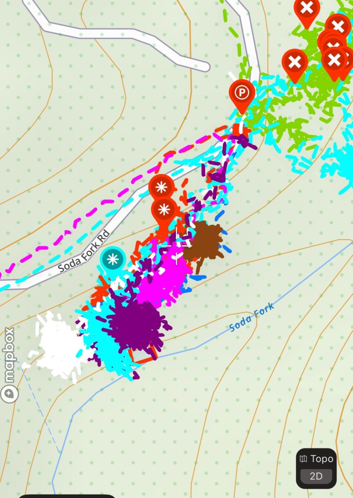
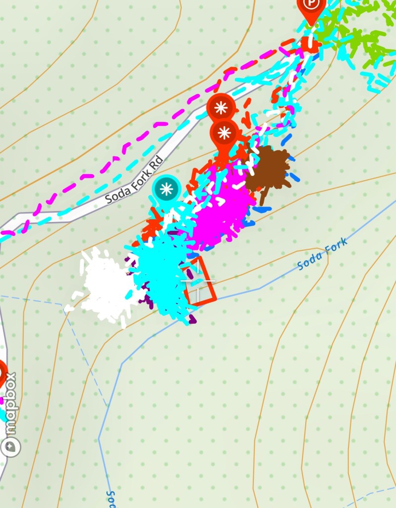
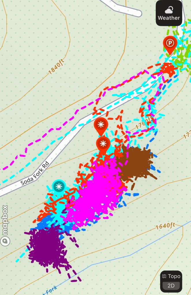
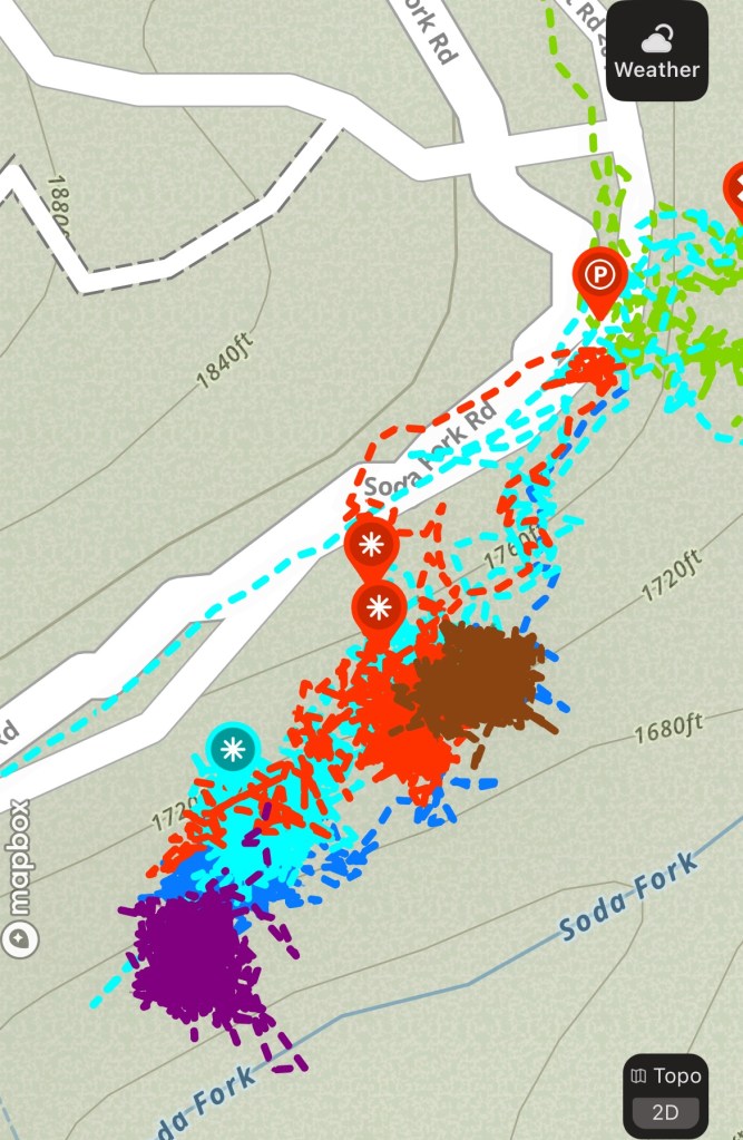
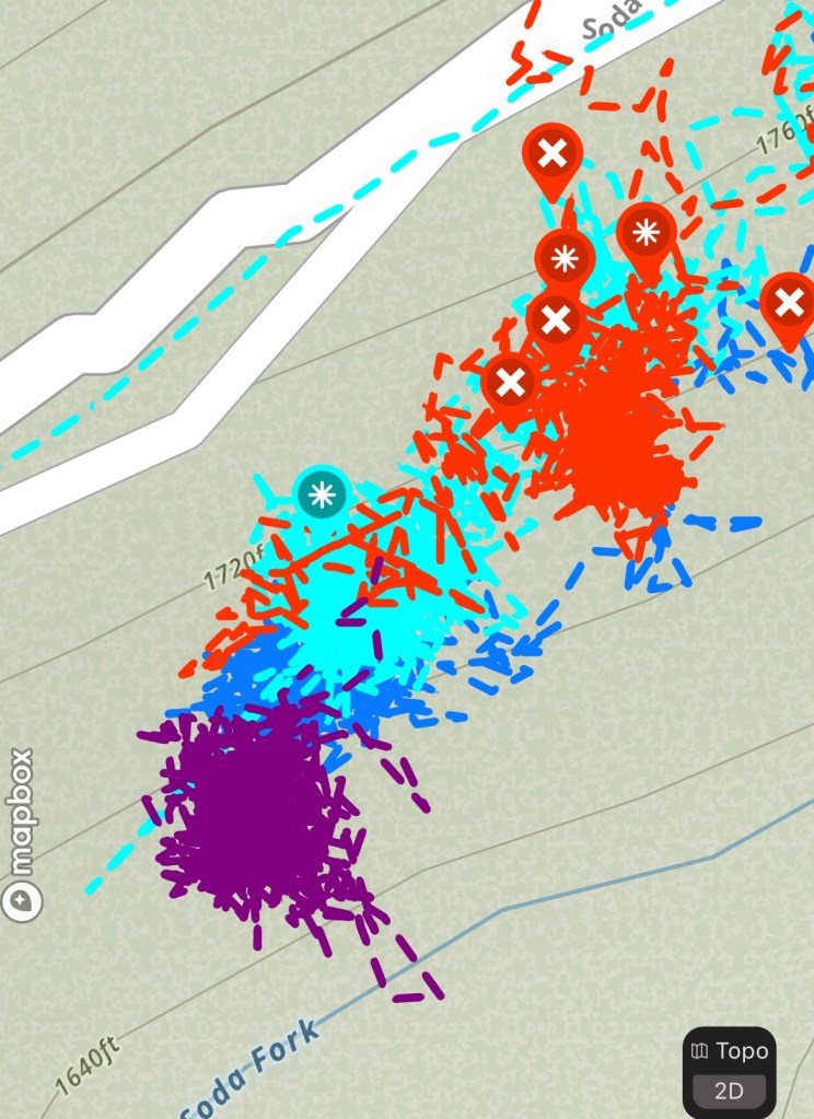
A video from the top, after completing the day’s work.5 October 2024 search area in dark purple, adjacent to the turquoise
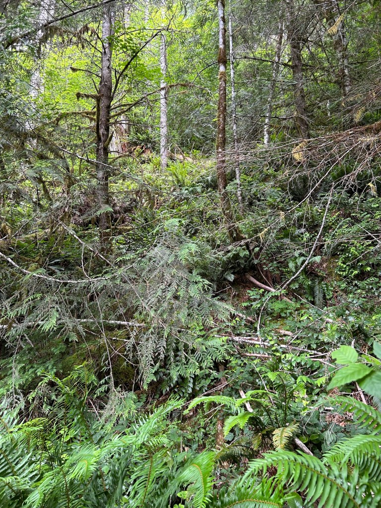
The search yesterday was one of the more physically demanding ones performed at the site. I’m continuing to grid the hillside between the upper bench and Soda Fork Creek and the angle of the slope is very taxing to work. I usually work on my hands and knees in the underbrush, but yesterday I probably spent an equal amount of time prone on my stomach to maximize contact with the ground. Gravity was a constant companion. I experienced one fairly long slide when the ground my boots were kicked into gave way, and gravity overcame the friction co-efficient.
I followed the trail I made down the hillside on the 21 July search, and began yesterday’s search to the south of that zone. I started by clearing the bench just above the cliff out to the creek. Once that area was complete, I began by side-hilling on a crawl to the south, until I reached a point where the cliff cut into the hillside significantly. That eroded area set a natural boundary to the south. I went up the hill about an arm’s length and then reversed my direction of travel to the north, clearing the next strip of ground.
The edge of the bench above Soda Fork Creek.Soda Fork Creek from the southern end of the day’s search area.
I continued this slow crossing of the hillside for the morning and into the afternoon. The underbrush was thick and there was one area that was tangled in native blackberry and devil’s club that I was unable to get into. The slope was steep and uneven enough that attempting to search it without being roped up red-lined my risk meter. I will get into that area, just on a day when I have the right equipment with me.
Once I finished crisscrossing the lane up the hill, and I was able to sit on the relatively flat ground at the top, I was done. It was grueling to work that hillside. This area would challenge anyone with the combination of terrain, angle, and vegetation. I split a peanut butter Clif bar with the dog and rested for a few minutes. I then marked off the next adjacent lane on the hill before calling it a day.
Looking back down the hill from the top. This photo covers about half the width of the area searched. It also attempts to show the angle of the hillside.Two surveying flags mark the next search zone. The second flag is the orange dot in the far background.
Another challenge was that my GPS accuracy was off. An iPhone without signal reverts to using solely GPS-A signal, which is less accurate than a signal generated from triangulated cell towers and the GPS satellite network. A stand-alone GPS unit is exceptionally accurate because its antenna is optimized to receive that signal. An iPhone antenna is designed to handle many different types of signals, so there are trade-offs to be made. As a result, the GPS track for yesterday completely overlaps with the 21 July search, making it appear that I covered the same ground twice. I’ve annotated the track with a red box to show the actual area I searched.
The red box with the crosshair in the center was the search area for the 14 September Search. the GPS track in turquoise is “off” and covers the area searched on 21 July.
The hillside I’m currently working on is directly below where I found the wine bottle. I consider the area “of interest” due to that proximity. If the bottle was left by Ackroyd when he revisited the crime scene, then downslope from there is a likely area to find disarticulated skeletal remains. That’s a lot of time and labor resting on the assumption that Ackroyd left that bottle, but if it drives thoroughness and a complete search of the landing area, it’s worth it.
In the fall of 2023 I submitted a FOIA request to the FBI for a copy of any documents that the Bureau had on John Arthur Ackroyd. The crimes associated with him seemed to be handled at the local level, with assistance from the Oregon State Police, rather than with FBI assistance. I thought that the FBI might have been involved to some degree with Rachanda Pickle’s case, and that a FOIA request was worth the effort to see what was on hand. It took about 6 months or so for the documents to arrive on CD-ROM, about 13 pages in total. As I had thought, these cases were locally led without significant assistance from the FBI.
I have photographed and posted the pages below, with additional info in the captions.
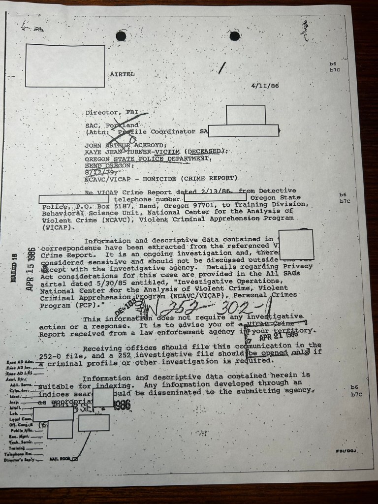
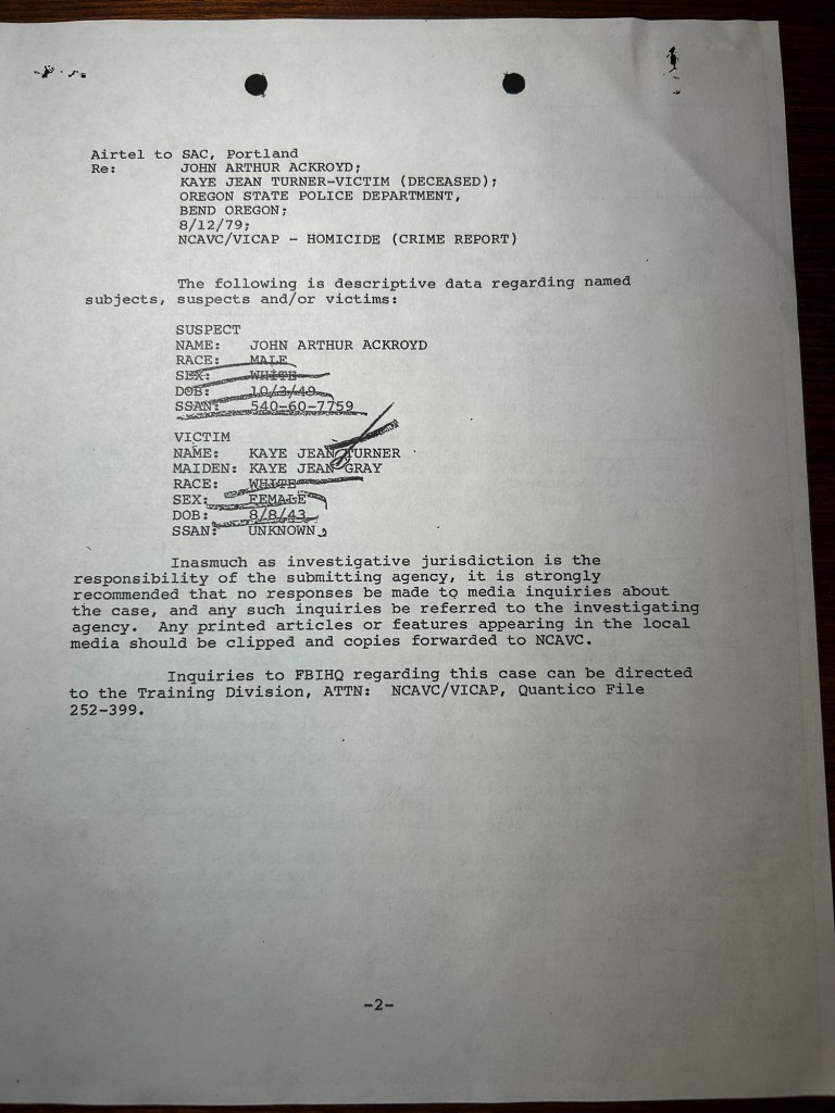
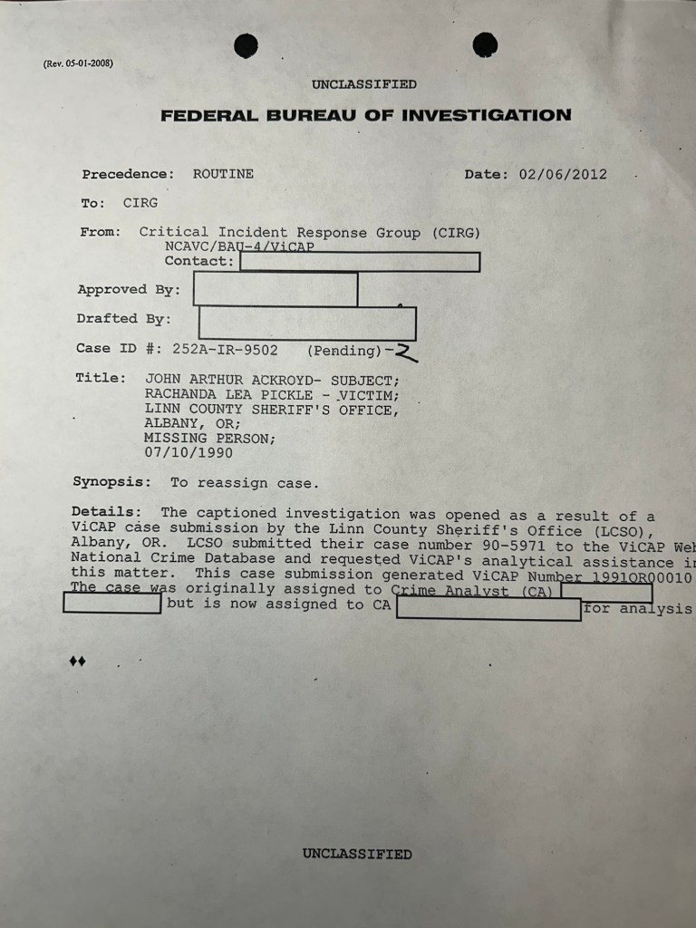
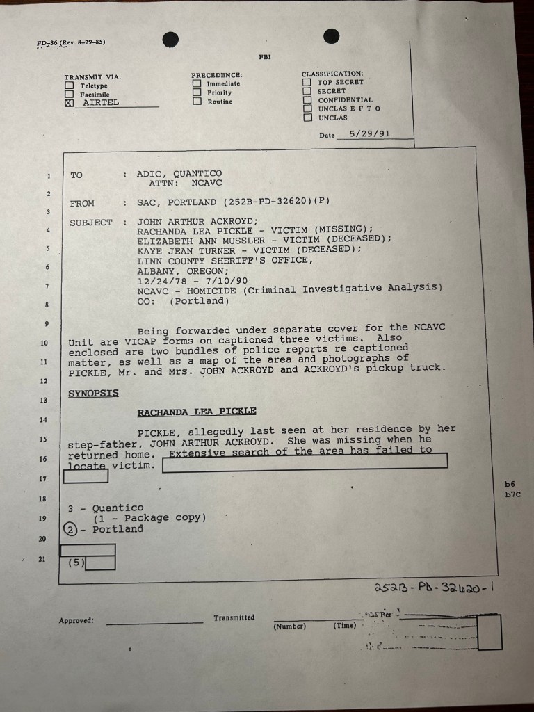
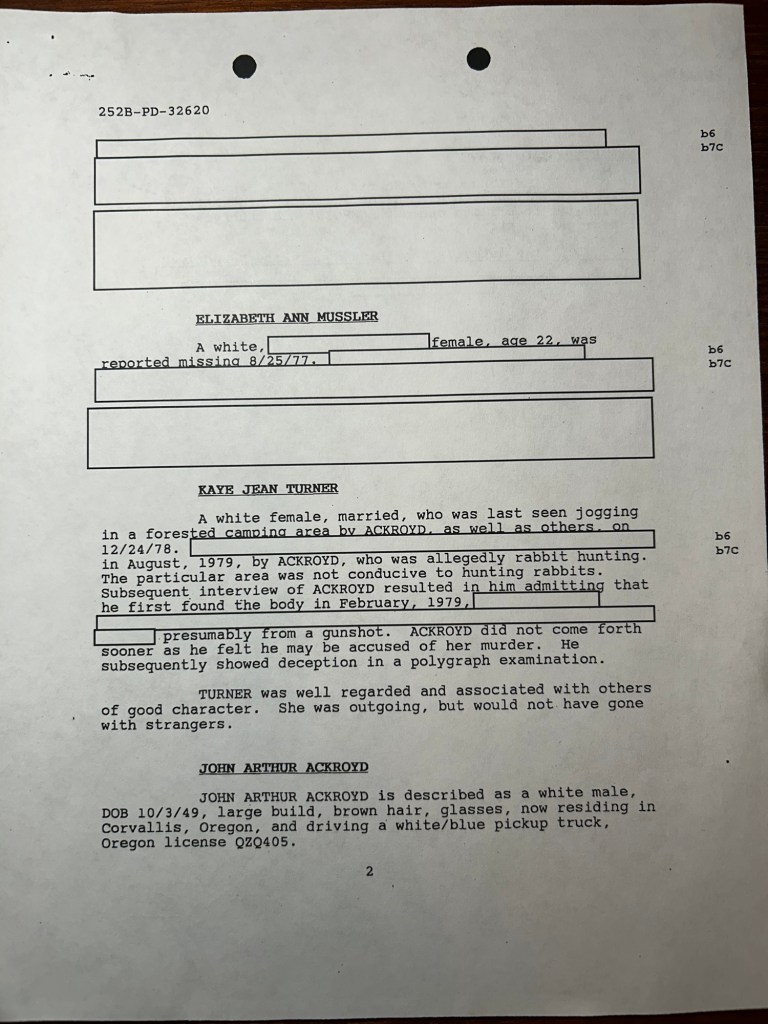
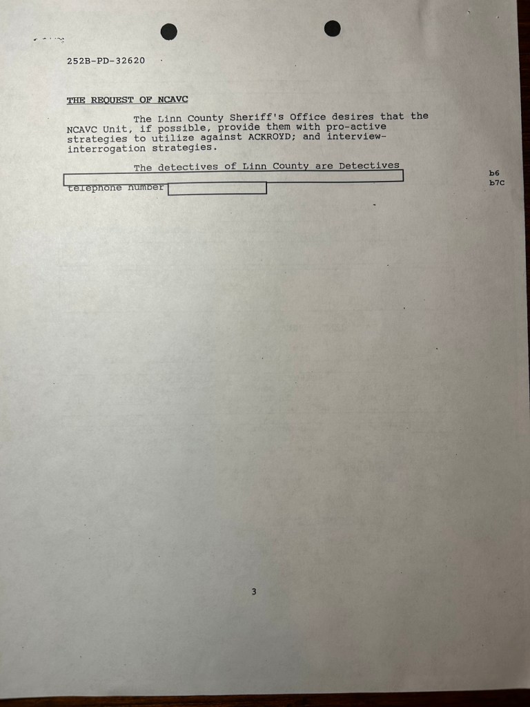
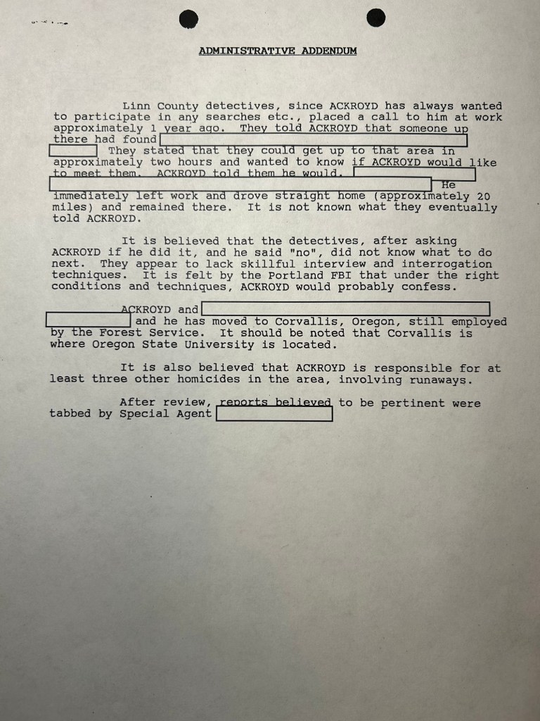
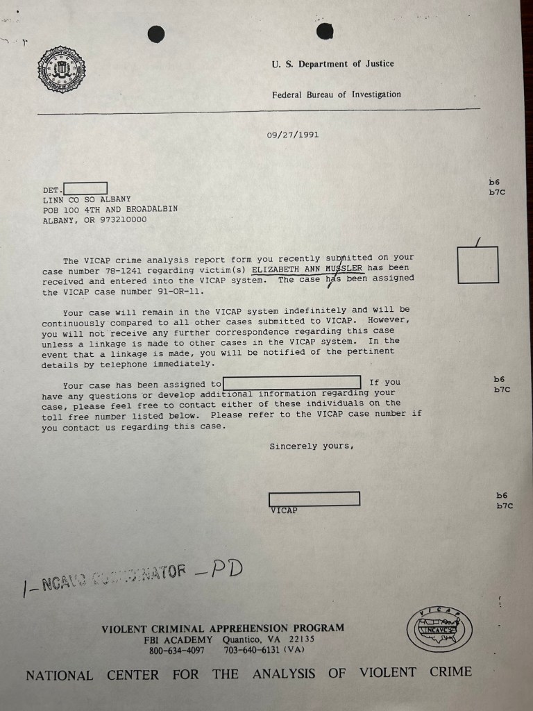
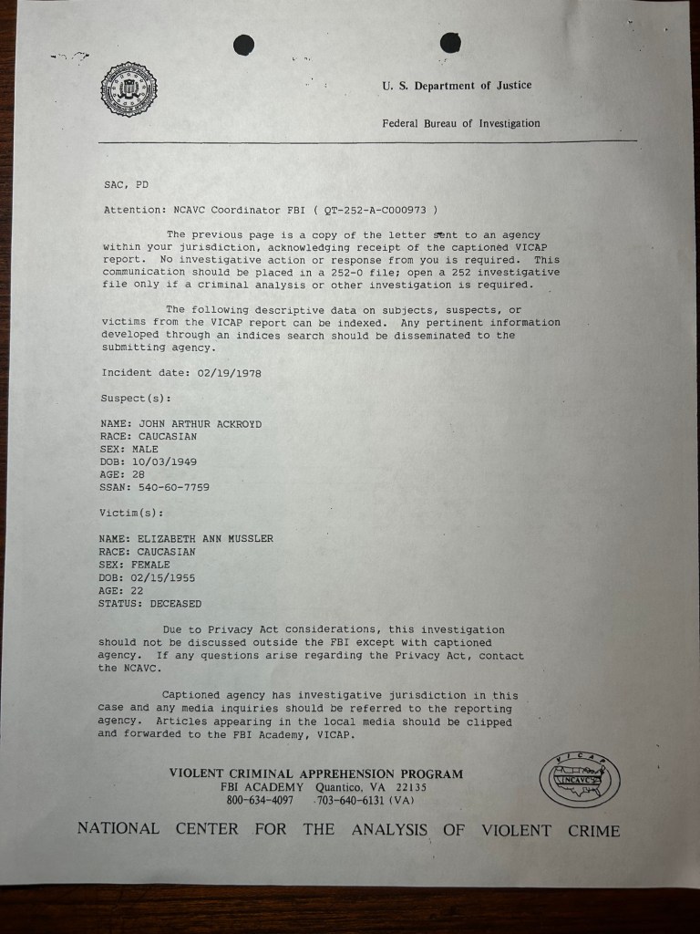
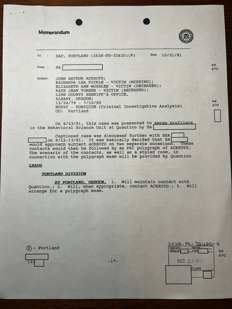
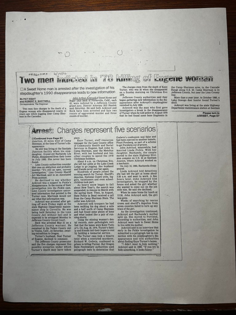
4/11/1986- OSP submits Kaye Jean Turner’s case to the Violent Criminal Apprehension Program (VICAP) run by the FBI’s Behavioral Analysis Unit. This is an airtel to the Portland FBI Field Office informing them that a VICAP report has been filed within their region.Further information in the 4/11/1986 airtel from Behavioral Analysis to Portland2/6/2012- A document from the reinvigoration era of the Ackroyd associated investigations as Ackroyd approached parole eligibility for his murder of Kaye Turner. This page documents a change in assignment for the FBI crime analyst assigned to Rachanda Pickle’s case.Airtel from SAC Portland to Behavioral Analysis regarding the Rachanda Pickle investigation, including information regarding Kaye Jean Turner and Elizabeth Ann Mussler. Dated 5/29/1991, this is approximately 11 months after Rachanda vanished from Santiam Junction. This is also the earliest document that associates Elizabeth Mussler’s 1977 homicide with John Ackroyd.Page 2 of the 5/29/1991 airtelPage 3 of the 5/29/1991 airtelAddendum to the 5/29/1991 airtel. Interesting to note that this document was produced after ODOT transferred Ackroyd from Santiam Junction to the Corvallis shops. Also of note is the 4th paragraph, which links Ackroyd to “three other homicides in the area, involving runaways.” Karen and Rodney are two of that number. Elizabeth Mussler, since she was an adult reported missing could be the third, as could the Swamp Mountain or Snow Creek Does. It is interesting to me that Ackroyd was linked to these late 70’s cases as early as 1991. Acknowledgement from the VICAP program to Linn County Sheriff’s Office that Elizabeth Ann Mussler’s case has been submitted to the VICAP system.Page 2 of the VICAP acknowledgement to LCSO re: MusslerCourtesy copy of the Mussler VICAP acknowledgement to the Portland FBI Office10/21/1991 A memo regarding VICAP profiling of the Rachanda Pickle, Kaye Jean Turner and Elizabeth Mussler cases. An interrogation approach has been developed to elicit a confession from Ackroyd.12/31/1991- Report from the Special Agent assigned to Ackroyd’s interrogation to the SAC in Portland. The conclusion of the Special Agent’s 12/31/1991 report, indicating that the interrogation approach was no longer feasible and that the FBI’s should close their part of the investigation.Oregonian Article, 6/14/1992 about the arrest of John Arthur Ackroyd and Roger Dale Beck in the murder of Kaye Jean Turner. Included in the FBI file
The interesting take aways from reading the file are 1) the Turner Case and Ackroyd were entered into VICAP in 1986; 2) John Ackroyd was a suspect in the homicides of Elizabeth Ann Mussler, Karen Jean Lee, Rodney Grissom and perhaps one additional case as early as 1991; 3) there was a missed opportunity for a BAU-informed interrogation of Ackroyd in the Turner / Mussler / Pickle cases.
It has been about 5 weeks since the Pyramid Fire closed access to the search sites. I continued to monitor the fire’s progress and watched the “percent contained” number rise on a daily basis. Having lived through the 2020 Beachie Creek Fire, I was concerned about a wind event stoking the smoldering brush and litter fire into a major conflagration that would obliterate the sites. Fortunately, the weather cooled, we had some rain and the fire crews were able to get the blaze under control. When I checked the fire map on Friday the 30th, the fire was 98% contained and the fire closure area had shrunk considerably. According to the map the sites were open to access again.
I drove out with the dog Saturday morning hoping that the ground reality tracked with the map. After the 90 minute drive from Salem, I pulled off HWY 20 and onto Soda Fork Rd. Some opening weekend elk hunters were camped at the junction of Soda Fork and the 2043 road; a positive sign of open access. I held my breath approaching the gate at Section 19, and it was chained open. I drove up to the Lee site landing and headed into the woods.
Down the hill and across the bench I made my way to the cedar where the bottle was located. I paused here to reorient myself to the ground. After 5 weeks away, a pause before moving on was worth the time. Memory can bend and warp, and examining the ground as it is with GPS records is useful in developing the day’s plan. I stood slightly uphill from the cedar and the bottle, surveying the ground. If this was the approximate crime scene, I decided to search the furthest southern portion of the hill side, and adjacent to where I searched on 29 June 2024. I dropped down the hill and began to grid search where the hill cliffed out above the creek.
Looking uphill from just above the drop to the creek. Thick vegetation and steep slope made for slow and deliberate searching.
The hillside was a series of small, narrow benches, about 20 feet apart, connected by drainage chutes. Overlapping with the 29 June search area, I cleared the first bench, then each drainage chute leading up to the next bench. At this point I would drop down, grab my pack, walk up to the next bench and repeat.
Vegetation on a bench that is approximately 3 feet wide.Cut stumps on the slope, indicative of logging operations
As usual, it is slow, methodical and physically demanding work. The hill is steep enough that it is easier to go up on your hands and knees than upright on two legs. Once the bench was cleared, I would then work up the drainage chutes, clearing away the leaf litter and woody debris. The larger branches and logs would get launched downslope, out of the way of where I was going. The sounds of the creek rushing by were occasionally joined by the rumble and clank of a diesel truck towing a low-boy loaded down with an excavator, removing equipment from the fire line.
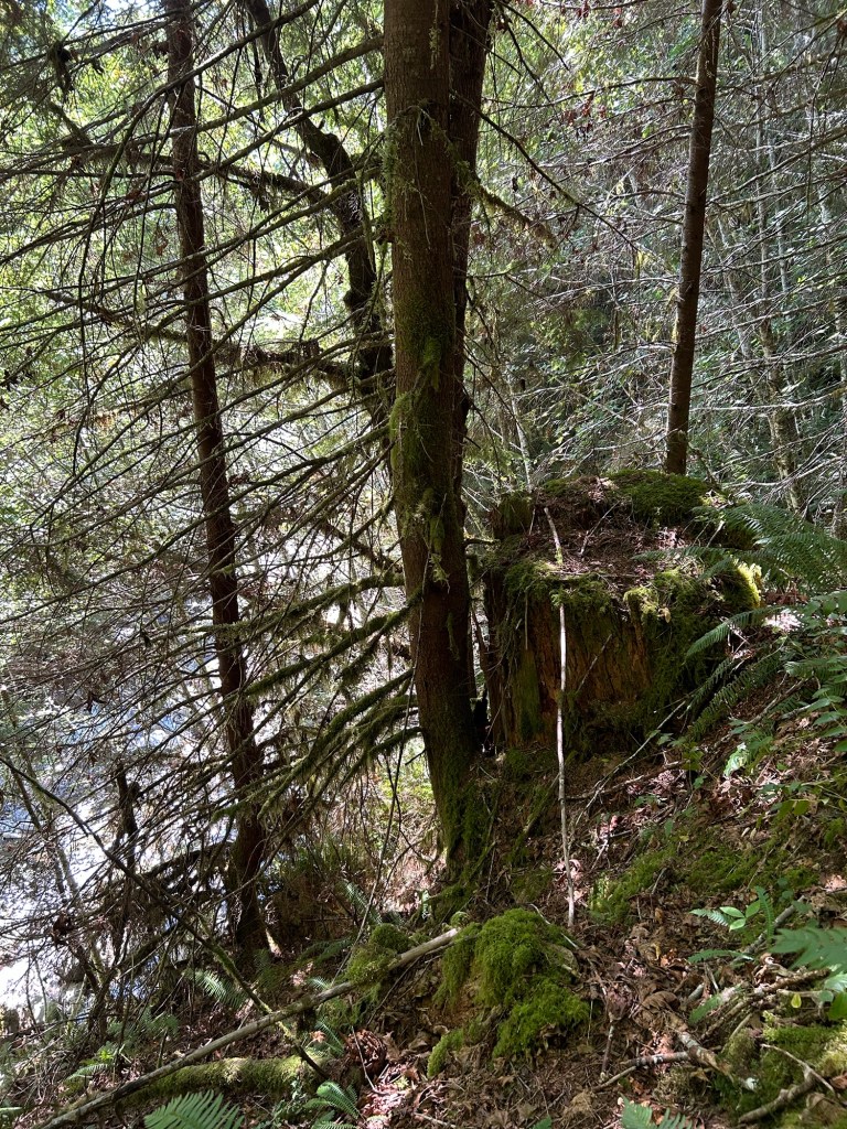
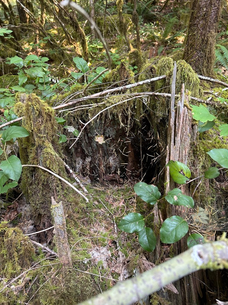
A massive stump that had toppled over as the ground gave way from erosion.Searching the hollow under the stump.
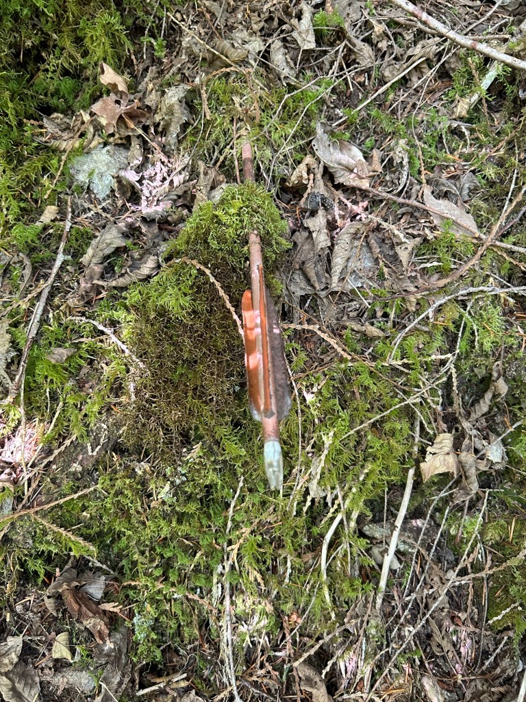
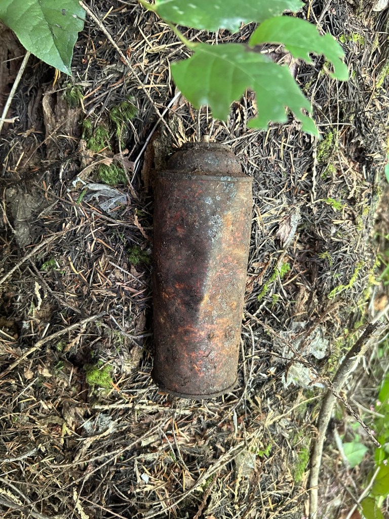
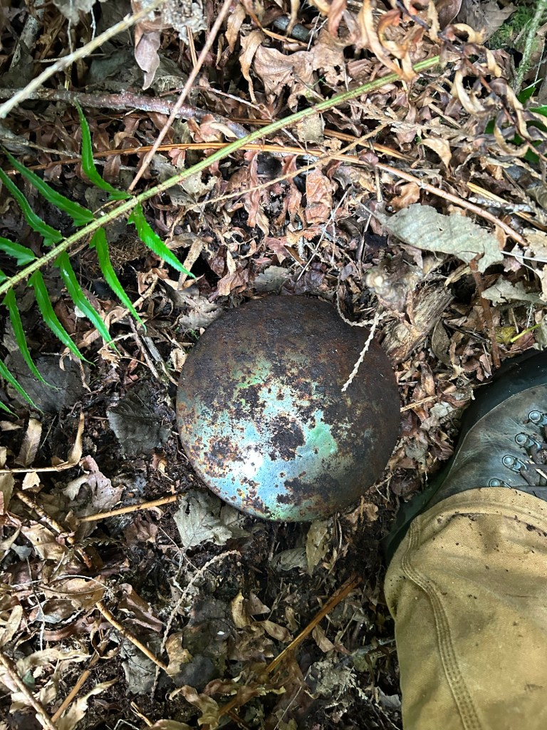
If one were to just walk across the ground, it would appear to be devoid of anything not of the forest. Clearing away the ground debris, one finds all kinds of evidence of human presence. This search turned up an Easton aluminum hunting arrow, and further up the hill in a drainage chute, a spray paint can. Looking back from the fletching of the arrow as it protruded from the ground, I could see where the hunter stood when he loosed his bow. The paint can was a good indicator that yes, debris from the roadway will make its way downhill by these drainage lines.
An old hunting arrow, uncovered clearing away ground debris.A very rusty spray paint can
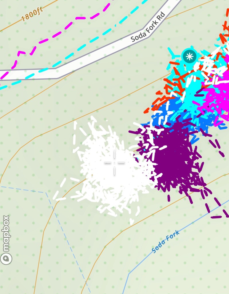
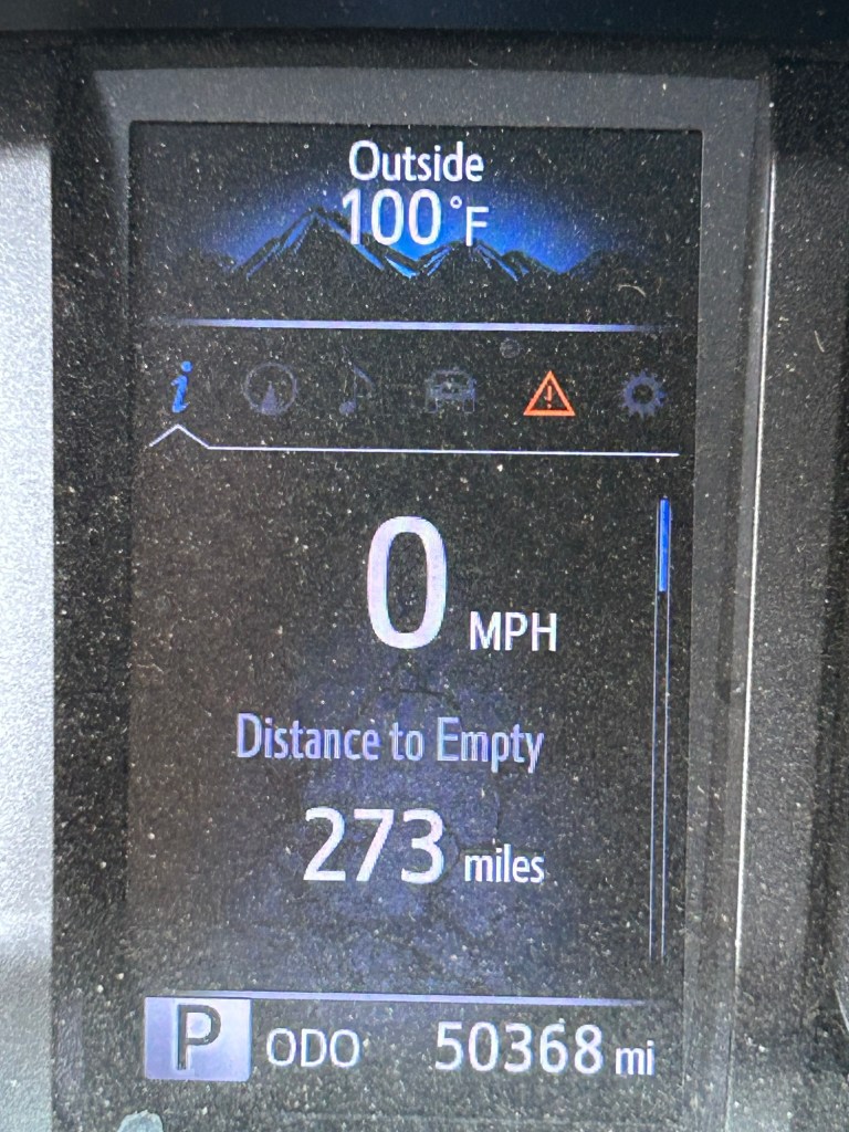
After 3 1/2 hours I reached the last bench that was level with the cedar and the bottle. My next search will be on the other side of the 29 June search area, and the following ones will continue north until I connect with the areas I searched in 2023. I had crawled 2.3 miles, crisscrossing the slope in 100 degree heat. Not a bad day’s work.
The 31 August Search area is the white track. The 29 June search area is the purple track to the right.The outside temp when I got back to the truck
The Pyramid Fire is at 98% contained and the fire closure area was modified. The search sites are now open and we are back to work along Soda Fork Rd. Post coming tomorrow.
The search sites are within the fire closure for the Pyramid Fire in Linn County. The Sweet Home Ranger District has closed that part of the Willamette National Forest until further notice.
The Pyramid Fire is being actively worked and is about 18 miles from the search sites, so right now it looks like minimal danger of those areas being burned. I’ll continue to monitor the fire and closure until it lifts.
Most likely I’ll resume ground searching in the fall and I’ll push as late into the winter as weather conditions allow.
This search season has had its share of weather challenges. Other than the first search of the season, which was in golf course weather, the other search days have alternated between pouring rain or blazing hot. Yesterday fell into the hot category.
Summer in Oregon is wildfire season, and there were several active burns to the east and south of Linn County. A red flag warning had been issued earlier in the week, and the day’s high was forecast to reach 95. I arrived at Soda Fork early in the morning and found the timber gate at the boundary of Section 19 closed to vehicle traffic. I hiked uphill along the road to reach the landing. Already well lathered in sweat, I descended the hill and got to work.
Looking to the south from the point of the spur
My plan for the day was to search that last “checker box” on the upper bench. I wanted to close this area of the hillside out before spending time on the lower slope and lower benches. The last area comprised a rise between the 15 June 2024 search area and the 11 May 2024 search area. The area was a spur between those two low spots, and had terrain varying from the salal covered top of the spur to vine maple and ferns on the slope of the spur.
The point of the spur before it drops to the creek below
My approach today was to clear the ground in the low spots and then grid walk the salal at the top of the spur. My thinking behind this is that any remains that may have been on the top of the spur would drift down to the low spots, making the low spots more likely to hold anything. I didn’t want to neglect the top, so I walked the top in a grid, taking a step, moving the vegetation aside to view the ground, then taking the next step.
I walked to the point of the spur and began the hands and knees search up the drainage lines. Once that completed, I moved to the low spots on the south side of the spur. I could see the cedar where I found the bottle on 11 May. Despite not being totally sure or convinced that the bottle is probative, I spent the most time here. I overlapped the search area from 11 May, and then cleared the entire south side of the spur to the dirt and rocks under the leaf litter.
Looking downhill at a cleared drainage line.
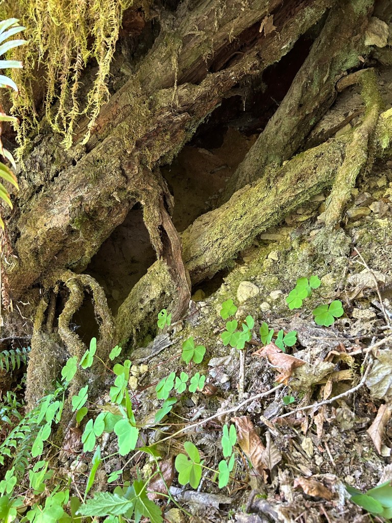
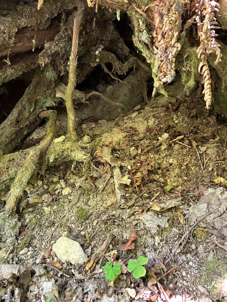
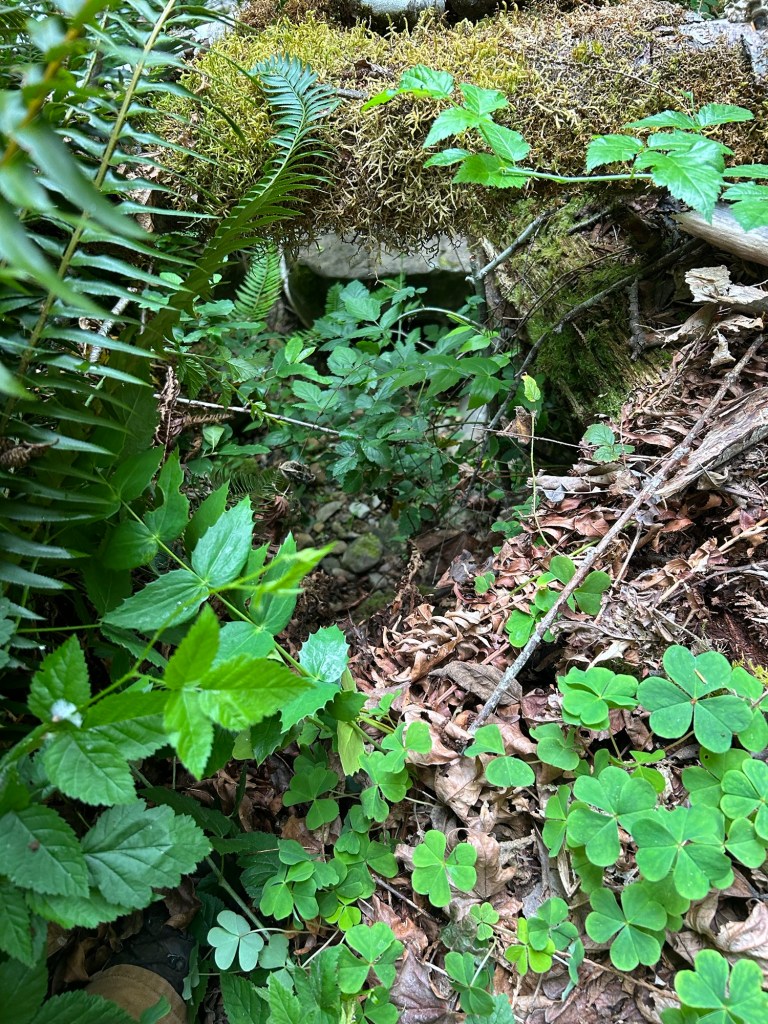
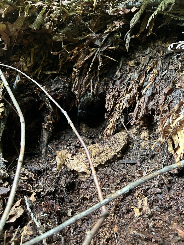
There was a cut cedar stump that had hollowed out with age. In the interest of thoroughness I searched the interior, cautiously, as the last time I did this I found a ground hornet nest the hard way. Fortunately, the stump was hornet free and ultimately, only filled with leaf litter and other natural debris .
The remains of a cut stump from the last time this area was logged. Clearing around the base of a vine maple thicket on the south side of the spur.
After clearing the south side, I took a brief water and food break. The temps were up, and after the hike in from the gate, the exertion of the hands and knees search and the smoke in the air from the wildfires, I was feeling it. After my break, I hands and knees searched the low spots and drainage lines on the northern side of the spur, which went rather quickly. The northern low spots were fewer, less vegetated and I was able to get through them and overlap with the 15 June search area.
Before starting the grid search of the top of the spur, I checked some low spots on the slope down to the creek. There were 3 of them about 25 feet down the hill, and they were good debris traps on the slope. I dropped down and had them cleared in about 30 minutes.
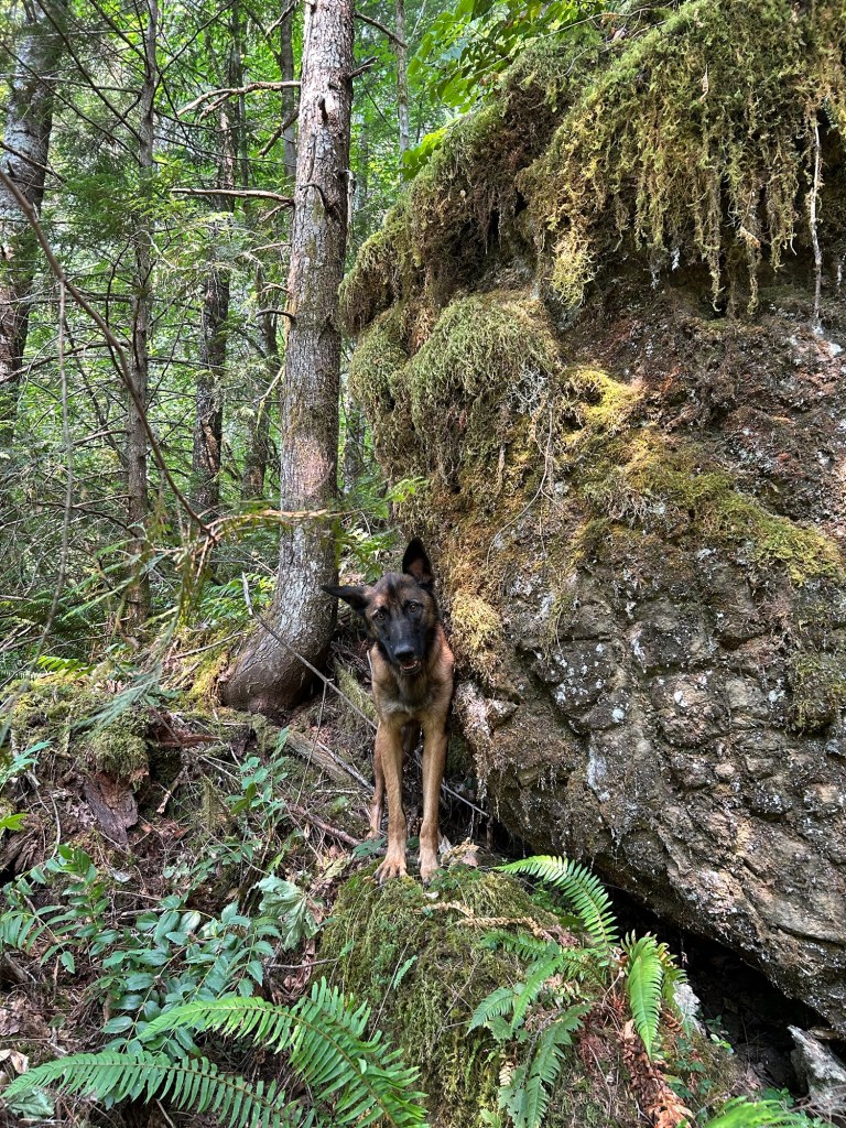
My trusty assistant with me in one of the downslope debris traps
Clambering back to the top of the spur, I grid walk the salal as mentioned earlier. It was methodical- take a step, pull back the vegetation, examine the ground, take the next step and repeat. An hour later I had finished this area. Remy and I finished off the last of our water, and walked back up the hill to start the hike back. Despite the return trip being all down hill, the sun was up over the east ridge line and it was a hot, dusty walk downhill to the truck.
The 20 July 2024 search area is in light purple. The next areas to search are the hill slope leading to the creek.
I took advantage of both the holiday and the “coolest forecasted temperatures” of the long weekend to head to the Lee Site and search an area I identified as part of the preparation for the 25 May 2024 Volunteer Day. It’s a small bench that is more of a depression than a level spot and it is slightly to the north and east of where the volunteers searched. It is also adjacent to where I searched on 15 June 2024, and I wanted to overlap that search.
I decided to search here instead of going downslope of the bottle for two reasons. One, despite it “only” going to 92 today, I wanted something less strenuous in the heat than going up and down the hill on a hands and knees grid search. The second reason is that while my gut instinct and about 55% of my intellect says the bottle is probative to this case, I want to listen to the other 45% that says it might not be. I decided not to fixate on that as a locus to search out from, and instead I’m clearing areas I’ve already identified. I want to be as thorough as possible with this area, and not fixating on one particular zone of interest.
The area I was working today started on the edge of the drop to the creek and was roughly bowl shaped. The search box was the bottom of the bowl, and then a secondary area to the south about 10 m wide and 25m long that bordered the 15 June search box. The bowl itself was filled with vine maple thickets. This posed two challenges, the first being that with the way the trees grow, it would require some contortion on my part to get through the area. The second is that the maples leaves formed thick, now dried mats on the ground, and to remove them was like trying to dig through a sponge with your fingertips.
A vine maple thicket in the bowl.
I followed my now usual protocol of starting at the drop and working uphill, through the bowl. I searched in adjacent lanes, until I hit a maple thicket, then I worked the interior of the thicket however I could before resuming the lane on the other side.
Starting at the edge of the drop. There is a line of cut stumps along the edge.The hill slope, with Soda Fork Creek visible at the bottom.
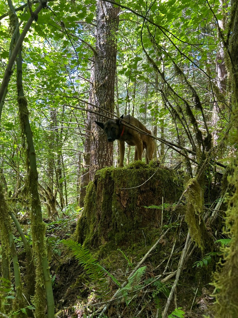
Between the contortions required to get through the maple thickets and the thick mat of maple leaves on the ground, I was reconsidering my decision that this was less physically taxing in the heat. My supervisor was out there with me, and he kept a close watch on my progress.
I finished the day’s work at about 2:15 and the heat was starting to really come on. I have no finds to report, but I cleared another patch of ground at the Lee Site. I have one more area on the upper bench to clear, and then I’ll focus my searches on the downslope to the creek.
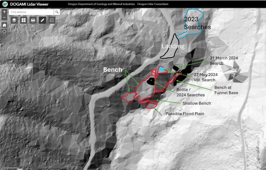
This week’s search was the first to cover the hill slope as it dropped from the benches below the landing to the creek. Being very steep, I’ve used the Lidar imagery of the area to guide the effort on the hillside.
Annotated Lidar Imagery of the Lee Site. The 29 June search was along the shallow bench and hillside to the south of the bottle’s location.
I’ve been wrestling with whether that bottle is probative to this case or just random woods trash. I’ve settled on at least using it to prioritize where on the hill slope to search, so that I have a starting point for this section of the work. The hill is steep; steep enough that in sections you can stand, reach out and just about touch the hillside. I found a narrow line that descended the hill at an angle, and used that to get to the base instead of roping up.
I started at the cliff out before it dropped to the creek. The edge was abrupt and not easily seen, and given the 10 foot drop to the rocks below, going slow was called for.
An obscured drop to the creek bed. A moss covered branch, vine maple, native blackberry, ferns and box sorrel obscure the edge. My boot, at the left, is just about on the edge of the cliff. You can see the rocky stream bed at the bottom.
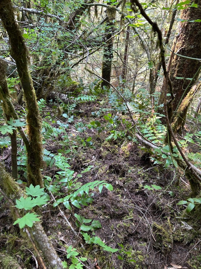
I grid searched the bench first, clearing out the branches and other large debris before going through the leaf litter on the floor. My plan was to clear the shallow bench, then work up the hill, going through debris traps and drainage funnels. The bench took about 2 hours to clear. The debris on the forest floor was much deeper than further up the hill. This makes sense if you consider that debris from above drifts down the hill with the movement of water and gravity.
The relative thickness of the leaf litter on the floor of the bench.
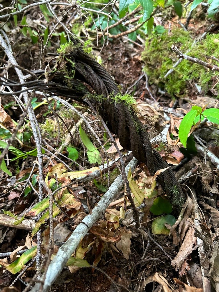
The bench was relatively free of man-made items, except for a hub cap and a length of drag line from the last time this area was logged (approx 1977-1982). I did find a few “river teeth”, which are the cores of knots left behind once the larger tree decomposes.
Steel cable drag lineHub capA collection of “river teeth”. You can see why they are called this..
After finishing this section of the bench, I began working my way up the hill via the drainage chutes above the bench. My hope is that if the bottle is probative to this case, remains may be drifting down via the chutes, or caught up in debris traps on the hill.
It was slow going, working up the hill on my hands and knees, clearing the shallow funnels made by the rain. I paid particular attention to bases of ferns, the collections of debris around tree trunks and any sort of terrain feature that caught debris within it.
Looking uphill from the bench. There is a lot of ground to grid search here.
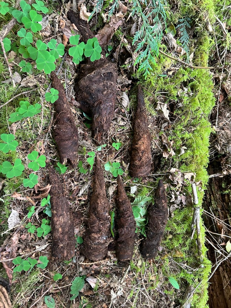
There is a type of fungi that grows here that always “throws me” during these searches. It looks vaguely like molars, and seeing a row of the fungi get uncovered when clearing debris stops me almost every time.
A few of these fungi, barely exposed can trick the eye into thinking they are molars in a mandible.
I spent about 2 hours working the hill side. I went up and down two drainage funnels and the debris traps near them. A large trap was formed by a tree that went over. Judging by the bark on the trunk, and the relative lack of new growth in the hole left by the root ball, it had gone over fairly recently. I still gave it a good once over, just in case.
The truck and root ballThe hole left behind by the tree going over.
After clearing the funnels and traps up to the upper bench, I descended, got my pack and walked up to leave. Standing at the top, looking back to the creek, I finished the day’s search the way I’ve finished all of them, with a silent prayer to Karen and Rodney.
Lidar is a type of ground scan using pulsed lasers to measure the ground. In Oregon, you can find the Oregon Lidar Consortium on the Department of Geology and Mineral Industries (DOGAMI) webpage. It is an open source lidar imagery database for the state. Lidar works similar to radar (radio waves in the air) or sonar (sound waves in water) in that laser light is emitted, bounces off the ground or objects on the ground and is returned to a sensor. The resulting sensor data is then rendered into an image.
I am analyzing the imagery as a supplement to my analysis of topographic maps, aerial photographic surveys and my own on-the-ground developed knowledge of this stretch of Soda Fork Rd. The lidar imagery is providing a more finely grained view of the topology of the hill side, and this informs my search plan for this year. The topographic maps would indicate that this area has a very moderate elevation change from the road to the stream, but the lidar confirms my own observations about the actual steepness of this hillside.
The lidar imagery also shows benches and funnels in the terrain that the topographic map does not. I’ve outlined those benches in red, and you can see the funnels leading from and to them in the darker greyscale of the imagery. In fact, the most visible funnel is the one below the turquoise shaded area that was searched on 25 May and 15 June. There might also be a way to skirt the south edge of the funnel to get to the narrow benches at the bottom.
The lidar, in concert with the 1982 BLM aerial photo-survey, also confirms something that has limited or frustrated prior searches by LCSO. The original reports of regarding the location where Karen and Rodney’s clothing and belongings were found are very general. We have a map sheet name, Upper Soda, the BLM section number 19 and a general and vague description of 1/4 mile down a rugged hillside from a logging landing, in an area of second growth timber and thick vegetation. Without a GPS grid to really nail down each location, finding a center point to work from is impossible. This is why I have resorted to a “brute force” hands and knees grid search. Using the shape of the terrain to inform how debris and hopefully remains have moved with water flow should help narrow down probable locations to search.
Topographic maps of the area can also confuse the search effort. In addition to the current FS 2041 road, annotated on the maps is a second road labeled Soda Fork Road, running parallel to and west of the 2041 road. Based on a map recon alone, one might think that “Soda Fork Road” was abandoned once the 2041 road was cut, thereby altering where to look along the road for a landing.
However the lidar imagery confirms the 1982 aerial photo-survey in this regard. The road network hasn’t;t changed over time. The current 2041 Road is the same as the “Soda Fork Road” listed in the original reports, and the road sign at the junction of US20 and FS 2041 still bears the name “Soda Fork Rd”. The lidar shows no abandoned road running parallel to the current one and this is true from the US20 junction to the log yard. You can see another, long abandoned landing along a spur road that splits from the 2041 Rd at the landing I am working out. That landing is next on my list to explore in case that is the one referenced in the original reports.