I had a major, yet unexpected development in this search last week. It is the best opportunity yet to try to locate Karen and Rodneys’ remains. Due to receiving this info in October, I won’t be able to fully pursue it until spring. I’ve notified family members that have been in contact with me about it, and I wanted to put a note here as to why grid searches stopped last week.
I will be site surveying for the rest of the fall, and working up the search plan during the winter. Talk to you soon.
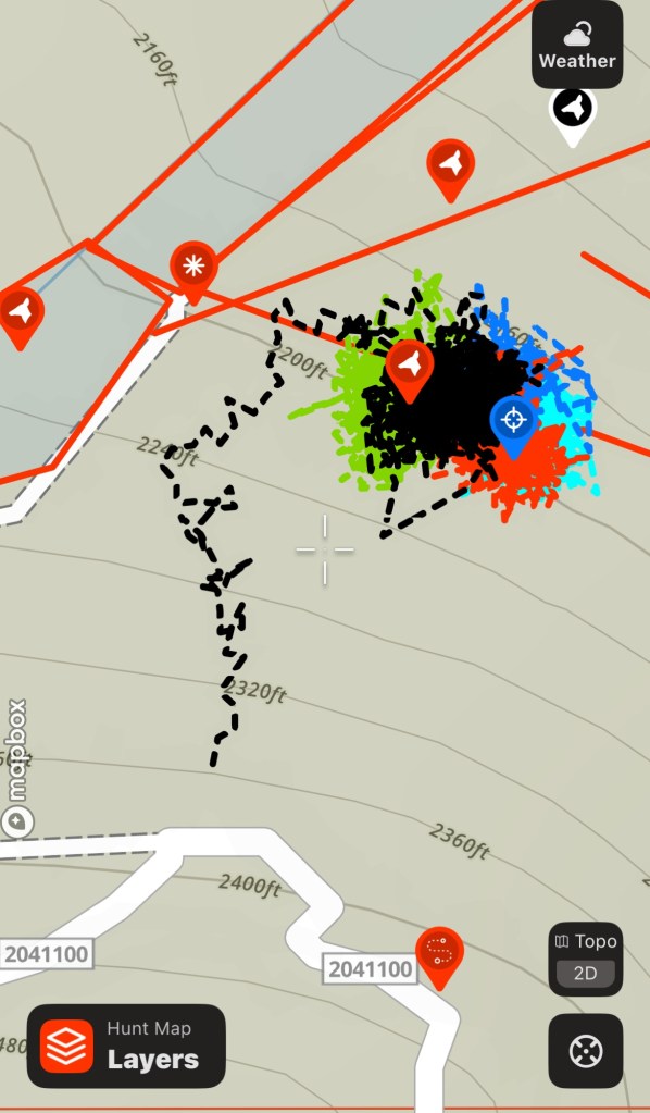
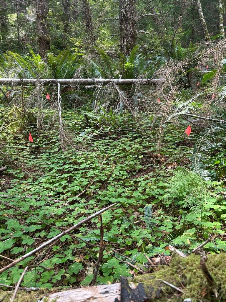
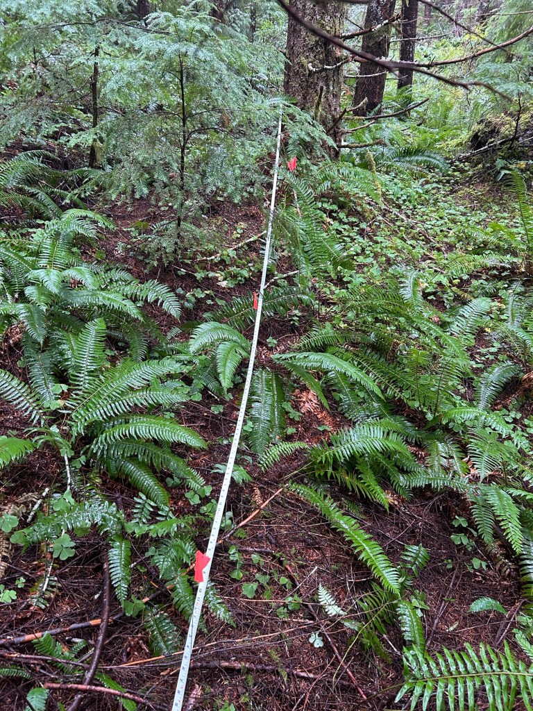
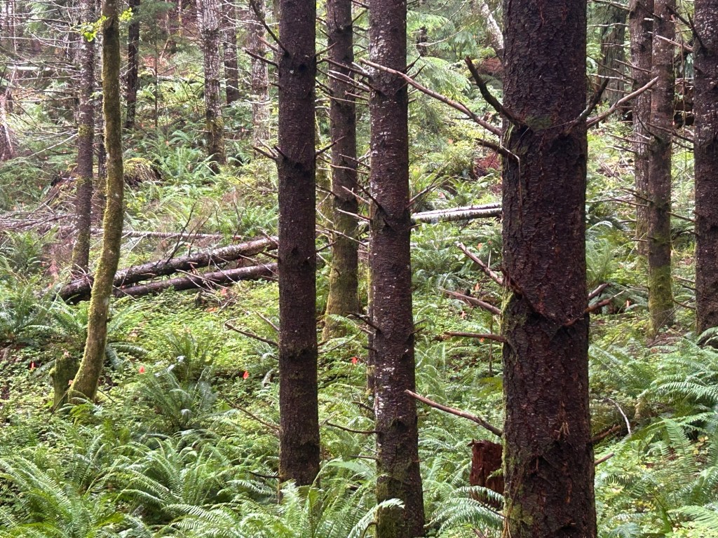
Things have been rather busy for me during the work week, and while I was able to carve out a few hours on the 20th to search the grid, I did not have time to write up the day’s work. I’m going to combine both reports into one. Both days were spent on the Northwest quadrant, and that quarter of the total is now searched. We have searched 50% of the total area. The half that remains is uphill from where Trooper alerted. I should have that half complete by the end of October.
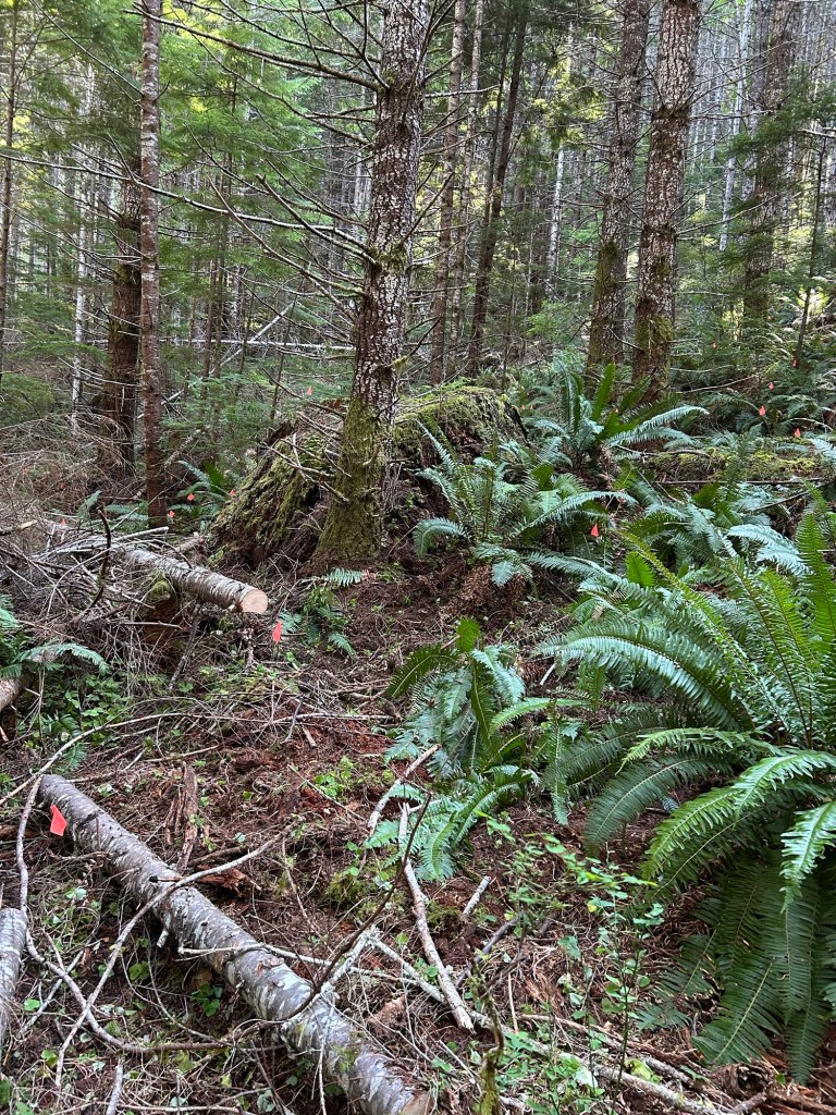
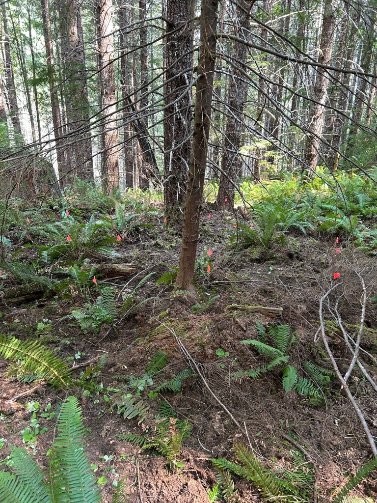
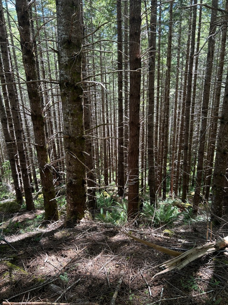
The northwest quadrant is fairly open
The Northwest quad was searched fairly quickly since it was far more open, with less deadfall tangles to contend with than the northeast quadrant. There is a small drainage channel that cuts the northwest quad into two roughly equal sections. Starting at that channel, each half would be a gentle uphill search, so I cleared west of the channel on the 20th and east of it on the 27th.
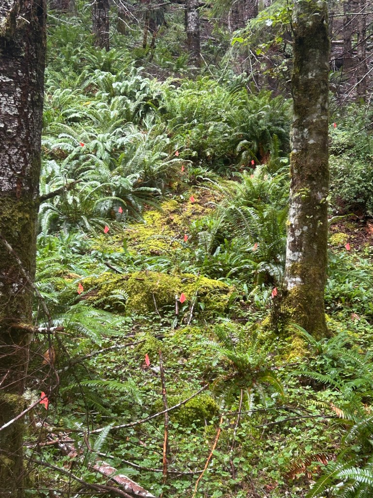
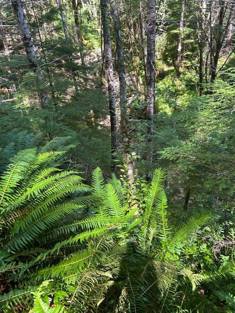
Looking uphill from the drainage channel. The first lane cleared
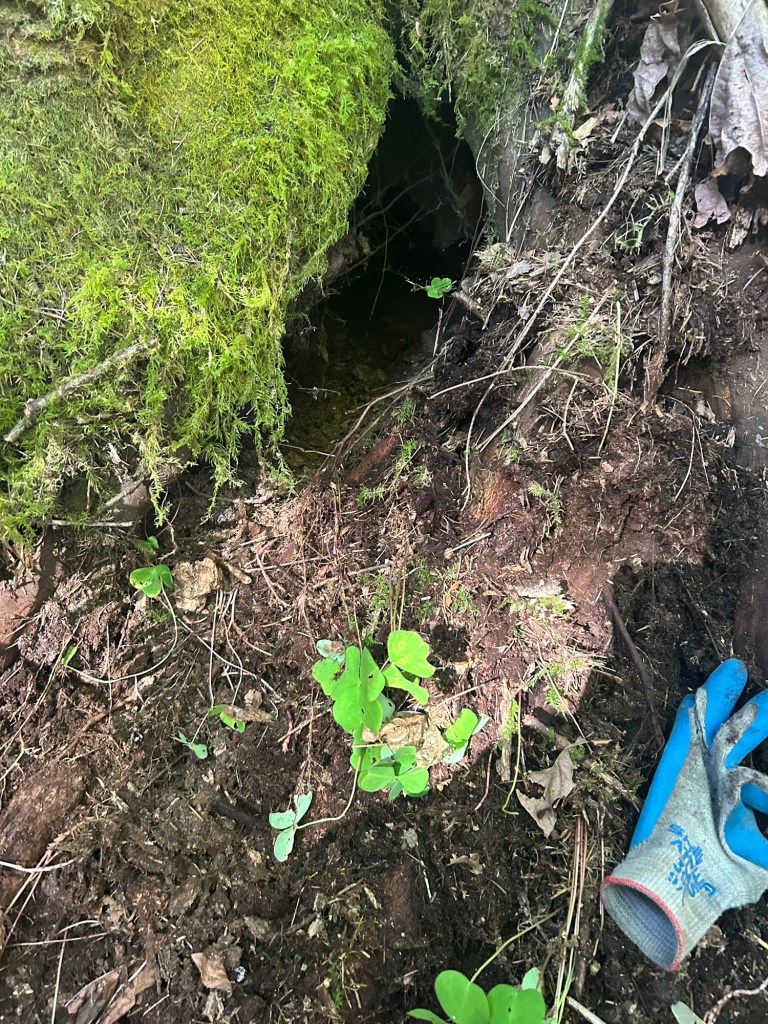
It was good searching, with a light duff layer and pretty open ground. I finished the first half of the northwest quad in about 4 hours. I checked animal burrows and rolled over deadfall as I was working.
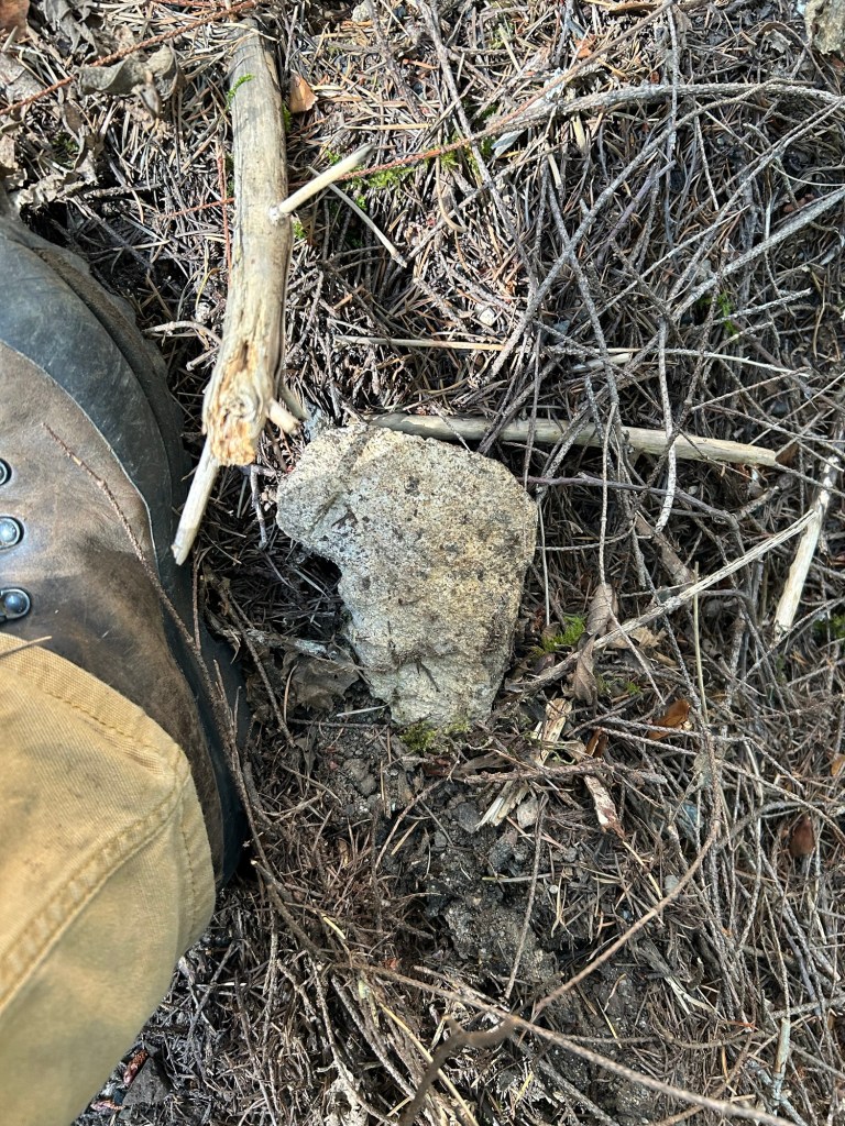
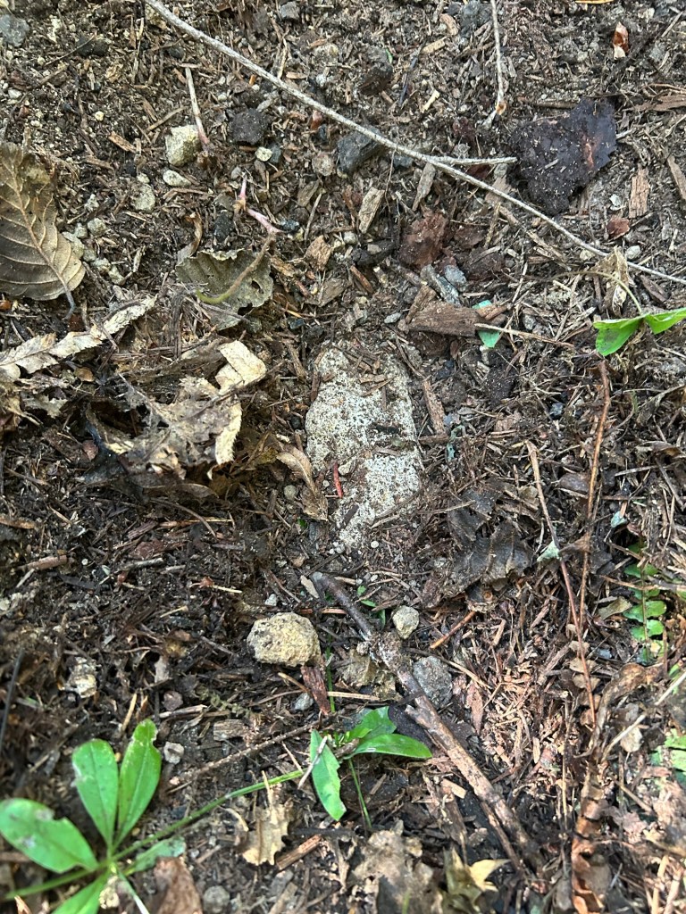
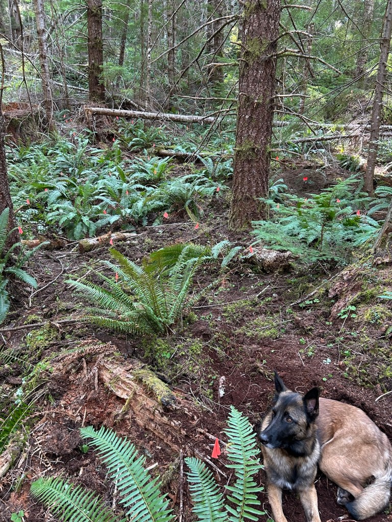
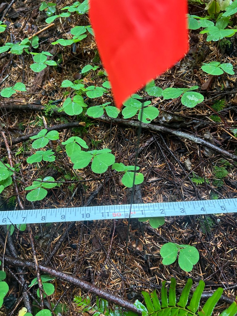
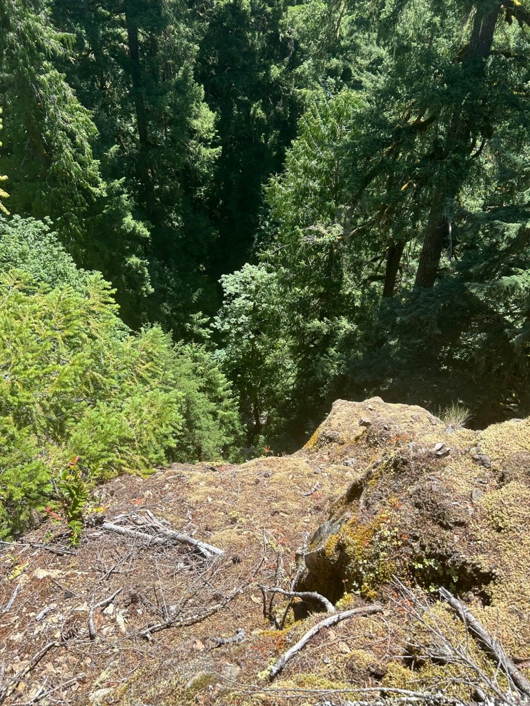
There is a rock type on this hillside that does throw constant false visual alerts. I’m not a rock expert, but this one does have the appearance and color of weathered bone.
On 27 September, I took a new route into the site. Trooper, the HRD K9, detected odor of interest while walking in. It was at a turn-out on the skidder track, and there was a spur running downhill in the general direction of the grid. I decided to walk that spur down to see where it led. The spur has a very defined game trail on it, and is a much shallower angle down than the draws on either side of it. The game trail led almost directly to the grid, while the natural line of drift on the spur would have led to the End of the Road.
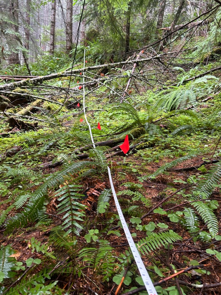
I started again at the drainage line and worked eastward. There was a little more deadfall on the eastern side, particularly as I got closer to the centerline and border with the northeast quad. This section, although slightly smaller overall, took about 5 hours to finish.
The supervisorWorking around some deadfall Clearing a burrowLight Green track is 9/20/2025Black track is 9/27/205Walking the game trail from the skidded track down to the grid
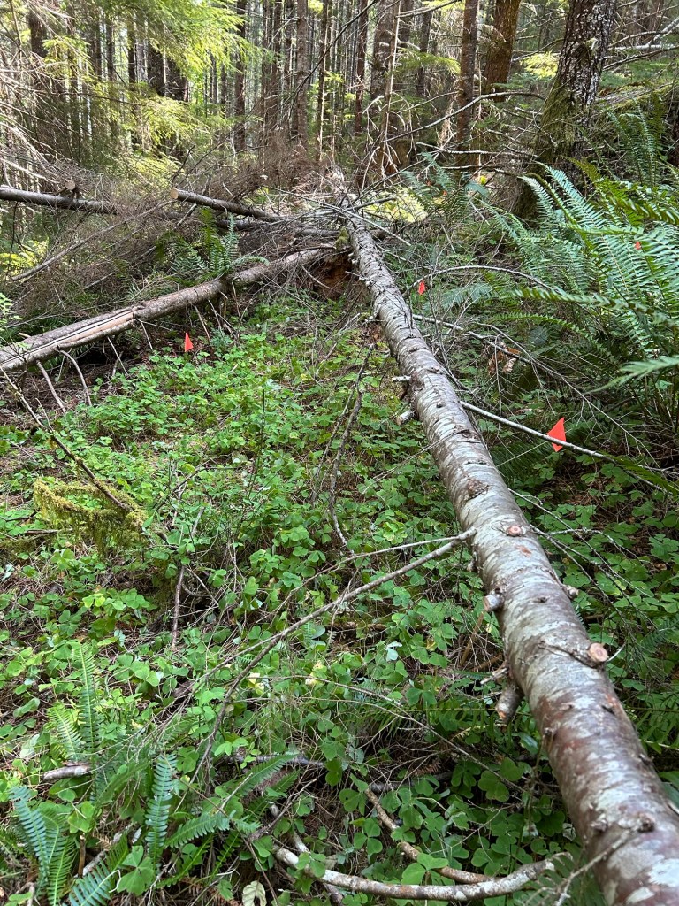
Temps were cool in the morning, then rose up to about 80 in the afternoon. I was able to complete the northeast quadrant of the grid. I had an “L” shaped segment left to search. The short leg of the L ran from where I stopped last weekend. It ran north-south and was a couple of lanes wide to reach the stump at the center line. The long leg of the L ran east-west for 50 ft, and was about 15ft wide.
Cutting away deadfall that ran the length of the long leg of the L. I was able to cut a decent amount away with the silky saw, then limbed the rest of the length.
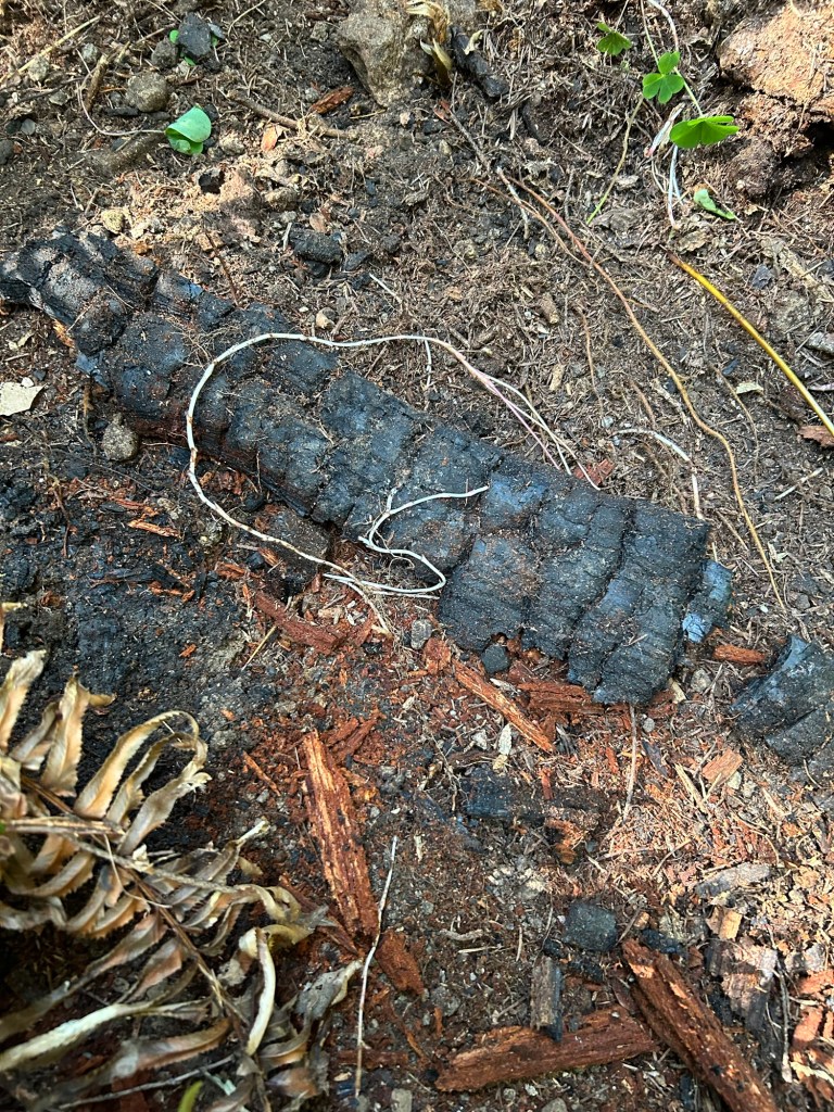
The short leg of the L and the first 1/3 of the long leg took the longest. This area is closest to the center point where the HRD K9 indicated, so I went slow and methodical through this area. There is evidence of a low intensity fire at some point in the past. The old growth stumps have some fire damage around them, and there are coals and partially burned dead fall in the deepest layer of duff. None of the current trees have burn scars and the understory and ground layer is very verdant. I checked a few sources and couldn’t find information on a fire occurring in this area. I’m hoping that means the fire was pre-1977. Evidence of the burn is throughout the saddle.
Old coals at the base of the duff
Some of the rocks in the soil layer look remarkably like bone, and three similar to this were discovered during the day.
Finding a rock like this definitely slows things down until resolved
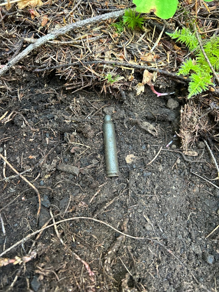
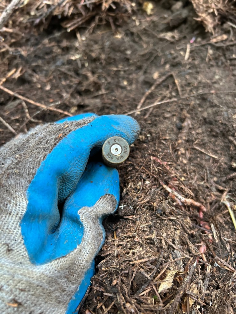
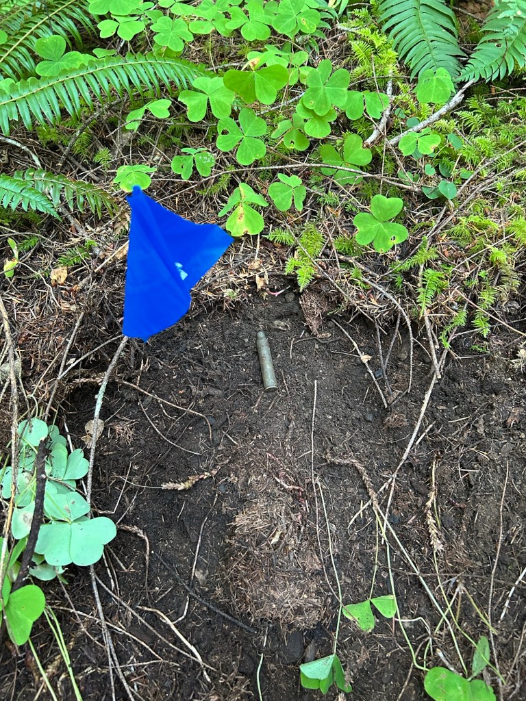
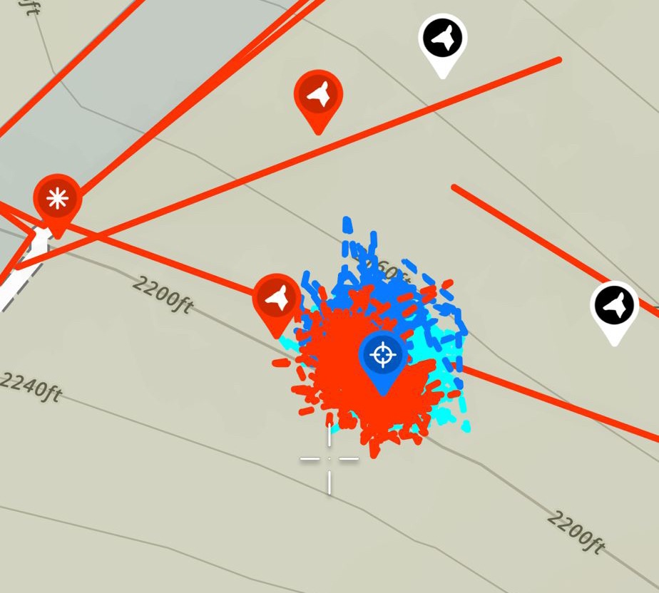
The most interesting item found was later in the afternoon, I found a 300 WinMag shell casing along the long leg of the L. It was been the first man-made object I’ve found in the grid. It was most likely ejected by an elk hunter, and probably not too long ago. The casing is tarnished and lightly pitted, but not yet deeply corroded. I’m guessing it laid here less than 10 years. I still flagged it and added a way point.
300 WinMag shell casing as found under the duffHead-stamp is still readable. Federal Cartridge Company, but no lot number for a year.Marked and I’m moving on.
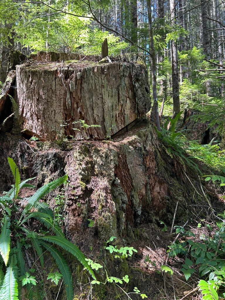
I finished the last bit and felt pretty satisfied with getting this quadrant completed. The next one will be the adjoining northwest quadrant. It’s more open, with less deadfall.
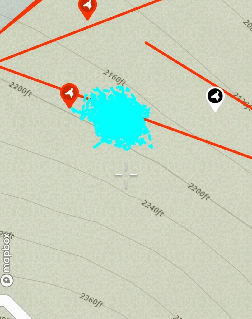
After clearing a series of lanesLooking at my progress and the branches moved into the already searched areaThe 9/13 track is in red. The shell casing is the blue cross-hair waypoint.
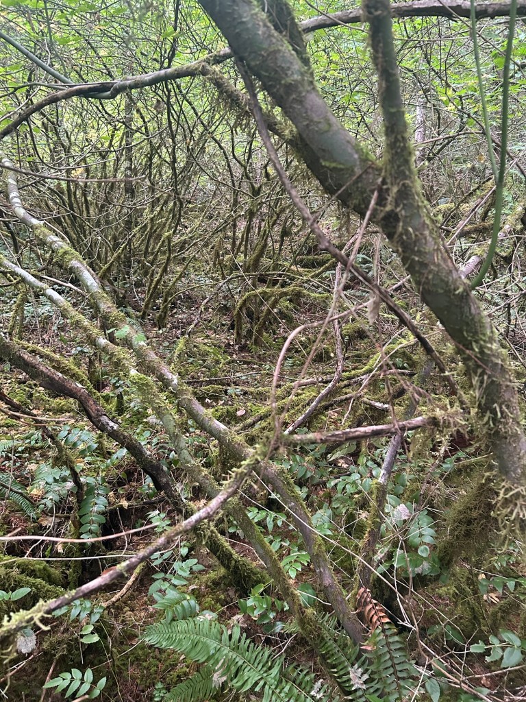
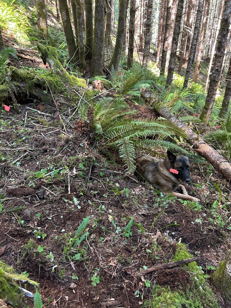
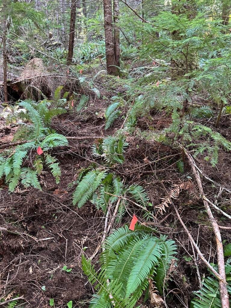
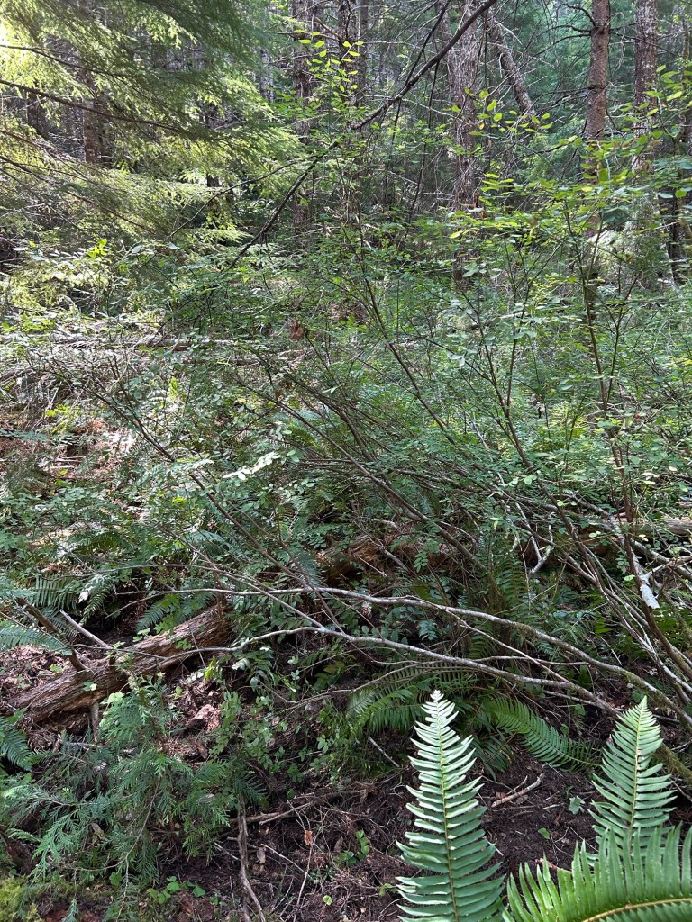
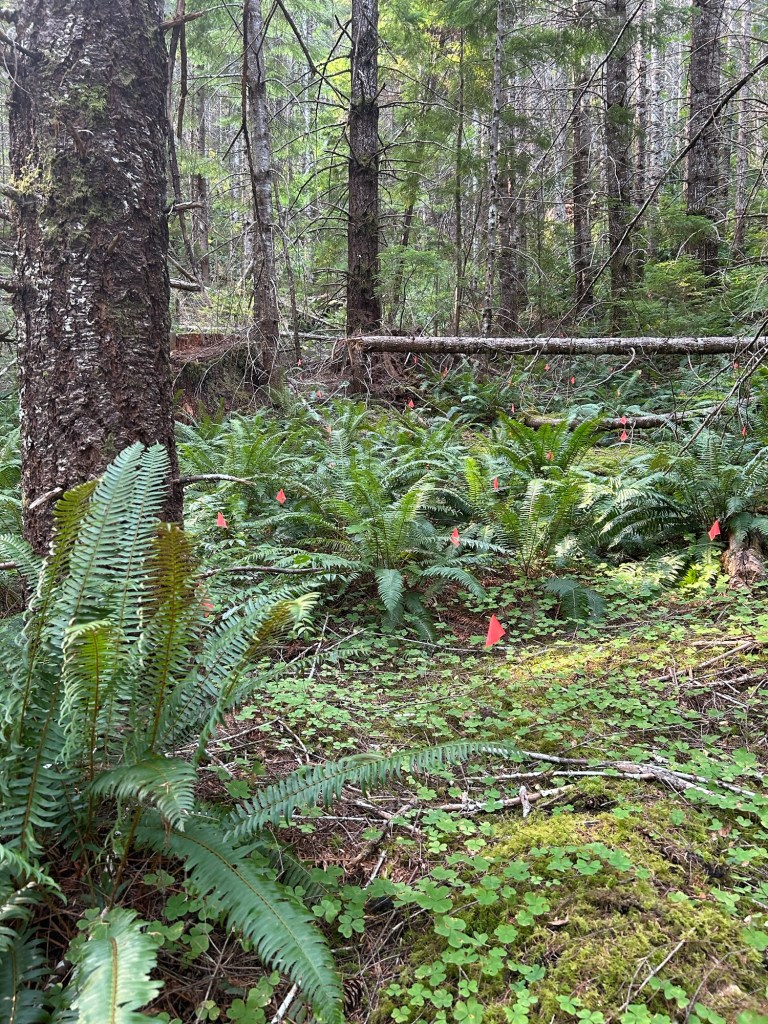
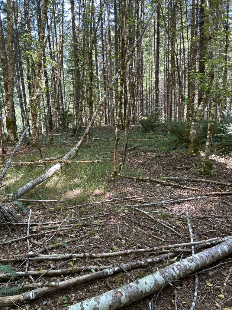
Remy and I returned early Saturday morning and started up on the next section of the grid. We are continuing the outside working in methodology, beginning at the lane adjacent to the last one finished the week before. This next section is a tangle of deadfall, fern and huckleberry, enough of a tangle that I didn’t even try to lay the grid across it.
The tangleAnother view of the huckleberry and deadfall
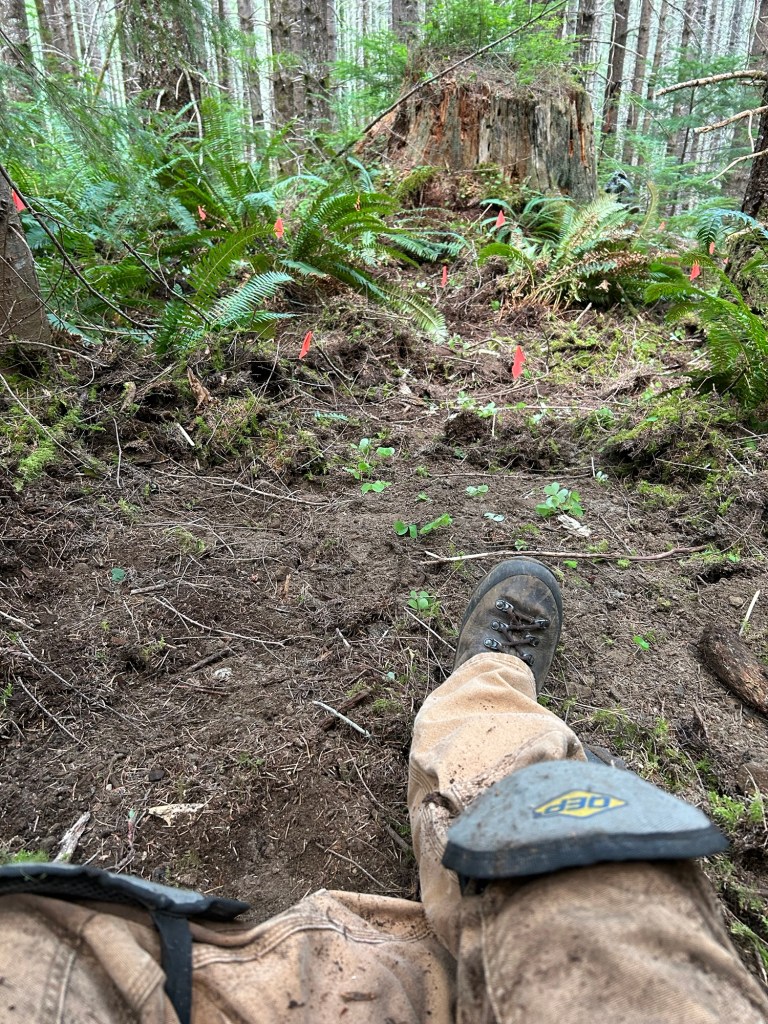
Remy settled into a cool patch of bare earth from last week, and I turned on the GPS, added knee pads and gloves and began the day’s search. It was slow work in the tangle, clearing the ground and moving through the brush. I worked the tangle until it was complete and I had “broke through” to the ground cleared last Saturday. There was a raven vocalizing in the canopy above me, which was a nice accompaniment to the morning.
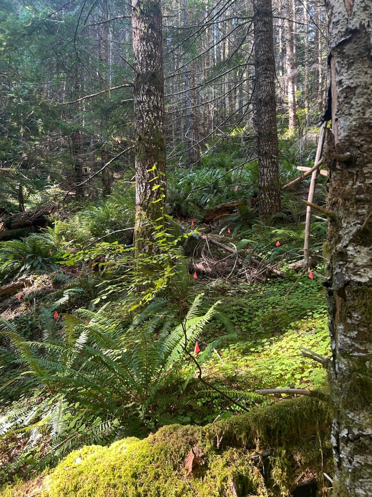
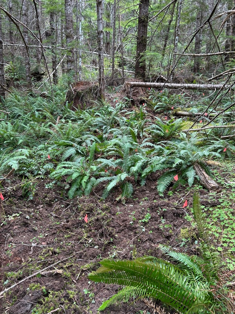
The area to the west of the tangle was more open, mostly box sorrel and fern for the ground cover. After the effort of getting around the tangle, this relative openness was deeply appreciated. I still went slow as I could see the center-point where Trooper, the HRD K9, had found odor of interest.
Opening up and almost no brush or deadfall to contend with
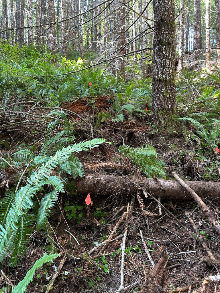
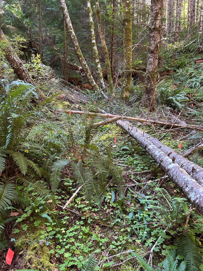
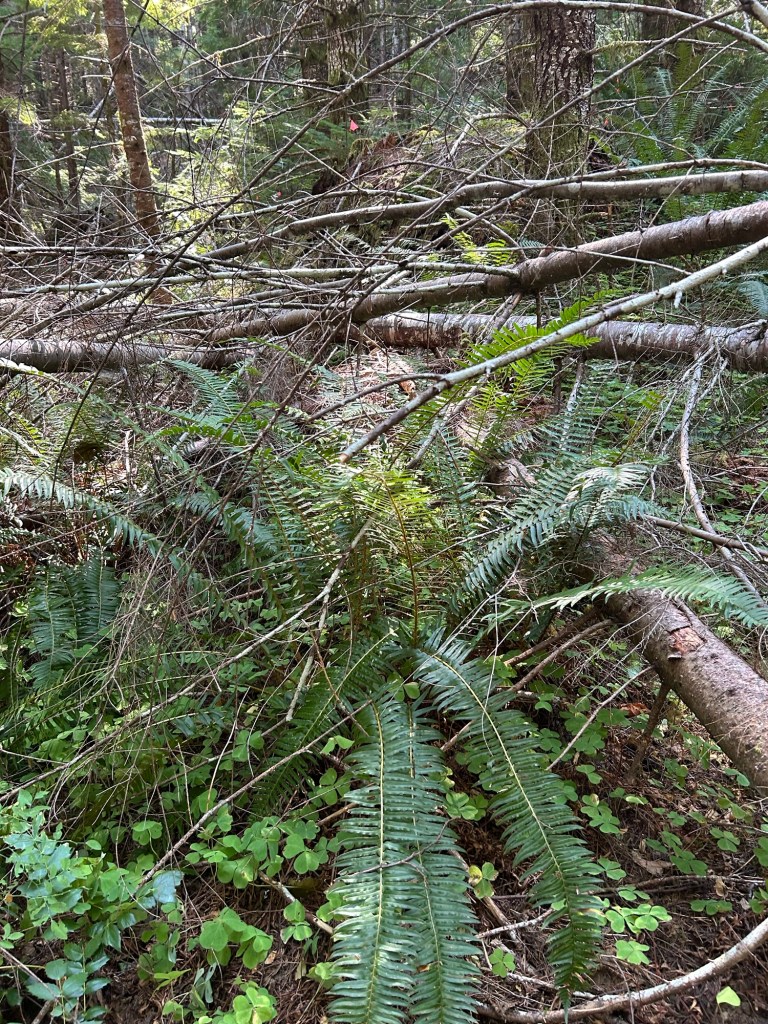
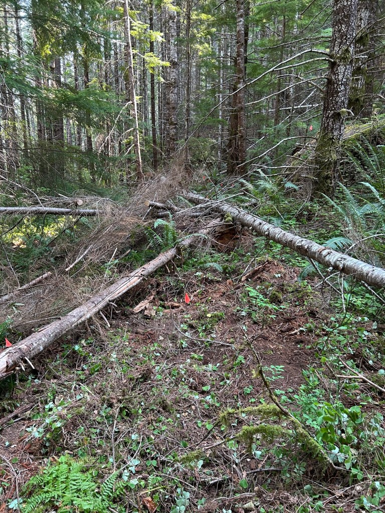
After reaching the deadfall, I paused the ground search. The deadfall formed two legs of a triangle heading back towards tangle. I took a few minutes to drink water and then limb off the trunks to make the next part easier.
Cutting limbs off to open the area up. The cut branches were piled up in the already searched tangle. The tree on the right was the southern limit of last week’s and this week’s search.Now cleared and searched.
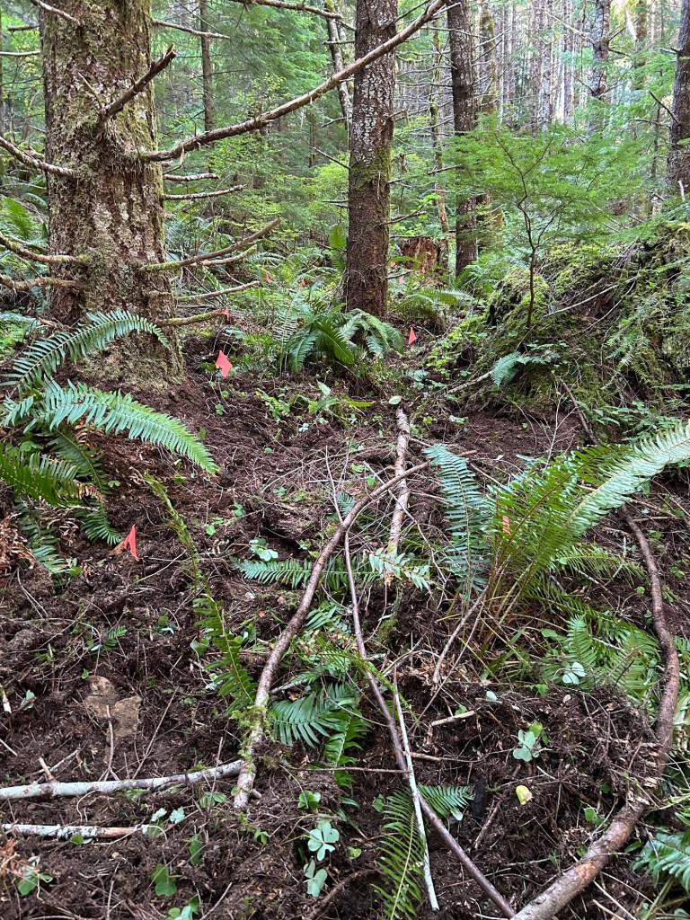
This was the limit of the day’s progress. I am within 15 feet of the north-south centerline and about the same distance from the east-west centerline. I’m slowly finishing the northeast quadrant. I’m hoping to complete this quad and begin a new one next weekend.
After a weekend working in Coos County on 23 & 24 August, Remy and I went back to Soda Fork Saturday and got started on clearing the grid. This is the first hands and knees search since I finished working the former timber boundary around Landing 3 in Section 19. We arrived at the alternate location, walked down the skidder track , walked down to the grid, dropped the pack and got to work.
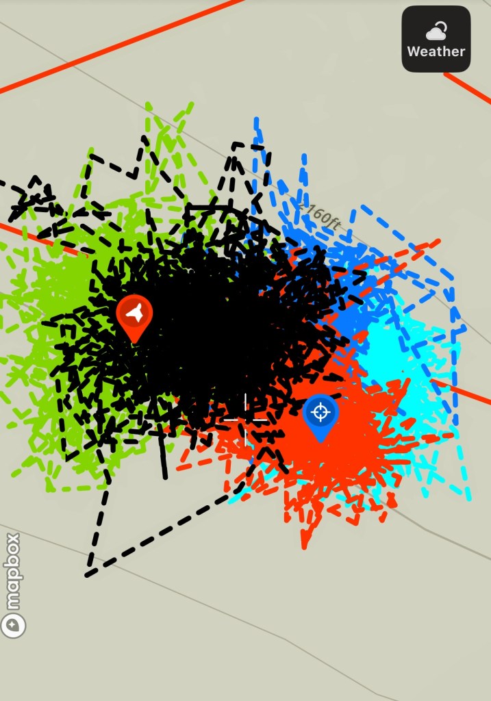
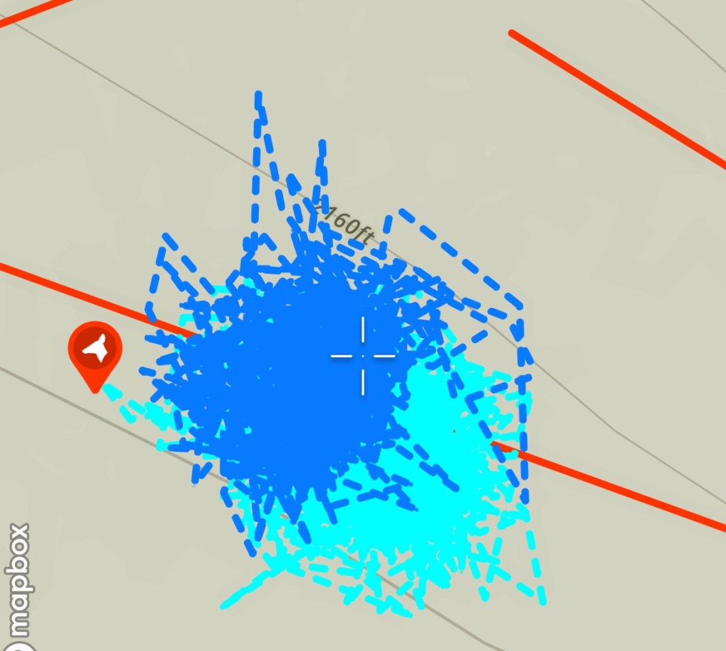
Since I have lanes clearly marked, my plan for the grid is to start at northeast corner and work my through each quadrant until complete. My goal for the day was to clear one 2500 square foot quadrant. The grid is 100×100 and centered on the area where the HRD K9 indicated “odor of interest” back on 2 August. That’s a 10,000 square foot area subdivided into 2500 square foot quadrants, and further subdivided into 5×5’ grid squares.
The edge of the northeast quadrant.
I began with my usual silent appeal to Karen and Rodney that Remy and I were there to help them come home, and if they wanted, today could be the day that the return journey began. With that, I gloved up, put the knee pads on, and started clearing the area.
I used the lawn mowing technique, where I cleared one lane to the bare earth, moving forward one grid square at a time. I was thorough and it was slow going all day. Since this location matches both the news accounts, the suspected offender’s preference for a murder / major assault / body dump locations (for this offender, both phases of his offense pattern would be the same location) and an HRD K9 showed strong interest, I am very deliberate and thorough. 48 years is a long time for a skeleton to disarticulate and scatter, so literally any grid square could be “the one”.
Taking a break and looking back on the first few lanes that were cleared.Cleared vs not-cleared
I hit the wall of my endurance at 4pm. I had cleared about 1500 square feet of ground, and I really couldn’t do much more that day. Based on what I was able to clear, I will be working this location through the fall. I am content with the thoroughness of the area searched, and that I would rather be slow and thorough than go faster and miss something.
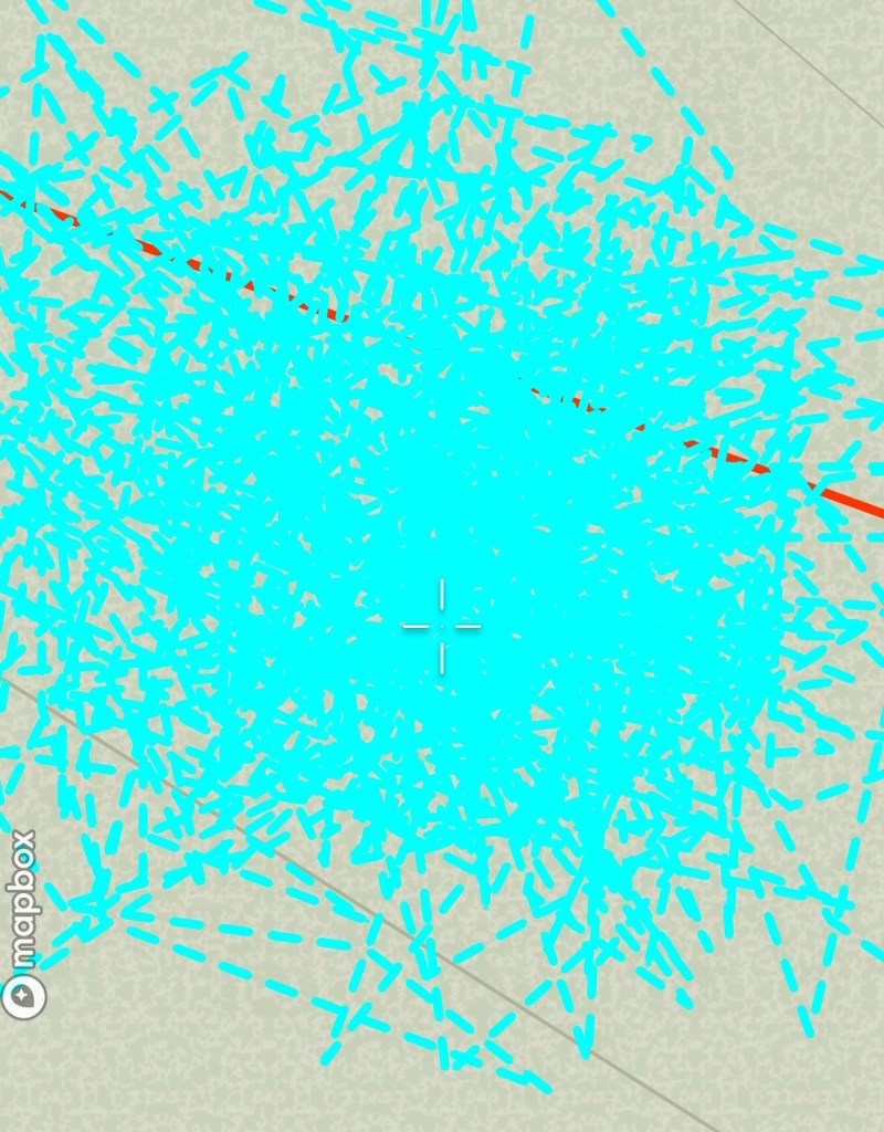
Looking from the center line at the area cleared. A long day, but worth it.Observing the area worked from roughly the day’s starting point. Remy supervised the work from his fox hole. GPS track of the partial northeast quadrant searchTrack density in the search area
Yesterday’s work was the measurement and layout of a grid centered on the marker where the HRD K9 gave his strongest indication of human remains. Based on the terrain in the area, I decided to start with a box 100’x100’, or 10,000 square feet of area. I stopped at the hardware store Friday and bought 500 blaze orange pin flags. I also bought a pack of pin flags in a different color for marking anything found. I packed a 100’ landscaper tape measure, stakes, spikes and other tools into my pack and had an early start.
I arrived at the search site about 8am and rucked the supplies down the skidder track and then down the hill from the End of the Road to the spot Trooper identified. I drove a spike into the stump where he whined and stamped the ground. I looped the tape measure over the spike and walked due north for 50 feet. I placed a pin flag every five feet along the tape until I had the line marked. I wound the tape back onto the reel, and repeated this process in the four cardinal directions.
Laying out and marking a centerline
Once I had the horizontal and vertical centerlines marked out, I then started the process to connect them and form four squares that share a corner on the center stump. I placed a spike at the 50’ mark, turned 90 degrees and ran the tape out another 50’. I repeated this in each direction from each of the four centerlines. This connected lines, forming the aforementioned boxes.
Marking the end of a centerlineConnecting a corner to form a 50’x50’ box. This one connects the southern and eastern centerlines
Once the larger 50’ x 50’ boxes were marked, I then subdivided each one into 5’ square grids. I ran a tape from centerline flag to the opposite centerline flag, then dropped flags every 5 feet. I repeated this ten times for each box, creating the grid.
Laying the grid out. Keeping this square was a challenge The grid taking shapeLooking down on the grid from the hill leading to the landing. There are 500 flags hidden in the ferns and huckleberry
I took me until 2:30pm to complete the grid. My original plan had me starting the grid search once laying the grid itself was done. We had some light rain in the Valley Friday and early Saturday, but those light rains stacked up on the Cascades and I was working in really wet conditions. I was a little too worn out to start the grid search, so that is for next time. We take a step at a time until the work is done.
Looking back at the End of the Road, anticipating starting the search
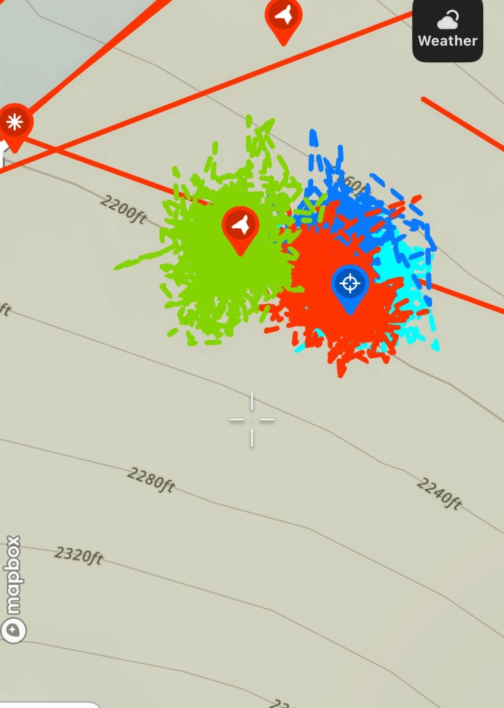
The HRD K9 team and I met up at Soda Fork Rd and US20 at 0700 and drove into the new search area. We geared up, readied a chainsaw in case I needed to cut more of a path down the road and we headed out. Thankfully, the path was open enough. As we were walking in, Kathy let me know that Trooper (K9) caught “odor of interest” when we were on the road above the area I wanted to search.
We rounded the turn to head east towards the end of the road, Trooper departed the road and went slightly north towards No-Name and Named Creek. His nose, to my eyes, definitely caught something and we followed him around that area for a bit. Kathy marked it on her GPS and I flagged roughly the center of the area he was interested in. We got to the End of the Road shortly thereafter. We walked the perimeter of the End of the Road, then dropped down the game trail towards the saddle and the hill opposite.
We were about 1/2 way down the hill from the End of the Road when Trooper again picked up “odor of interest” near a rock on the hillside. We GPS’d the location and flagged it. Trooper got back on the search and immediately went on his own to the south, towards the base of the hill that the road runs along. He moved with a purpose and without regard to how close Kathy and I were to him. He showed odor interest in a really compact area. Although he did not show his “trained final response” to locating a human remain, his behavior indicated that he was smelling human decomp. I lightly searched the immediate area where he sat down and started whining, but I found no bones or other items of interest.
Kathy and I went back up to the landing for a short break and some water. Once refreshed, we dropped back down the hill. Trooper again detected “odor of interest” in the same two spots, which was very encouraging. We led him around the beginning area of the Dry Drainage and about 150 yards down it. He showed no interest in the drainage. He also showed no interest in the north side of the hill, where Named Creek runs.
After that we hiked back up to the trucks. Trooper again demonstrated “odor of interest” when we were above the area he went to on the south side of the landing. When we got to the trucks, Kathy hid some human bone training specimens for Trooper to find so he could get a treat after working so hard. What I noticed while he was working to find the training specimens was that his behavior when he caught the specimen’s scent was the same that he demonstrated earlier that morning in the woods.
My go forward plan is to create a 100’ x 100’ grid with pin flags around the area where he showed the most interest. In the context of the terrain, that area fits all the descriptions and the terrain also supports being a major assault / murder site.
On the attached GPS screenshot, yesterday’s track is in red. The areas where Trooper detected “odor of interest” are the red dog icons. The white dog icons were pre-planned search areas for him that he showed either no interest or we didn’t go because he didn’t lead us there.
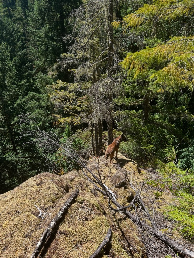
This past Saturday I completed the third and final site survey before running HRD K9s this coming weekend. I located the 1982 timber boundary, which is anchored on a very prominent terrain feature, which also serves as a barrier to further travel. It’s a fairly deep and cliffed out ravine that Named Creek runs through.
I also identified a natural line of drift from the saddle between the End of the Road and the hill. That line of drift channels foot traffic into a dry drainage that runs east-west parallel to Named Creek and south of the hill. This dry drainage is the area I’ve identified as the first search area. We will see how the day goes.
Looking down into the ravine that forms the timber boundary. Named Creek runs along the bottom. Above the ravine
I got out early trying to beat the heat for a more in depth look at the area around 3 Mile Landing, in particular the area where the road ran out past the landing. I brought a silky saw with me to open up passages through some of the deadfall, but that got exhausting quick. I have removed proper place names.
I walked from 3 Mile Landing to the End of the Road, which once I walked past the sea of ferns, was actually a large landing. Large enough to allow an entrained log truck to pull-through and complete a turn-around. I used my GPS to measure the distance from the center of 3 Mile Landing to the End of the Road and it was 155 yards. Doing the math, if LT Martinak crossed 3 miles on the odometer at the first landing, the odometer wouldn’t have turned over yet to 3.1 miles by the time he parked here.
The End of the Road. A large landing 155 yards from 3 Mile Landing.
After I walked the perimeter of the landing, I determined that no-name creek, the hillside to the immediate south of the landing and the most walkable path from the landing all channel foot movement in one direction, to the east-northeast and Named Creek. Walking east-northeast from the landing, there is a game trail down the slope that runs towards the opposite low hill. It’s a very easy walk, unlike the slopes from Landing 2 towards Soda Fork Creek and the draws / spurs across from (presumably) where Rodney’s clothes were found in Section 19. Based on current conditions, I could see a victim in smooth soled moccasins being able to walk this hill. Also, if an offender at 5’10” and 225-250lbs had to fireman’s carry the deceased 128 pound victim down this hill, that would also be very possible here. From the End of the Road, it is 314 yards to the timber boundary. There are two draws around the hill that channel movement to the timber boundary. The one that side hills Named Creek is 176.5 yards to the timber boundary. The draw on the south side of the hill is 218.3 yards to the timber boundary.
The slope down from The End of the Road towards Named Creek. It is fairly gentle by Section 19 standards.
Named Creek is a definite barrier to movement. The V bank is about 30 feet down, across the creek then up a hillside on the opposite bank. It’s a steep bank, and I can’t see either an offender and living victim or offender carrying a deceased victim crossing that obstacle only to keep climbing the other side.
The V bank down towards Named Creek. The opposite bank is a hillside.
Each draw that runs towards the timber boundary has benches along the way, so not a pure side hill to walk that way. I marked off areas to run HRD dogs through based on the terrain. I did not grid search this area since I wanted to keep intact any detectable odors.
I also was able to confirm that the timber harvest in 1977-1982 in this section would have been second growth, which matches all the descriptions of where Karen’s clothes were found. I found high top stumps with buck board notches when this was old growth harvested in the late 1800s to early 1900s.
I went out to Soda Fork Saturday and completed a site survey of the area outside of but adjacent to Section 19. I identified this area based on a February 1978 Albany-Democrat-Herald article about the search for Karen’s remains. Since I’m down to the last 4 acres in Section 19 that align with the known location data, I’m now expanding out from that part of Section 19 into alternate areas.
This particular article had sat off to the side for the past few years, mainly because the location data within it was not in accordance with other articles and the LCSO case file summary provided to the Oregonian. Since every reference except this one pointed to a landing in Section 19, I focused there at the beginning, intending to examine the singular outlier after closing out Section 19.
With 4 acres left to search in Section 19, I’ve started the work up to prepare for a search of the outlier area. First steps were topo maps, historical aerial imagery, LiDAR scans and working through the thin documentation to identify landings within the new area. Once I had those identified, the next item was a site survey and developing a plan to search the new areas.
What drew my attention to this area, is that other than the section it is in, it does fit all the other location data. The road leading to it is labeled “Soda Fork Rd” on older topographic maps; it was an area of active timber operations at the time; the landing locations and terrain align with reports. It also ties to other Ackroyd dump sites by the environment, and that it’s an area with game animals or other outdoor rec opportunities.
During the survey, I determined that the road to the location exists and is mostly drivable. I was able to find all the spur roads and landings north of the main line, although there had been zero maintenance done on the main line or any of the spurs since probably the 1980s. I identified two initial search boxes based on the terrain, and that the landing associated with them maps the outlier location data almost precisely.
This is my next search area once Section 19 is completed.