Karen Jean Lee was last heard from 47 years ago today, at 3:18pm Pacific. She made a call from a pay phone in Lebanon, Oregon and vanished. Traveling with her was Rodney Grissom, who has also never been seen again. May they come home soon.
Karen Jean Lee was last heard from 47 years ago today, at 3:18pm Pacific. She made a call from a pay phone in Lebanon, Oregon and vanished. Traveling with her was Rodney Grissom, who has also never been seen again. May they come home soon.
In the official documentation on NAMUS, LCSO, etc, Rodney Grissom is listed as missing since May 24, 1977, and was last seen in Albany Oregon. You’ll find this same information in the earlier entries in my website, as it is the “official record”. However, I have found through additional research in contemporaneous newspapers that this information is incorrect, not out of intentional error or negligence, but due to the passage of time between his actual disappearance date and point last seen.
Rodney Grissom was officially reported missing in 2012, not in 1977. His family in Hillsborough may have reported him missing to the Washington County Sheriff’s Office, but through error or the lack of a priority that a teen runaway would have been given in 1977, it was not officially recorded. When Lt. Mike Harmon began a new investigation in 2012, he contacted Rodney’s family, determined that he was still missing and LCSO filed the official missing persons report then.
This post-fact reporting introduced both the 24 May date and the Albany point last seen into the record. Albany Oregon is the Linn County seat, the headquarters of LCSO and would probably be the default for LCSO making a report. The official report does state that LCSO filed the report as a courtesy to Washington County, which indicates that the actual point last seen would have been there.
The 24 May date could have been a typographical error, or an error in memory on the part of Rodney’s family when talking with the investigator. It’s hard to determine which, but it is a good faith error.
All the contemporary accounts (1977-1982) list Rodney as traveling with Karen on the day she disappeared, 26 May 1977. Her last phone call indicates that they were traveling together as well. I apologize for my own earlier propagation of the incorrect 24 May 1977 and Albany information. I hope that this entry helps clear up that error.
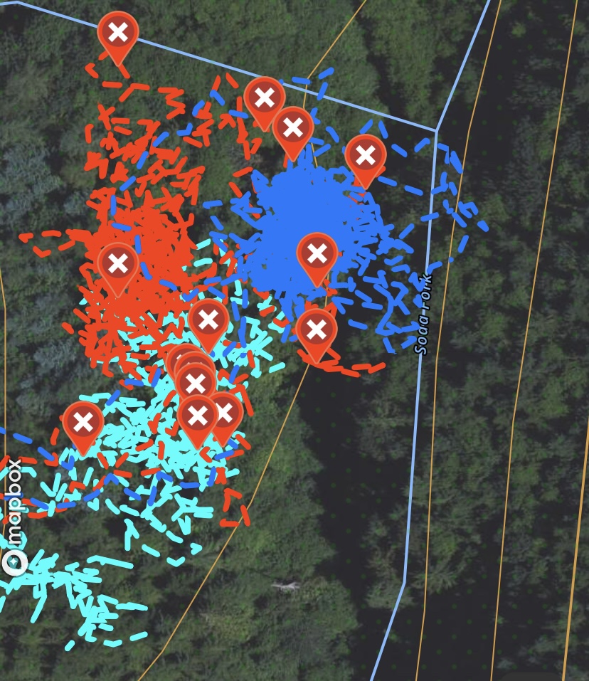
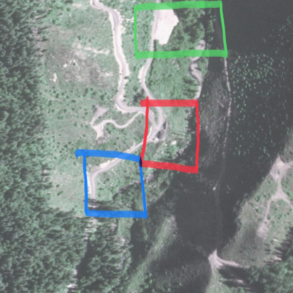
The search at the Lee Site yesterday was a continuation of the prior 27 April Search. I started by overlapping the ground search with the 27 April area, since there is a decent amount of deadfall in the area. I wanted to make sure that I didn’t leave a seam between the two search boxes and inadvertently miss something.
I’m still working the plan I developed after finding the 1982 aerial survey, which is to work the edge of the felled area. Once I have that line on the hillside searched, I’ll get ropes to descend the hill and work between that line and the creek. The task for today was to clear a large pile of deadfall, branches, and debris that had built up in that search box. The weather was excellent-90, sunny and dry.

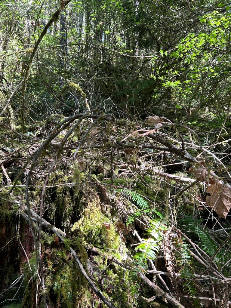
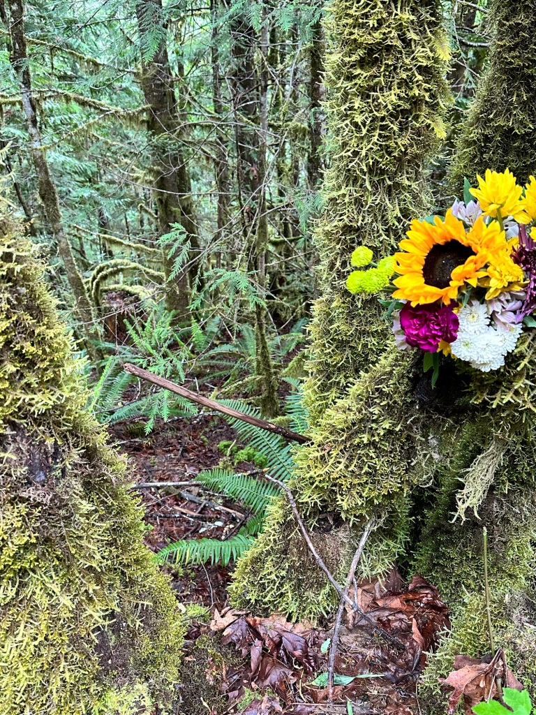
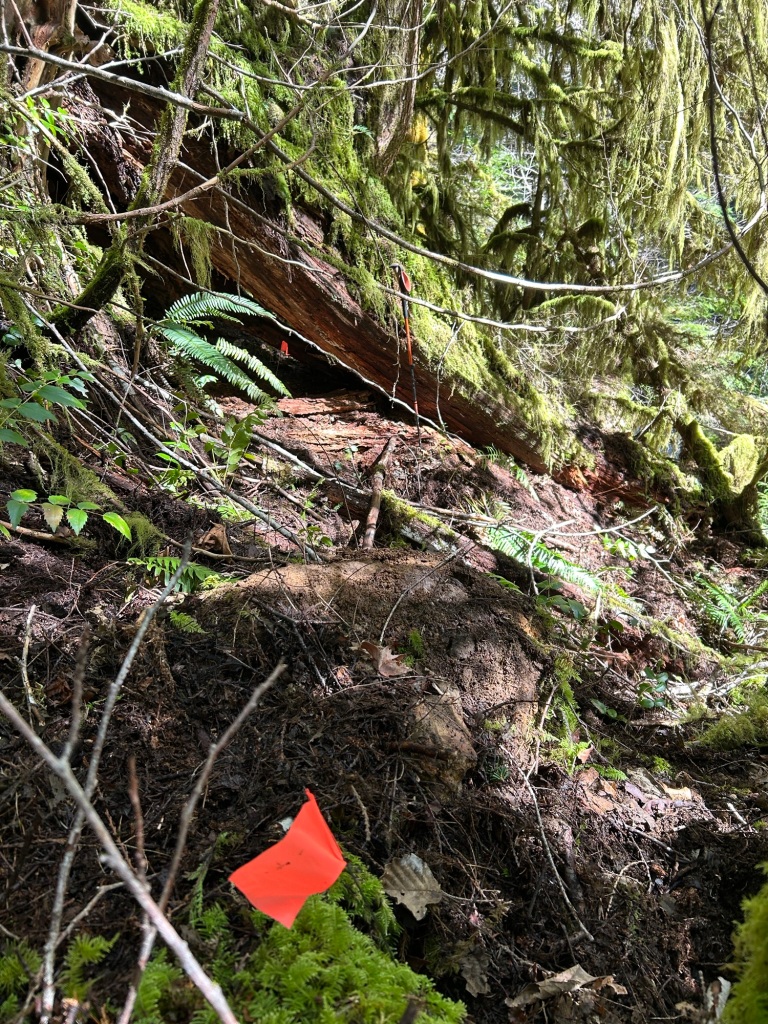
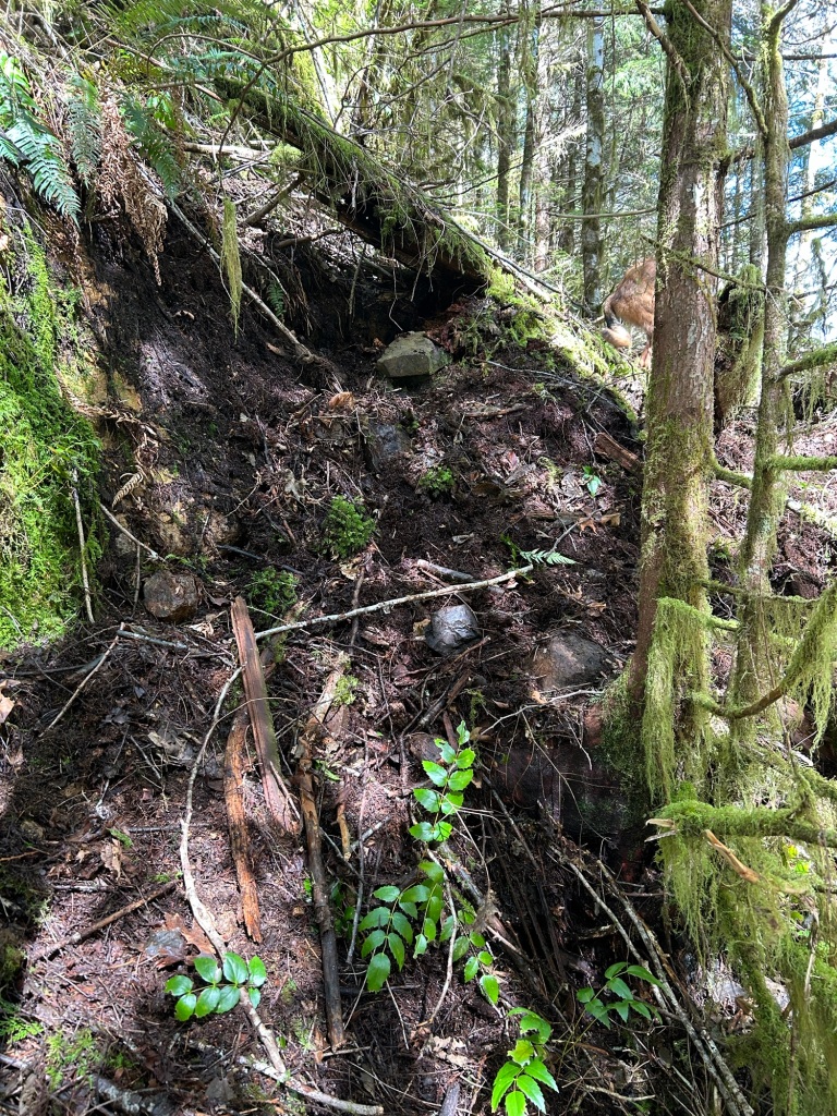
I was clearing debris from around the base of a standing cedar, visible in the center of the first photo above, when I discovered an unusual item.
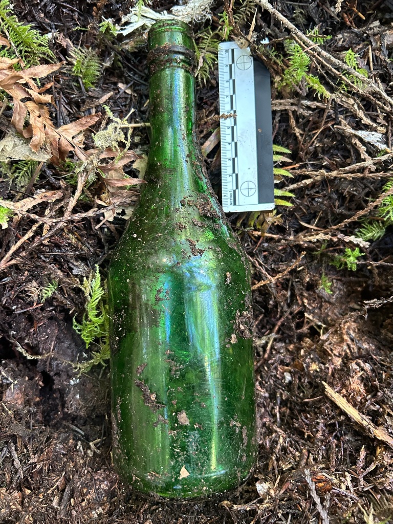
Underneath the leaf litter, I found an old fortified wine bottle. I found it odd at the time, and throughout the day and into the night, it gnawed at me. I’m familiar with the “it’s Miller Time” beverages of the PNW working man. Beer cans don’t even rate a mention when found, but this is unusual. Fortified wine would be an out of the ordinary choice for a logger at the end of the day, let alone an entire bottle. It’s too far from the road to have been thrown from a passing truck and land in this spot, let alone land intact. There are enough debris traps between the road and its location to have prevented it from rolling downhill. Usually, you find these around campsites, but this isn’t a place you’d camp in or “hang out” at. Around the landing, sure, this wouldn’t be out of place. Here it is. Whoever drank this, sat here for a while, and left it behind when done.
John Arthur Ackroyd is known to have revisited his body dumps. We know that in February 1979 he revisited where he left Kaye Turner. We also have statements from Rachanda Pickle’s cousin, Jennifer Persinger, that she believes he revisited Rachanda’s remains while she was catching a ride with him along US20. Ackroyd is also a known drinker, according to neighbors. It is also not unusual for serial killers to revisit their body dumps. Typically this is done as part of reliving the crime. Gary Ridgeway (The Green River Killer) is one example of many who have also exhibited this behavior.
Given the location of this bottle, in context with the description of where Karen Lee’s clothing and bag were found, it’s possible this is from Ackroyd. That possibility is 100% speculation on my part, and without latent prints lifted from the glass, it would be impossible to confirm. Once thing I feel comfortable asserting is that whomever drank this, was in this spot deliberately, stayed here long enough to finish the bottle and then left it behind.
To say this has been gnawing at me since I found it, is an understatement. If it is correlated with the location where Karen’s clothing was found, it’s a strong indication that I am in the right area. I’m considering bringing a brush and powder back with me on the next search. After 47 years, developing and lifting a latent print is the longest of long shots, but worth the effort.
I finished the search of this particular debris field about 2pm. I had cleared a decent amount of ground, given the density of the grid I searched. I drove home via US20 and OR22, via the Santiam Junction. It was a good drive to think about that find and what it may mean, if anything.

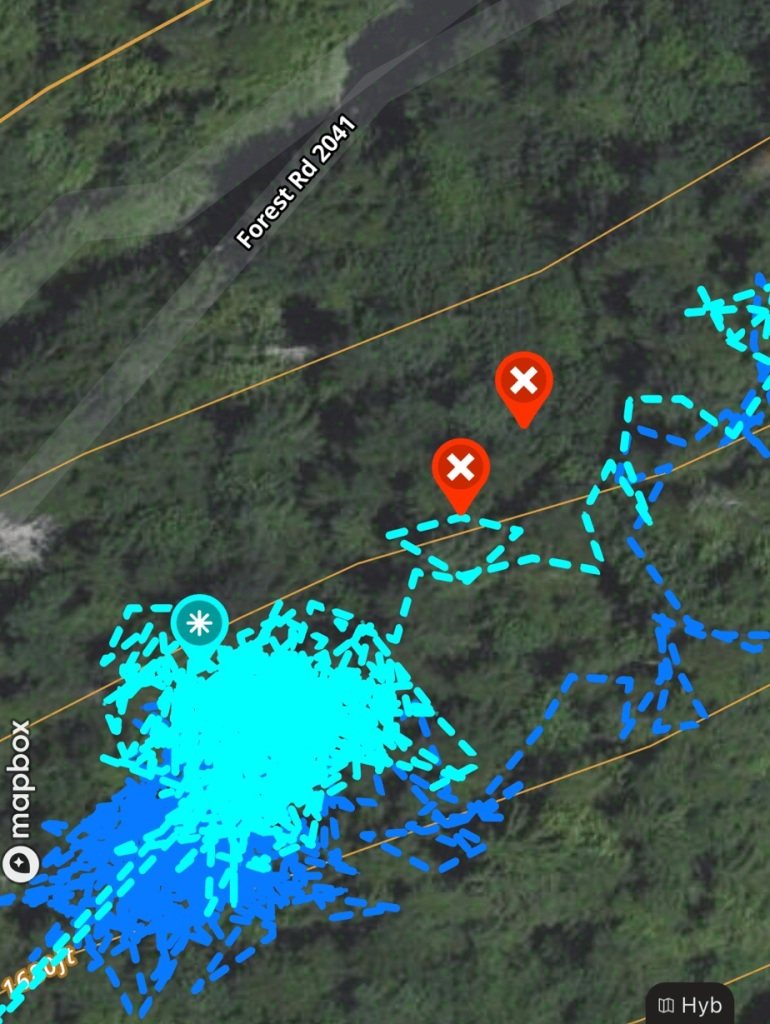
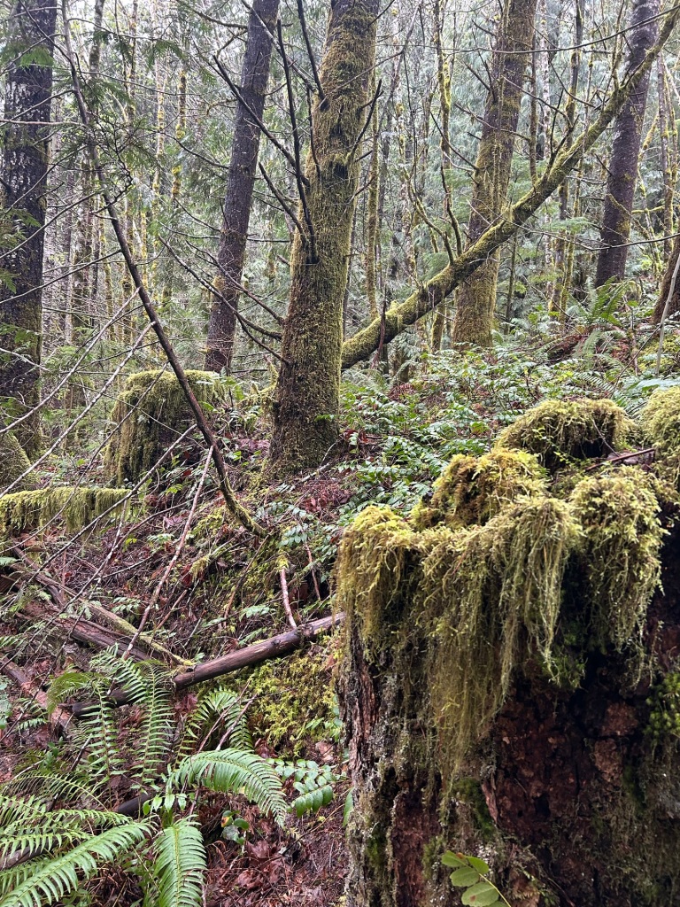
Most of my April Saturdays have been taken up with SAR training, both for this year’s Academy students and ground team training. I had my first free Saturday since the last search, and despite the weather not being ideal, I went out to Soda Fork Rd in the morning.
I had two tasks for the day. The first was to locate the limit of tree felling operations on the hillside, then head out about 1/3rd of a mile from the landing along that limit. This would establish the day’s search box. From the 27 April location my plan is to work a line along the hillside connecting back to the 31 March 2024 search box. The second task was to locate a search zone within that line for the volunteers that are coming later this month to assist.
Locating the limit of tree felling, even almost 50 years on, isn’t that difficult. I found the last row of stumps on the hillside, then followed that until my GPS told me I had gone about 1/3 of a mile from where I started at the landing. According to contemporary news accounts, Karen’s clothing and bag were found in an area of second growth timber and heavy underbrush 1/4 mile from the landing. To me this indicates that it would have been along the limit of tree felling. Now since that limit would have expanded as trees were cut, I’m starting at the final line of stumps and working in from there.

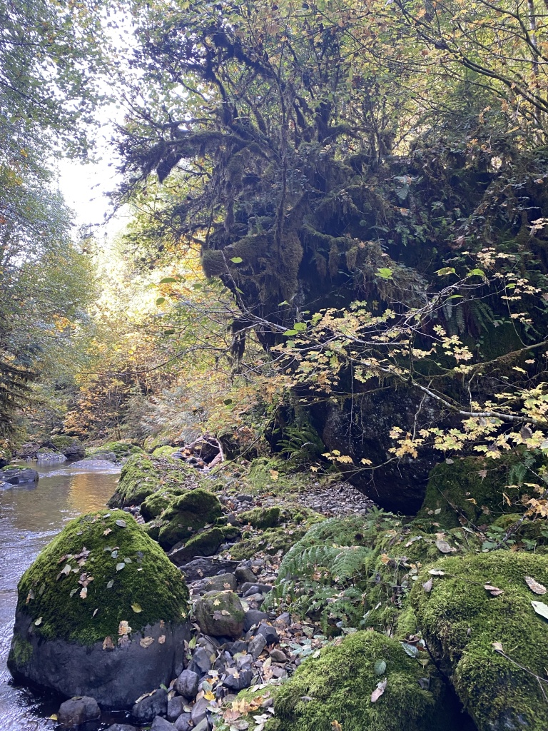
I located a bench just above a steep drop to Soda Fork Creek, dropped my pack at roughly the center of the bench, gloved up, put the knee pads on and began the day’s grid search. It was 45 and raining fairly decently, so I got drenched from the 360 degree wet of working in the undergrowth. My search technique is clearing the ground of cover until bare earth and rocks are exposed. I was able to work for about 4 hours until I lost dexterity in my hands from the cold and wet. I still managed to search about 1.75 miles within the day’s search zone.
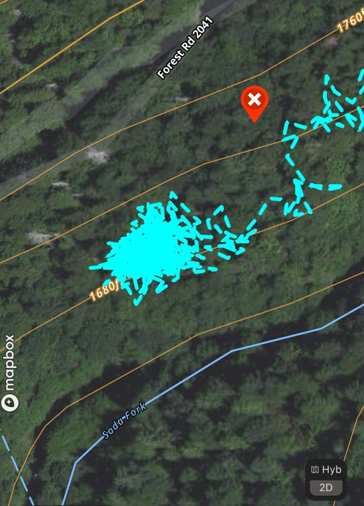
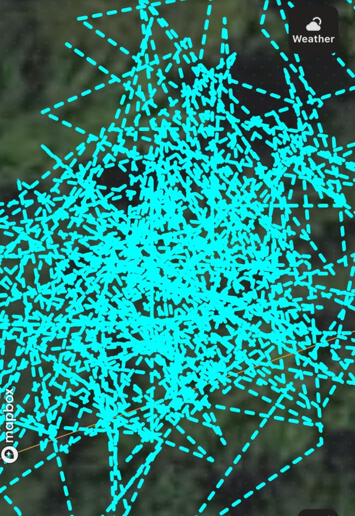

As you can see from the track, I’m pretty thorough on the section of ground I’m working on. This is slow and meticulous work, in very difficult terrain and with less than ideal weather. As the summer approaches, I should be able to search longer on each outing, covering more ground and hopefully making a recovery.
I completed the first search of 2024 today at the Lee Site. My search plan was informed by the 1982 aerial survey of the area, which provided a roughly contemporary view of the area that I could line up with news reports from when Karen’s clothing and belongings were located by Willamette Industries loggers and turned over to LCSO.
Since it has been about 5 months since I’ve been on the ground, my first order of business was to reorient myself to the site, locate where I stopped searching in October 2023, and then determine the area I wanted to search today. Winter storms have knocked down quite a few branches and trees, but without the new undergrowth springing up, the ground was fairly easy to move through and search. I wanted to start the year’s search where the “second growth timber and heavy underbrush” had been at the time. I was able to locate and follow the faint spur ridge that extends south-southwest from the landing in the 1982 photo. When I reached the end of the spur, roughly where the riparian barrier had been left in 1982, the hillside cliffed out then became flood plain about 15-20 below the cliff.
There was a network of drainage chutes leading from the knob at the end of the spur to the cliff edge. A fallen cedar became the northern boundary for today’s search, with my goal to clear the chutes to the south of that log.

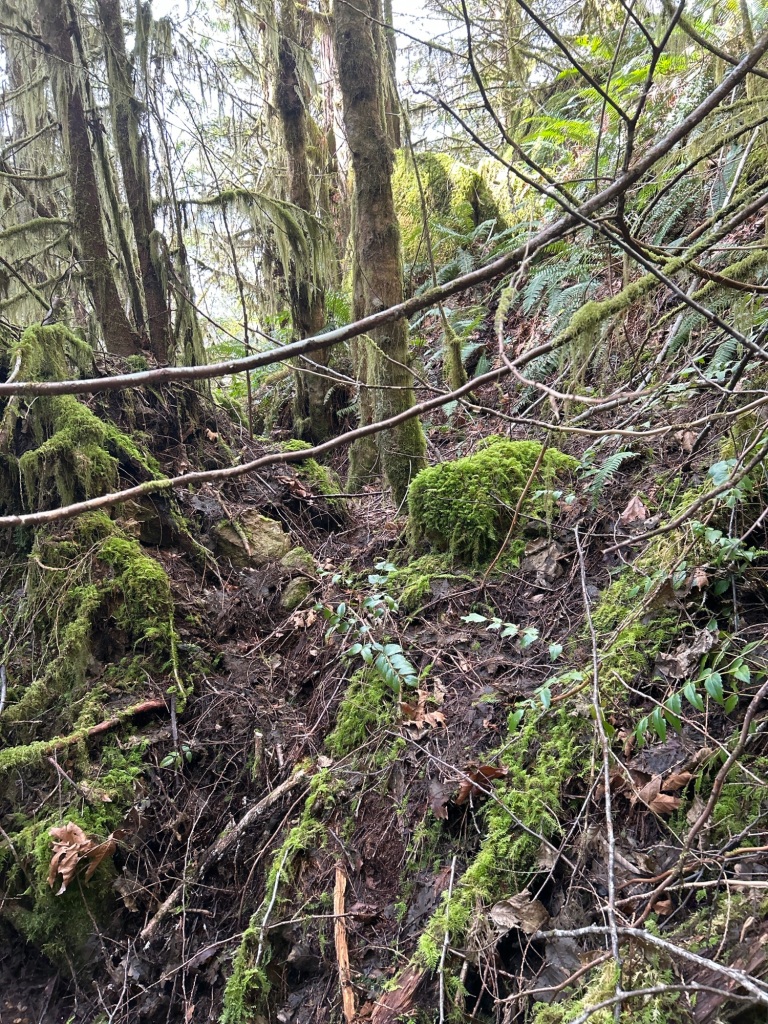
My search procedure for today is the same as it was last year. Starting from the lowest portion of the boundary, I cleared the ground of vegetation and leaf litter until I reached the rock substrate of the hillside. Thankfully on a steep slope like this, the top layer is only about 1” – 3” deep before hitting rock. I worked uphill to the knob, then shifted south one arm length for the next lane.
This work is slow and methodical, and at this time of year, cold and damp. The air temp was in the low 40’s at this elevation and near the creek bottom. I was able to cover about 1.5 miles within the drainage chutes, clearing debris in a grid. One of the chutes was particularly tricky to search, being exceptionally steep and slick, and after a 90 degree turn to the south, it went under a rock fall and over a cliff into Soda Fork creek.
After 3 hours of clearing the chutes, I walked around the top of the cliff edge, making a site survey for the next search. I was able to locate the limit of the felling operation by the rather neat line of cut stumps. The area below this line will form the Spring 2024 search area for the Lee Site.
The forecast is clear this coming weekend, 30-31 March, and I have a search plan put together. Look for a ground search report at the beginning of the week.
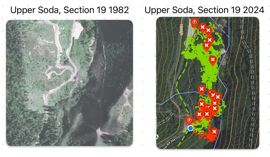
I have taken a pause in on the ground searching for the winter. Until the weather improves in March / April, or we get an exceptionally fine stretch of decent weather, I’m focusing on desk research and re-examining assumptions and interpretations of the facts. This week I found an online repository of historical aerial surveys, and I bought the image for Upper Soda, Section 19.
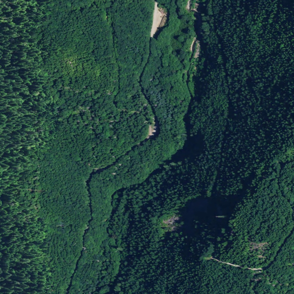
Above is the current aerial image for Soda Fork, Section 19. You can see the trace of Soda Fork Road (FS 2041), the clearing where the Lee site landing is, and at the top of the photo, the log yard area that I cleared this summer. A persistent question I’ve had is “what did this area look like in 1977” and this week I found my answer.
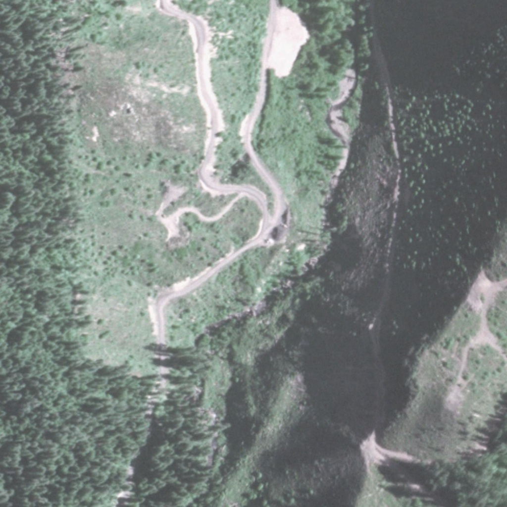
This photo depicts the same area, but with much less timber and vegetation due to logging operations. On the left of the image you can see the boundary line of the Menagerie Wilderness and the amount of clear cutting on both sides of Soda Fork Rd.
What can we learn from the 1982 image that we can’t from the 2020 image or being on the ground? Let’s start with what we can infer from the image.
I’ve spent a lot of windshield time driving HWY 20, thinking about the “Ghosts of Highway 20” and the following are my random bullet point thoughts from the past six months. These are more just singular thoughts from thinking about all the cases, and I mainly wanted to write them down.
Fall has arrived in the Willamette Valley and the west slope of the Cascades. The drive out yesterday was through a decent rain, but it mostly dissipated by the time I made a pit stop at Foster Lake. Without the summer traffic to Bend and Central Oregon, Highway 20 felt deserted once I passed Sweet Home.
My plan for the day was to focus on the bench above the creek, and then, time and weather permitting, clear two other areas along the stream, both a little to the north of the bench. I took a circuitous route to the start point, passing through the area I searched two weeks earlier. I came up to the bench, dropped my pack, and geared up to start the day’s work.
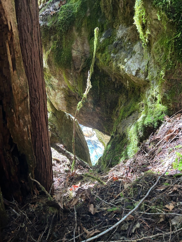
I started by finding a way down the cliff above the creek, and examining the base of the cliff along the stream. This was an exclusionary search and a good “once over”. After 46 years of winter storms and spring runoff, I’d estimate the chances of remains being found along the stream bed as low, but it was still worth the time to check out.
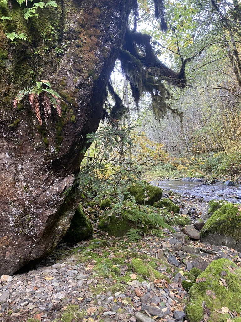
Once I was satisfied that the area along the base of the cliff was clear, I started on the bench proper. I decided to approach the day’s work like mowing a lawn. I would start with my feet over the edge of the cliff, then go forward on my hands and knees, clearing the debris away until I got to bare earth. Once the first pass was completed, I’d head back to the cliff, line up on the lane I just made, and repeat the process.
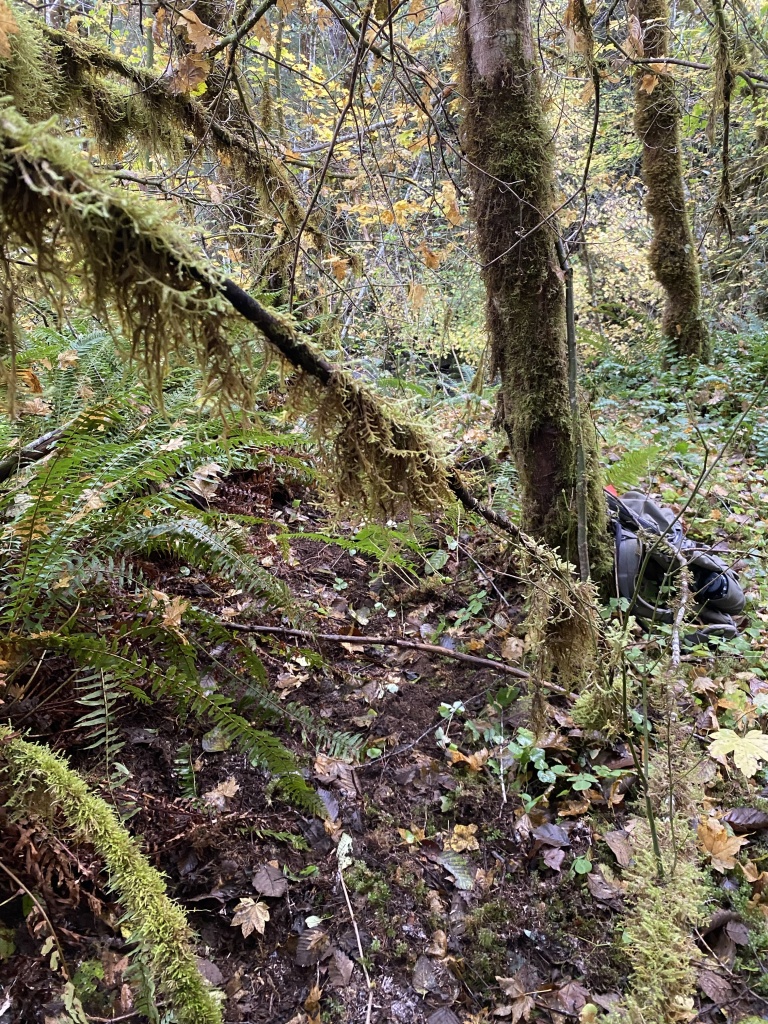
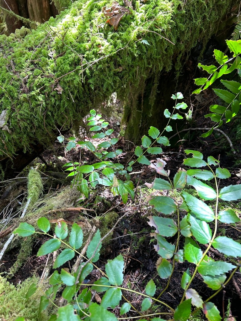
After the first few passes, I then had to clear the salal ground cover. Salal is a native edible plant, with berries similar to a tart blueberry or huckleberry. Unfortunately, no berries were there to sustain me, and instead I had to work through the spiny leaves as I searched the forest floor.

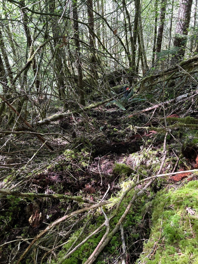
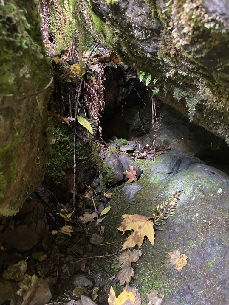
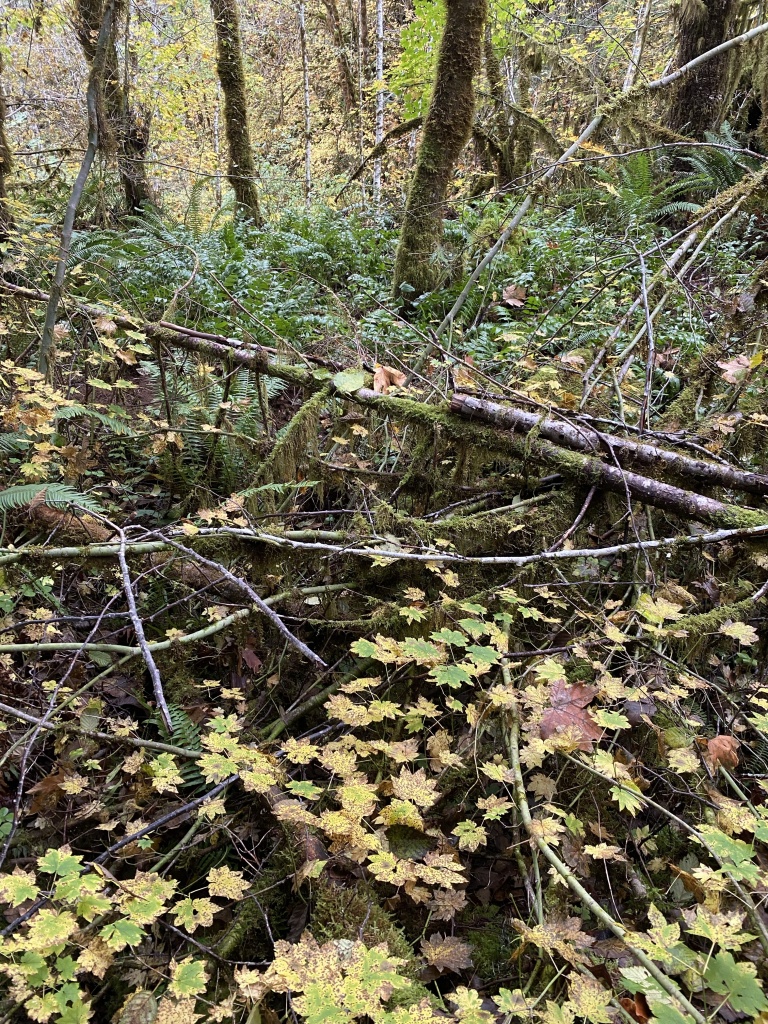
There was a large Doug Fir deadfall that split the bench nearly in half. A mat of other fallen trees, but smaller, created a sort of lean to, with a decent amount of ground underneath and seemingly inaccessible due to the jumble of branches.
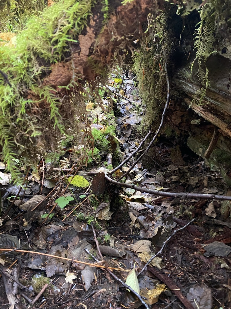
I found a hollow along the Doug Fir, that allowed me to slip underneath the tangle and search as well as I could under that.
After going through that area, I restarted the “lawnmower” lanes on the other side of the log. I spent another couple of hours searching that area.
I took a quick video of the area I had searched that day. I managed to search about half to 2/3rds of the bench before the wet and the effort of being on my hands and knees for the day called it. It was a good search, and I felt like I made good progress at this site. The day’s track is in blue, and covers the two miles I ground searched within that area.